
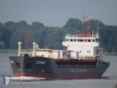
CEMBAY
Cement Carrier
Current Trip
| Time Travelled | 2 days |
|---|---|
| Remaining Time | --- |
| Distance Travelled | 442.35 nm |
| Remaining Distance | --- |
| AVG Speed | 8.6 Knots |
| MAX Speed | 10.6 Knots |
| AVG Wind | 18.3 knots |
| MAX Wind | 27 knots |
| MIN Temp | 9.3°C / 48.74°F |
| MAX Temp | 16.2°C / 61.16°F |
| Draught | 5.2 m |
| Position Received | 2 m ago |
Current Position
| Longitude | -4.14993° |
|---|---|
| Latitude | 50.34421° |
| Status | At anchor |
| Speed | |
| Course | 334° |
| Area | English Channel |
| Station | T-AIS |
| Position Received | 2 m ago |
Info
Information
The current position of CEMBAY is in English Channel with coordinates 50.34421° / -4.14993° as reported on 2024-04-16 16:52 by AIS to our vessel tracker app. The vessel's current speed is 0 Knots
The vessel CEMBAY (IMO: 9183465, MMSI: 212542000) is a Cement Carrier that was built in 1997 ( 27 years old ). It's sailing under the flag of [CY] Cyprus.
In this page you can find informations about the vessels current position, last detected port calls, and current voyage information. If the vessels is not in coverage by AIS you will find the latest position.
The current position of CEMBAY is detected by our AIS receivers and we are not responsible for the reliability of the data. The last position was recorded while the vessel was in Coverage by the Ais receivers of our vessel tracking app.
The current draught of CEMBAY as reported by AIS is 5.2 meters
Weather
| Temperature | 10.3°C / 50.54°F |
|---|---|
| Wind Speed | 19 knots |
| Direction | 326° NW |
| Pressure | 1018.8 hPa |
| Humidity | 73 % |
| Cloud Coverage | 26 % |
Featured Company
Last Port Calls
| Port | Arrival | Departure | Time In Port |
|---|---|---|---|
| 2024-04-13 04:12 | 2024-04-14 08:29 | 1 d | |
| 2024-04-09 20:43 | 2024-04-09 21:25 | 41 m | |
| 2024-04-09 20:02 | 2024-04-09 20:22 | 20 m | |
| 2024-04-07 01:04 | 2024-04-09 19:17 | 2 d | |
| 2024-04-06 23:31 | 2024-04-06 23:51 | 20 m | |
| 2024-04-06 22:29 | 2024-04-06 23:08 | 39 m | |
| 2024-04-01 23:47 | 2024-04-03 10:17 | 1 d | |
| 2024-03-30 15:26 | 2024-04-01 15:00 | 1 d | |
| 2024-03-27 10:48 | 2024-03-28 13:04 | 1 d | |
| 2024-03-27 02:35 | 2024-03-27 03:08 | 33 m |
Last Trips
| Origin | Departure | Destination | Arrival | Distance | |
|---|---|---|---|---|---|
| 2024-04-09 22:25 | 2024-04-13 06:12 | 703.27 nm | |||
| 2024-04-09 21:22 | 2024-04-09 21:43 | 1.19 nm | |||
| 2024-04-09 20:17 | 2024-04-09 21:02 | 4.48 nm | |||
| 2024-04-07 00:51 | 2024-04-07 02:04 | 5.67 nm | |||
| 2024-04-07 00:08 | 2024-04-07 00:31 | 2.02 nm | |||
| 2024-04-03 12:17 | 2024-04-06 23:29 | 627.90 nm | |||
| 2024-04-01 16:00 | 2024-04-02 01:47 | 83.17 nm | |||
| 2024-03-28 14:04 | 2024-03-30 15:26 | 376.85 nm | |||
| 2024-03-27 04:08 | 2024-03-27 11:48 | 49.37 nm | |||
| 2024-03-26 06:55 | 2024-03-27 03:35 | 225.91 nm |
Events
| Time | Event | Details | Position / Dest | Info |
|---|---|---|---|---|
| 2024-04-16 11:52 | STOP Moving | 1.11 nm, South of PLYMOUTH |
50.34483 / -4.15007
GBPLY
|
Speed: 0.3 kn Course: 318° |
| 2024-04-16 11:49 | Status Changed | At anchor Under way using engine |
50.34500 / -4.15059
GBPLY
|
Speed: 0.7 kn Course: 358° |
| 2024-04-16 08:08 | ETA Changed | 2024/04/16 12:00 2024/04/16 09:00 |
49.85502 / -4.53758
GBPLY
|
Speed: 9.6 kn Course: 33.7° |
| 2024-04-16 07:36 | Detected in Sea | United Kingdom part of the English Channel |
49.78260 / -4.60705
English Channel
GBPLY
|
Speed: 9.9 kn Course: 29.8° |
| 2024-04-16 07:36 | Status Changed | Under way using engine Default |
49.78260 / -4.60705
GBPLY
|
Speed: 9.9 kn Course: 28° |
| 2024-04-16 07:29 | IN Coverage |
49.78260 / -4.60705
English Channel
GBPLY
|
Speed: 9.9 kn Course: 29.8° |
|
| 2024-04-15 10:16 | Status Changed | Default Under way using engine |
47.40700 / -5.25759
GBPLY
|
Speed: 6.9 kn Course: 346.3° |
| 2024-04-15 10:07 | OUT of Coverage |
47.38967 / -5.25013
Celtic Sea
GBPLY
|
Speed: 6.9 kn Course: 346.3° |
|
| 2024-04-15 10:00 | Change Sea Area | French part of the Celtic Sea Spanish part of the Bay of Biscay |
47.37625 / -5.24482
Celtic Sea
GBPLY
|
Speed: 7.6 kn Course: 345.8° |
| 2024-04-15 10:00 | Status Changed | Under way using engine Default |
47.37625 / -5.24482
GBPLY
|
Speed: 7.4 kn Course: 342° |