
2CAN
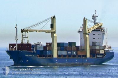
Container Ship
Current Trip
MALTA
| Time Travelled | --- |
|---|---|
| Remaining Time | --- |
| Distance Travelled | 151.25 nm |
| Remaining Distance | --- |
| AVG Speed | 5.1 Knots |
| MAX Speed | 8.4 Knots |
| AVG Wind | 11 knots |
| MAX Wind | 22 knots |
| MIN Temp | 25.1°C / 77.18°F |
| MAX Temp | 28.4°C / 83.12°F |
| Draught | 5.5 m |
| Position Received | 4 d ago |
Current Position
| Longitude | -61.76225° |
|---|---|
| Latitude | 17.13843° |
| Status | Default |
| Speed | 4.5 Knots |
| Course | 150.7° |
| Area | Caribbean Sea |
| Station | T-AIS |
| Position Received | 4 d ago |
Info
Information
The current position of 2CAN is in Caribbean Sea with coordinates 17.13843° / -61.76225° as reported on 2024-04-20 14:13 by AIS to our vessel tracker app. The vessel's current speed is 4.5 Knots
The vessel 2CAN (IMO: 9145243, MMSI: 304960000) is a Container Ship that was built in 1998 ( 26 years old ). It's sailing under the flag of [AG] Antigua Barbuda.
In this page you can find informations about the vessels current position, last detected port calls, and current voyage information. If the vessels is not in coverage by AIS you will find the latest position.
The current position of 2CAN is detected by our AIS receivers and we are not responsible for the reliability of the data. The last position was recorded while the vessel was in Coverage by the Ais receivers of our vessel tracking app.
The current draught of 2CAN as reported by AIS is 5.5 meters
Weather
| Temperature | 26.8°C / 80.24°F |
|---|---|
| Wind Speed | 10 knots |
| Direction | 61° ENE |
| Pressure | 1015.8 hPa |
| Humidity | 75.1 % |
| Cloud Coverage | 8 % |
Featured Company
Last Port Calls
| Port | Arrival | Departure | Time In Port |
|---|---|---|---|
| 2024-02-04 13:43 | 2024-02-12 14:34 | 8 d |
Most Visited Ports (Last year)
| Port | Arrivals | |
|---|---|---|
| 1 | ||
| 1 |
Last Trips
| Origin | Departure | Destination | Arrival | Distance | |
|---|---|---|---|---|---|
| 2023-12-30 11:43 | 2024-02-04 09:43 | 19.57 nm |
Events
| Time | Event | Details | Position / Dest | Info |
|---|---|---|---|---|
| 2024-04-20 14:13 | OUT of Coverage |
17.13843 / -61.76225
Caribbean Sea
|
Speed: 4.5 kn Course: 150.7° |
|
| 2024-04-20 14:05 | IN Coverage |
17.14709 / -61.76796
Caribbean Sea
|
Speed: 5.8 kn Course: 151.4° |
|
| 2024-04-17 18:57 | OUT of Coverage |
17.07855 / -61.89876
Caribbean Sea
|
Speed: 0.1 kn Course: 184.5° |
|
| 2024-04-17 17:45 | STOP Moving | 3.53 nm, South West of ST JOHNS |
17.07855 / -61.89874
MALTA
|
Speed: 0.2 kn Course: 511° |
| 2024-04-17 16:22 | IN Coverage |
17.00915 / -61.85247
Caribbean Sea
|
Speed: 4.7 kn Course: 350.9° |
|
| 2024-04-16 20:16 | OUT of Coverage |
17.01023 / -61.77797
Caribbean Sea
|
Speed: 0.1 kn Course: 134.4° |
|
| 2024-04-16 18:07 | IN Coverage |
17.01041 / -61.77777
Caribbean Sea
|
Speed: 0.4 kn Course: 255.9° |
|
| 2024-04-16 15:16 | OUT of Coverage |
17.01035 / -61.77779
Caribbean Sea
|
Speed: 0.1 kn Course: 121.1° |
|
| 2024-04-16 15:16 | IN Coverage |
17.01035 / -61.77779
Caribbean Sea
|
Speed: 0.1 kn Course: 121.1° |
|
| 2024-04-14 17:31 | OUT of Coverage |
17.01007 / -61.77799
Caribbean Sea
|
Speed: 0.2 kn Course: 71.1° |