
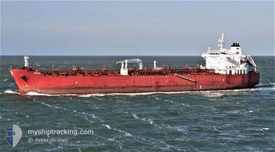
ZOILO
Tanker
Current Trip
| Time Travelled | 44 days |
|---|---|
| Remaining Time | 3 days |
| Distance Travelled | 6287.30 nm |
| Remaining Distance | 1355.12 nm |
| AVG Speed | 11.6 Knop |
| MAX Speed | 11.6 Knop |
| AVG Wind | 10.2 knots |
| MAX Wind | 27 knots |
| MIN Temp | 10.4°C / 50.72°F |
| MAX Temp | 32°C / 89.6°F |
| Djupgående | 8 m |
| Position mottagen | 1 d sen |
Current Position
| Longitud | -105.64976° |
|---|---|
| Latitude | 19.37916° |
| Status | Under way using engine |
| Fart | 13.8 Knop |
| Kurs | 121.3° |
| Område | North Pacific Ocean |
| Station | T-AIS |
| Position mottagen | 1 d sen |
Info
Information
The current position of ZOILO is in North Pacific Ocean with coordinates 19.37916° / -105.64976° as reported on 2024-04-17 15:26 by AIS to our vessel tracker app. The vessel's current speed is 13.8 Knop and is heading at the port of BALBOA. The estimated time of arrival as calculated by MyShipTracking vessel tracking app is 2024-04-22 21:18 LT
The vessel ZOILO (IMO: 9704441, MMSI: 215923000) is a Tanker It's sailing under the flag of [MT] Malta.
In this page you can find informations about the vessels current position, last detected port calls, and current voyage information. If the vessels is not in coverage by AIS you will find the latest position.
The current position of ZOILO is detected by our AIS receivers and we are not responsible for the reliability of the data. The last position was recorded while the vessel was in Coverage by the Ais receivers of our vessel tracking app.
The current draught of ZOILO as reported by AIS is 8 meters
Weather
| Temperature | 28.1°C / 82.58°F |
|---|---|
| Wind Speed | 10 knots |
| Direction | 290° WNW |
| Pressure | 1011.5 hPa |
| Humidity | 71.5 % |
| Cloud Coverage | 89 % |
Featured Company
Last Port Calls
| Port | Arrival | Departure | Time In Port |
|---|---|---|---|
| 2024-03-02 08:07 | 2024-03-06 05:11 | 3 d | |
| 2024-02-20 15:33 | 2024-02-21 02:44 | 11 h | |
| 2024-02-01 15:28 |
Most Visited Ports (Last year)
| Port | Arrivals | |
|---|---|---|
| 3 | ||
| 2 | ||
| 2 | ||
| 1 | ||
| 1 | ||
| 1 |
Last Trips
| Origin | Departure | Destination | Arrival | Distance | |
|---|---|---|---|---|---|
| 2024-02-20 21:44 | 2024-03-02 02:07 | 2233.08 nm | |||
| 2024-02-01 16:28 | 2024-02-20 10:33 | 4095.12 nm |
Events
| Tid | Event | Detaljer | Position / Dest | Information |
|---|---|---|---|---|
| 2024-04-17 15:30 | Status ändrad | Default Under way using engine |
19.37065 / -105.63558
PABLB
|
Fart: 13.8 kn Kurs: 121.3° |
| 2024-04-17 15:26 | UTANFÖR täckningsområde |
19.37916 / -105.64976
North Pacific Ocean
PABLB
|
Fart: 13.8 kn Kurs: 121.3° |
|
| 2024-04-17 15:21 | Status ändrad | Under way using engine Default |
19.38927 / -105.66796
PABLB
|
Fart: 13.7 kn Kurs: 119° |
| 2024-04-17 15:05 | Status ändrad | Default Under way using engine |
19.42147 / -105.72266
PABLB
|
Fart: 14.8 kn Kurs: 124.8° |
| 2024-04-17 14:43 | Status ändrad | Under way using engine Default |
19.47248 / -105.80265
PABLB
|
Fart: 14.7 kn Kurs: 126° |
| 2024-04-17 14:40 | Status ändrad | Default Under way using engine |
19.47985 / -105.81368
PABLB
|
Fart: 14.5 kn Kurs: 125.3° |
| 2024-04-17 14:36 | Status ändrad | Under way using engine Default |
19.49002 / -105.82890
PABLB
|
Fart: 14.3 kn Kurs: 128° |
| 2024-04-17 14:29 | Status ändrad | Default Under way using engine |
19.50674 / -105.85246
PABLB
|
Fart: 14.3 kn Kurs: 127.5° |
| 2024-04-17 05:42 | Status ändrad | Under way using engine Default |
20.50013 / -107.45043
PABLB
|
Fart: 12 kn Kurs: 124° |
| 2024-04-17 05:37 | Status ändrad | Default Under way using engine |
20.50966 / -107.46581
PABLB
|
Fart: 12 kn Kurs: 123.6° |