
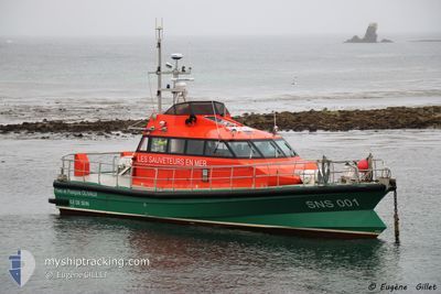
SNS001 Y & F OLIVAUX
Search and Rescue vessel
Current Trip
| Trip Time | 1 h, 17 mins |
|---|---|
| Trip Distance | 6.27 nm |
| AVG Speed | 8 Knop |
| MAX Speed | 8 Knop |
| Djupgående | 1.6 m |
| AVG Wind | 9.5 knots |
| MAX Wind | 9.9 knots |
| MIN Temp | 9.6°C / 49.28°F |
| MAX Temp | 10.3°C / 50.54°F |
| Position mottagen | 1 d sen |
Current Position
| Longitud | -4.84788° |
|---|---|
| Latitude | 48.03860° |
| Status | Under way using engine |
| Fart | 0.1 Knop |
| Kurs | --- |
| Område | Celtic Sea |
| Station | T-AIS |
| Position mottagen | 1 d sen |
Info
Information
The current position of SNS001 Y & F OLIVAUX is in Celtic Sea with coordinates 48.03860° / -4.84788° as reported on 2024-04-22 10:32 by AIS to our vessel tracker app. The vessel's current speed is 0.1 Knop and is currently inside the port of SEIN.
The vessel SNS001 Y & F OLIVAUX (MMSI: 227400510) is a Search and Rescue vessel It's sailing under the flag of [FR] France.
In this page you can find informations about the vessels current position, last detected port calls, and current voyage information. If the vessels is not in coverage by AIS you will find the latest position.
The current position of SNS001 Y & F OLIVAUX is detected by our AIS receivers and we are not responsible for the reliability of the data. The last position was recorded while the vessel was in Coverage by the Ais receivers of our vessel tracking app.
The current draught of SNS001 Y & F OLIVAUX as reported by AIS is 1.6 meters
Weather
| Temperature | 10.1°C / 50.18°F |
|---|---|
| Wind Speed | 9 knots |
| Direction | 25° NNE |
| Pressure | 1029.6 hPa |
| Humidity | 64.9 % |
| Cloud Coverage | 73 % |
Featured Company
Last Port Calls
| Port | Arrival | Departure | Time In Port |
|---|---|---|---|
| 2024-04-22 10:25 | |||
| 2024-04-19 10:27 | 2024-04-22 09:08 | 2 d | |
| 2024-04-12 12:57 | 2024-04-19 09:36 | 6 d | |
| 2024-02-27 16:18 | 2024-04-12 10:51 | ||
| 2024-02-17 15:33 | 2024-02-27 06:00 | 9 d | |
| 2024-02-16 12:15 | 2024-02-17 15:29 | 1 d | |
| 2024-02-16 10:46 |
Last Trips
| Origin | Departure | Destination | Arrival | Distance | |
|---|---|---|---|---|---|
| 2024-04-22 11:08 | 2024-04-22 12:25 | 6.27 nm | |||
| 2024-04-19 11:36 | 2024-04-19 12:27 | 10.83 nm | |||
| 2024-04-12 12:51 | 2024-04-12 14:57 | 26.24 nm | |||
| 2024-02-27 07:00 | 2024-02-27 17:18 | 30.04 nm | |||
| 2024-02-17 16:29 | 2024-02-17 16:33 | 0.34 nm | |||
| 2024-02-16 11:46 | 2024-02-16 13:15 | 24.35 nm |
Events
| Tid | Event | Detaljer | Position / Dest | Information |
|---|---|---|---|---|
| 2024-04-22 10:32 | UTANFÖR täckningsområde |
48.03860 / -4.84788
Celtic Sea
[FR] SEIN
|
Fart: 0.1 kn Kurs: 274° |
|
| 2024-04-22 10:28 | STOPPAR förflyttning |
48.03867 / -4.84797
[FR] SEIN
|
Fart: 0.3 kn Kurs: 511° |
|
| 2024-04-22 10:25 | ANLÄNDER HAMN |
|
48.04026 / -4.84771
[FR] SEIN
|
Fart: 11 kn Kurs: 178.4° |
| 2024-04-22 10:21 | STARTAR förflyttning | 1.78 nm, North of SEIN |
48.06573 / -4.84497
EXER REMORQUAGE ES3
|
Fart: 20.3 kn Kurs: 196.8° |
| 2024-04-22 10:11 | STOPPAR förflyttning | 1.9 nm, North of SEIN |
48.06785 / -4.84553
EXER REMORQUAGE ES3
|
Fart: 0.2 kn Kurs: 511° |
| 2024-04-22 10:09 | STARTAR förflyttning | 1.91 nm, North of SEIN |
48.06791 / -4.84614
EXER REMORQUAGE ES3
|
Fart: 3.3 kn Kurs: 105.1° |
| 2024-04-22 10:06 | Status ändrad | Under way using engine Restricted manoeuverability |
48.06919 / -4.84773
EXER REMORQUAGE ES3
|
Fart: 0.4 kn Kurs: 511° |
| 2024-04-22 10:02 | STOPPAR förflyttning | 2.01 nm, North of SEIN |
48.06972 / -4.84663
EXER REMORQUAGE ES3
|
Fart: 0.3 kn Kurs: 511° |
| 2024-04-22 09:40 | Destination ändrad | EXER REMORQUAGE ES3 EXERCICE H160 |
48.06874 / -4.85083
EXER REMORQUAGE ES3
|
Fart: 4.7 kn Kurs: 112.2° |
| 2024-04-22 09:40 | ETA ändrat | 2024/04/22 09:30 2024/04/19 09:50 |
48.06874 / -4.85083
EXER REMORQUAGE ES3
|
Fart: 4.7 kn Kurs: 112.2° |