
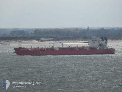
AQUASMERALDA
Tanker
Current Trip
| Time Travelled | 5 days |
|---|---|
| Remaining Time | --- |
| Distance Travelled | 1366.96 nm |
| Remaining Distance | --- |
| AVG Speed | 10 Knop |
| MAX Speed | 13.9 Knop |
| AVG Wind | 20.9 knots |
| MAX Wind | 28.9 knots |
| MIN Temp | 4°C / 39.2°F |
| MAX Temp | 20.5°C / 68.9°F |
| Djupgående | 8.4 m |
| Position mottagen | 5 d sen |
Current Position
| Longitud | -72.43091° |
|---|---|
| Latitude | 39.33060° |
| Status | Under way using engine |
| Fart | 11.6 Knop |
| Kurs | 135.2° |
| Område | North Atlantic Ocean |
| Station | T-AIS |
| Position mottagen | 5 d sen |
Info
Information
The current position of AQUASMERALDA is in North Atlantic Ocean with coordinates 39.33060° / -72.43091° as reported on 2024-04-14 18:31 by AIS to our vessel tracker app. The vessel's current speed is 11.6 Knop and is heading at the port of FREEPORT (BS). The estimated time of arrival as calculated by MyShipTracking vessel tracking app is 2024-04-16 12:00 LT
The vessel AQUASMERALDA (IMO: 9884801, MMSI: 636020363) is a Tanker It's sailing under the flag of [LR] Liberia.
In this page you can find informations about the vessels current position, last detected port calls, and current voyage information. If the vessels is not in coverage by AIS you will find the latest position.
The current position of AQUASMERALDA is detected by our AIS receivers and we are not responsible for the reliability of the data. The last position was recorded while the vessel was in Coverage by the Ais receivers of our vessel tracking app.
The current draught of AQUASMERALDA as reported by AIS is 8.4 meters
Weather
| Temperature | 4°C / 39.2°F |
|---|---|
| Wind Speed | 14 knots |
| Direction | 293° WNW |
| Pressure | 1008.7 hPa |
| Humidity | 78.7 % |
| Cloud Coverage | 100 % |
Featured Company
Last Port Calls
| Port | Arrival | Departure | Time In Port |
|---|---|---|---|
| 2024-04-13 08:42 | 2024-04-14 08:42 | 23 h | |
| 2024-04-10 12:42 | 2024-04-12 03:04 | 1 d | |
| 2024-03-25 15:15 | 2024-03-27 22:44 | 2 d | |
| 2024-03-19 20:07 | 2024-03-22 18:08 | 2 d | |
| 2024-03-01 05:08 | 2024-03-01 08:01 | 2 h | |
| 2024-02-29 03:46 | 2024-03-01 04:12 | 1 d | |
| 2024-02-26 10:29 | 2024-02-29 03:22 | 2 d | |
| 2024-02-24 20:45 | 2024-02-26 02:21 | 1 d | |
| 2024-02-22 19:41 | 2024-02-24 10:17 | 1 d | |
| 2024-02-04 21:55 | 2024-02-06 00:00 | 1 d |
Last Trips
| Origin | Departure | Destination | Arrival | Distance | |
|---|---|---|---|---|---|
| 2024-04-11 23:04 | 2024-04-13 04:42 | 64.22 nm | |||
| 2024-03-27 23:44 | 2024-04-10 08:42 | 3371.80 nm | |||
| 2024-03-22 19:08 | 2024-03-25 16:15 | 501.07 nm | |||
| 2024-03-01 02:01 | 2024-03-19 21:07 | 5476.88 nm | |||
| 2024-02-29 22:12 | 2024-02-29 23:08 | 10.81 nm | |||
| 2024-02-28 21:22 | 2024-02-28 21:46 | 1.60 nm | |||
| 2024-02-25 20:21 | 2024-02-26 04:29 | 101.41 nm | |||
| 2024-02-24 04:17 | 2024-02-24 14:45 | 95.92 nm | |||
| 2024-02-05 19:00 | 2024-02-22 13:41 | 2178.54 nm | |||
| 2024-01-20 22:09 | 2024-02-04 16:55 | 3645.86 nm |
Events
| Tid | Event | Detaljer | Position / Dest | Information |
|---|---|---|---|---|
| 2024-04-14 18:33 | Status ändrad | Default Under way using engine |
39.32500 / -72.42333
USNYC >BSFPO
|
Fart: 11.6 kn Kurs: 135.2° |
| 2024-04-14 18:31 | UTANFÖR täckningsområde |
39.33060 / -72.43091
North Atlantic Ocean
USNYC >BSFPO
|
Fart: 11.6 kn Kurs: 135.2° |
|
| 2024-04-14 18:20 | Status ändrad | Under way using engine Default |
39.35526 / -72.46250
USNYC >BSFPO
|
Fart: 11 kn Kurs: 135° |
| 2024-04-14 18:15 | Status ändrad | Default Under way using engine |
39.36666 / -72.47667
USNYC >BSFPO
|
Fart: 11.6 kn Kurs: 133.7° |
| 2024-04-14 18:07 | Status ändrad | Under way using engine Default |
39.38474 / -72.50073
USNYC >BSFPO
|
Fart: 11 kn Kurs: 134° |
| 2024-04-14 18:03 | I täckningsområde |
39.38474 / -72.50073
North Atlantic Ocean
USNYC >BSFPO
|
Fart: 11.6 kn Kurs: 135.3° |
|
| 2024-04-14 12:57 | Status ändrad | Default Under way using engine |
40.05333 / -73.36500
USNYC >BSFPO
|
Fart: 10.5 kn Kurs: 138.2° |
| 2024-04-14 12:55 | UTANFÖR täckningsområde |
40.05965 / -73.37140
North Atlantic Ocean
USNYC >BSFPO
|
Fart: 10.5 kn Kurs: 138.2° |
|
| 2024-04-14 08:42 | AVGÅTT HAMN |
|
40.57723 / -74.03637
USNYC >BSFPO
|
Fart: 14.3 kn Kurs: 168° |
| 2024-04-14 08:21 | STARTAR förflyttning |
40.63918 / -74.05213
[US] NEW YORK
|
Fart: 3.1 kn Kurs: 243° |