
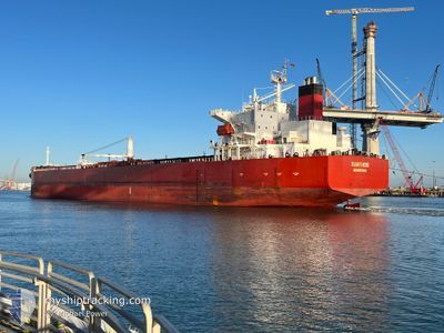
XANTHOS
Crude Oil Tanker
Current Trip
| Time Travelled | 3 days |
|---|---|
| Remaining Time | --- |
| Distance Travelled | 519.62 nm |
| Remaining Distance | 10.53 nm |
| AVG Speed | 9.4 Knop |
| MAX Speed | 12.4 Knop |
| AVG Wind | 12.1 knots |
| MAX Wind | 26.9 knots |
| MIN Temp | 20.8°C / 69.44°F |
| MAX Temp | 25°C / 77°F |
| Djupgående | 7.5 m |
| Position mottagen | 1 m sen |
Current Position
| Longitud | -97.66982° |
|---|---|
| Latitude | 22.23142° |
| Status | At anchor |
| Fart | |
| Kurs | 59° |
| Område | Gulf of Mexico |
| Station | T-AIS |
| Position mottagen | 1 m sen |
Info
Information
The current position of XANTHOS is in Gulf of Mexico with coordinates 22.23142° / -97.66982° as reported on 2024-04-23 19:24 by AIS to our vessel tracker app. The vessel's current speed is 0 Knop and is heading at the port of TAMPICO. The estimated time of arrival as calculated by MyShipTracking vessel tracking app is 2024-04-23 01:00 LT
The vessel XANTHOS (IMO: 9289178, MMSI: 636012425) is a Crude Oil Tanker that was built in 2005 ( 19 År gammal ). It's sailing under the flag of [LR] Liberia.
In this page you can find informations about the vessels current position, last detected port calls, and current voyage information. If the vessels is not in coverage by AIS you will find the latest position.
The current position of XANTHOS is detected by our AIS receivers and we are not responsible for the reliability of the data. The last position was recorded while the vessel was in Coverage by the Ais receivers of our vessel tracking app.
The current draught of XANTHOS as reported by AIS is 7.5 meters
Weather
| Temperature | 23.8°C / 74.84°F |
|---|---|
| Wind Speed | 8 knots |
| Direction | 91° E |
| Pressure | 1015.3 hPa |
| Humidity | 80.5 % |
| Cloud Coverage | --- |
Featured Company
Last Port Calls
| Port | Arrival | Departure | Time In Port |
|---|---|---|---|
| 2024-04-18 21:38 | 2024-04-20 16:15 | 1 d | |
| 2024-04-14 15:16 | 2024-04-16 11:37 | 1 d | |
| 2024-04-04 22:21 | 2024-04-07 00:41 | 2 d | |
| 2024-03-25 07:11 | 2024-03-27 15:26 | 2 d | |
| 2024-03-14 17:31 | |||
| 2024-03-09 03:13 | |||
| 2024-02-29 18:03 | 2024-03-01 18:26 | 1 d | |
| 2024-02-27 01:57 | 2024-02-29 13:39 | 2 d | |
| 2024-02-17 19:53 | 2024-02-21 01:33 | 3 d | |
| 2024-02-13 03:29 | 2024-02-13 06:52 | 3 h |
Most Visited Ports (Last year)
| Port | Arrivals | |
|---|---|---|
| 11 | ||
| 7 | ||
| 4 | ||
| 1 | ||
| 1 | ||
| 1 |
Last Trips
| Origin | Departure | Destination | Arrival | Distance | |
|---|---|---|---|---|---|
| 2024-04-16 06:37 | 2024-04-18 16:38 | 698.04 nm | |||
| 2024-04-06 19:41 | 2024-04-14 10:16 | 718.78 nm | |||
| 2024-03-27 09:26 | 2024-04-04 17:21 | 710.89 nm | |||
| 2024-03-08 21:13 | 2024-03-14 12:31 | 918.79 nm | |||
| 2024-02-29 08:39 | 2024-02-29 13:03 | 30.19 nm | |||
| 2024-02-20 19:33 | 2024-02-26 20:57 | 1072.37 nm | |||
| 2024-02-13 00:52 | 2024-02-17 13:53 | 789.03 nm | |||
| 2024-02-11 20:45 | 2024-02-12 21:29 | 22.18 nm | |||
| 2024-02-02 20:56 | 2024-02-09 00:56 | 27.39 nm | |||
| 2024-01-21 07:29 | 2024-02-02 15:32 | 1193.20 nm |
Events
| Tid | Event | Detaljer | Position / Dest | Information |
|---|---|---|---|---|
| 2024-04-23 16:24 | Status ändrad | At anchor Default |
22.23095 / -97.66937
TAMPICO
|
Fart: Kurs: 44° |
| 2024-04-23 16:21 | Status ändrad | Default At anchor |
22.23093 / -97.66945
TAMPICO
|
Fart: Kurs: 43° |
| 2024-04-23 01:45 | Status ändrad | At anchor Under way using engine |
22.23202 / -97.66748
TAMPICO
|
Fart: 0.4 kn Kurs: 5° |
| 2024-04-23 01:45 | STOPPAR förflyttning | 9.93 nm, East of TAMPICO |
22.23202 / -97.66748
TAMPICO
|
Fart: 0.3 kn Kurs: 5° |
| 2024-04-22 22:41 | Byter havsområde | Mexican part of the Gulf of Mexico United States part of the Gulf of Mexico |
22.55337 / -97.52375
Gulf of Mexico
TAMPICO
|
Fart: 9.6 kn Kurs: 229° |
| 2024-04-22 22:41 | Status ändrad | Under way using engine Default |
22.55337 / -97.52375
TAMPICO
|
Fart: 9.2 kn Kurs: 228° |
| 2024-04-22 22:31 | I täckningsområde |
22.55337 / -97.52375
Gulf of Mexico
TAMPICO
|
Fart: 9.6 kn Kurs: 229° |
|
| 2024-04-20 21:34 | Status ändrad | Default Under way using engine |
28.81002 / -94.42696
TAMPICO
|
Fart: 10.9 kn Kurs: 179° |
| 2024-04-20 21:28 | Status ändrad | Under way using engine Default |
28.82787 / -94.42712
TAMPICO
|
Fart: 10.8 kn Kurs: 179° |
| 2024-04-20 21:28 | UTANFÖR täckningsområde |
28.82787 / -94.42712
Gulf of Mexico
TAMPICO
|
Fart: 10.9 kn Kurs: 179° |