
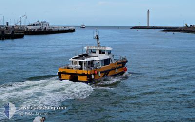
WINDCAT17
High speed craft
Current Trip
| Trip Time | 9 h, 44 mins |
|---|---|
| Trip Distance | 72.57 nm |
| AVG Speed | 12.8 Knop |
| MAX Speed | 12.8 Knop |
| Djupgående | 2 m |
| AVG Wind | 15.6 knots |
| MAX Wind | 19 knots |
| MIN Temp | 6.4°C / 43.52°F |
| MAX Temp | 7.7°C / 45.86°F |
| Position mottagen | 11 h, 54 m sen |
Current Position
| Longitud | -2.97572° |
|---|---|
| Latitude | 57.68943° |
| Status | Under way using engine |
| Fart | 22.8 Knop |
| Kurs | 174° |
| Område | North Sea |
| Station | T-AIS |
| Position mottagen | 11 h, 54 m sen |
Info
Information
The current position of WINDCAT17 is in North Sea with coordinates 57.68943° / -2.97572° as reported on 2024-04-23 15:28 by AIS to our vessel tracker app. The vessel's current speed is 22.8 Knop and is currently inside the port of BUCKIE.
The vessel WINDCAT17 (MMSI: 235070402) is a High speed craft It's sailing under the flag of [GB] United Kingdom.
In this page you can find informations about the vessels current position, last detected port calls, and current voyage information. If the vessels is not in coverage by AIS you will find the latest position.
The current position of WINDCAT17 is detected by our AIS receivers and we are not responsible for the reliability of the data. The last position was recorded while the vessel was in Coverage by the Ais receivers of our vessel tracking app.
The current draught of WINDCAT17 as reported by AIS is 2 meters
Weather
| Temperature | 5.9°C / 42.62°F |
|---|---|
| Wind Speed | 15 knots |
| Direction | 343° NNW |
| Pressure | 1022.6 hPa |
| Humidity | 68 % |
| Cloud Coverage | 59 % |
Featured Company
Last Port Calls
| Port | Arrival | Departure | Time In Port |
|---|---|---|---|
| 2024-04-23 15:30 | |||
| 2024-04-22 14:38 | 2024-04-23 05:46 | 15 h | |
| 2024-04-21 15:38 | 2024-04-22 05:54 | 14 h | |
| 2024-04-20 17:03 | 2024-04-21 05:50 | 12 h | |
| 2024-04-18 10:54 | 2024-04-20 05:49 | 1 d | |
| 2024-04-16 16:37 | 2024-04-17 13:22 | 20 h | |
| 2024-04-15 15:56 | 2024-04-16 09:05 | 17 h | |
| 2024-04-14 13:24 | 2024-04-15 08:28 | 19 h | |
| 2024-04-12 14:08 | 2024-04-14 06:04 | 1 d | |
| 2024-04-10 16:44 | 2024-04-12 06:32 | 1 d |
Last Trips
| Origin | Departure | Destination | Arrival | Distance | |
|---|---|---|---|---|---|
| 2024-04-23 06:46 | 2024-04-23 16:30 | 72.57 nm | |||
| 2024-04-22 06:54 | 2024-04-22 15:38 | 81.16 nm | |||
| 2024-04-21 06:50 | 2024-04-21 16:38 | 61.07 nm | |||
| 2024-04-20 06:49 | 2024-04-20 18:03 | 91.79 nm | |||
| 2024-04-17 14:22 | 2024-04-18 11:54 | 106.68 nm | |||
| 2024-04-16 10:05 | 2024-04-16 17:37 | 63.05 nm | |||
| 2024-04-15 09:28 | 2024-04-15 16:56 | 71.67 nm | |||
| 2024-04-14 07:04 | 2024-04-14 14:24 | 52.68 nm | |||
| 2024-04-12 07:32 | 2024-04-12 15:08 | 59.42 nm | |||
| 2024-04-10 10:32 | 2024-04-10 17:44 | 55.71 nm |
Events
| Tid | Event | Detaljer | Position / Dest | Information |
|---|---|---|---|---|
| 2024-04-23 16:08 | Status ändrad | Default Under way using engine |
57.68127 / -2.95456
[GB] BUCKIE
|
Fart: 22.8 kn Kurs: 174° |
| 2024-04-23 16:08 | STOPPAR förflyttning |
57.68127 / -2.95456
[GB] BUCKIE
|
Fart: 0.1 kn Kurs: -1° |
|
| 2024-04-23 15:30 | ANLÄNDER HAMN |
|
57.68127 / -2.95456
[GB] BUCKIE
|
Fart: 22.8 kn Kurs: 174° |
| 2024-04-23 15:28 | Status ändrad | Under way using engine Default |
57.68943 / -2.97572
MONTROSE<>SEAGREEN
|
Fart: 20.5 kn Kurs: 180° |
| 2024-04-23 15:28 | UTANFÖR täckningsområde |
57.68943 / -2.97572
North Sea
[GB] BUCKIE
|
Fart: 22.8 kn Kurs: 174° |
|
| 2024-04-23 15:26 | I täckningsområde |
57.68943 / -2.97572
North Sea
|
Fart: 22.8 kn Kurs: 174° |
|
| 2024-04-23 13:58 | STARTAR förflyttning | 16.55 nm, South East of LYBSTER |
58.06293 / -3.00820
MONTROSE<>SEAGREEN
|
Fart: 20.2 kn Kurs: 245° |
| 2024-04-23 13:38 | STOPPAR förflyttning | 16.58 nm, South East of LYBSTER |
58.07165 / -2.98229
MONTROSE<>SEAGREEN
|
Fart: 0.2 kn Kurs: -1° |
| 2024-04-23 13:34 | STARTAR förflyttning | 16.43 nm, South East of LYBSTER |
58.07472 / -2.98231
MONTROSE<>SEAGREEN
|
Fart: 13.4 kn Kurs: 175° |
| 2024-04-23 13:26 | STOPPAR förflyttning | 16.11 nm, South East of LYBSTER |
58.08128 / -2.98239
MONTROSE<>SEAGREEN
|
Fart: 0.3 kn Kurs: -1° |