
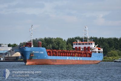
WILSON LUGA
General Cargo
Current Trip
| Time Travelled | 7 days |
|---|---|
| Remaining Time | --- |
| Distance Travelled | 1401.47 nm |
| Remaining Distance | --- |
| AVG Speed | 8.1 Knop |
| MAX Speed | 10.8 Knop |
| AVG Wind | 14.5 knots |
| MAX Wind | 40.7 knots |
| MIN Temp | -3.4°C / 25.88°F |
| MAX Temp | 8.1°C / 46.58°F |
| Djupgående | 4.9 m |
| Position mottagen | 2 h, 10 m sen |
Current Position
| Longitud | 19.02588° |
|---|---|
| Latitude | 60.28069° |
| Status | Under way using engine |
| Fart | 9.5 Knop |
| Kurs | 338.2° |
| Område | Gulf of Bothnia |
| Station | T-AIS |
| Position mottagen | 2 h, 10 m sen |
Info
Information
The current position of WILSON LUGA is in Gulf of Bothnia with coordinates 60.28069° / 19.02588° as reported on 2024-04-19 04:17 by AIS to our vessel tracker app. The vessel's current speed is 9.5 Knop and is heading at the port of SORAKER. The estimated time of arrival as calculated by MyShipTracking vessel tracking app is 2024-04-19 22:00 LT
The vessel WILSON LUGA (IMO: 9156187, MMSI: 314471000) is a General Cargo that was built in 1996 ( 28 År gammal ). It's sailing under the flag of [BB] Barbados.
In this page you can find informations about the vessels current position, last detected port calls, and current voyage information. If the vessels is not in coverage by AIS you will find the latest position.
The current position of WILSON LUGA is detected by our AIS receivers and we are not responsible for the reliability of the data. The last position was recorded while the vessel was in Coverage by the Ais receivers of our vessel tracking app.
The current draught of WILSON LUGA as reported by AIS is 4.9 meters
Weather
| Temperature | 0.7°C / 33.26°F |
|---|---|
| Wind Speed | 8 knots |
| Direction | 49° NE |
| Pressure | 1011.6 hPa |
| Humidity | 72.3 % |
| Cloud Coverage | 99 % |
Featured Company
Last Port Calls
| Port | Arrival | Departure | Time In Port |
|---|---|---|---|
| 2024-04-09 17:29 | 2024-04-11 21:09 | 2 d | |
| 2024-04-01 19:57 | 2024-04-04 14:33 | 2 d | |
| 2024-03-28 20:19 | 2024-03-29 18:07 | 21 h | |
| 2024-03-26 22:04 | 2024-03-28 05:17 | 1 d | |
| 2024-03-14 00:55 | 2024-03-20 13:11 | 6 d | |
| 2024-03-04 01:41 | |||
| 2024-02-28 17:53 | 2024-03-02 07:34 | 2 d | |
| 2024-02-23 19:16 | 2024-02-23 20:50 | 1 h | |
| 2024-02-14 21:31 | 2024-02-20 00:23 | 5 d |
Last Trips
| Origin | Departure | Destination | Arrival | Distance | |
|---|---|---|---|---|---|
| 2024-04-04 16:33 | 2024-04-09 19:29 | 1096.92 nm | |||
| 2024-03-29 19:07 | 2024-04-01 21:57 | 599.30 nm | |||
| 2024-03-28 06:17 | 2024-03-28 21:19 | 53.90 nm | |||
| 2024-03-20 14:11 | 2024-03-26 23:04 | 1117.17 nm | |||
| 2024-03-02 08:34 | 2024-03-04 02:41 | 277.98 nm | |||
| 2024-02-23 21:50 | 2024-02-28 18:53 | 906.82 nm | |||
| 2024-02-20 02:23 | 2024-02-23 20:16 | 766.89 nm | |||
| 2024-01-26 14:45 | 2024-02-14 23:31 | 1917.62 nm |
Events
| Tid | Event | Detaljer | Position / Dest | Information |
|---|---|---|---|---|
| 2024-04-19 04:17 | UTANFÖR täckningsområde |
60.28069 / 19.02588
Gulf of Bothnia
SESOR
|
Fart: 9.5 kn Kurs: 338.2° |
|
| 2024-04-19 03:45 | Byter havsområde | Swedish part of the Gulf of Bothnia Finnish part of the Gulf of Bothnia |
60.20074 / 19.08491
Gulf of Bothnia
SESOR
|
Fart: 9.4 kn Kurs: 336.8° |
| 2024-04-19 00:23 | Byter havsområde | Finnish part of the Gulf of Bothnia Finnish part of the Baltic Sea |
59.78989 / 19.75618
Gulf of Bothnia
SESOR
|
Fart: 9.6 kn Kurs: 320.7° |
| 2024-04-18 23:32 | Byter havsområde | Finnish part of the Baltic Sea Swedish part of the Baltic Sea |
59.68708 / 19.94188
Baltic Sea
SESOR
|
Fart: 9.8 kn Kurs: 315.9° |
| 2024-04-18 23:31 | I täckningsområde |
59.68708 / 19.94188
Baltic Sea
SESOR
|
Fart: 9.8 kn Kurs: 315.9° |
|
| 2024-04-17 20:09 | Status ändrad | Default Under way using engine |
55.96235 / 16.45000
SESOR
|
Fart: 9 kn Kurs: 60.6° |
| 2024-04-17 20:02 | UTANFÖR täckningsområde |
55.95416 / 16.42384
Baltic Sea
SESOR
|
Fart: 9 kn Kurs: 60.6° |
|
| 2024-04-17 19:50 | Status ändrad | Under way using engine Default |
55.93964 / 16.37727
SESOR
|
Fart: 9 kn Kurs: 61° |
| 2024-04-17 19:45 | Status ändrad | Default Under way using engine |
55.93296 / 16.35564
SESOR
|
Fart: 9.1 kn Kurs: 61.1° |
| 2024-04-17 15:41 | Byter havsområde | Swedish part of the Baltic Sea Danish part of the Kattegat |
55.62231 / 15.35934
Baltic Sea
SESOR
|
Fart: 9.8 kn Kurs: 60.2° |