
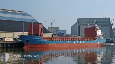
WILSON GRIMSBY
General Cargo
Current Trip
| Trip Time | 23 h, 45 mins |
|---|---|
| Trip Distance | 218.42 nm |
| AVG Speed | 9.1 Knop |
| MAX Speed | 10.1 Knop |
| Djupgående | 5.8 m |
| AVG Wind | 10.5 knots |
| MAX Wind | 17.8 knots |
| MIN Temp | 5.2°C / 41.36°F |
| MAX Temp | 8.5°C / 47.3°F |
| Position mottagen | 1 m sen |
Current Position
| Longitud | 14.60555° |
|---|---|
| Latitude | 53.40218° |
| Status | Moored |
| Fart | |
| Kurs | 174° |
| Område | Baltic Sea |
| Station | T-AIS |
| Position mottagen | 1 m sen |
Info
Information
The current position of WILSON GRIMSBY is in Baltic Sea with coordinates 53.40218° / 14.60555° as reported on 2024-04-25 19:00 by AIS to our vessel tracker app. The vessel's current speed is 0 Knop and is currently inside the port of SZCZECIN.
The vessel WILSON GRIMSBY (IMO: 9056040, MMSI: 314193000) is a General Cargo that was built in 1993 ( 31 År gammal ). It's sailing under the flag of [BB] Barbados.
In this page you can find informations about the vessels current position, last detected port calls, and current voyage information. If the vessels is not in coverage by AIS you will find the latest position.
The current position of WILSON GRIMSBY is detected by our AIS receivers and we are not responsible for the reliability of the data. The last position was recorded while the vessel was in Coverage by the Ais receivers of our vessel tracking app.
The current draught of WILSON GRIMSBY as reported by AIS is 5.8 meters
Weather
| Temperature | 4.5°C / 40.1°F |
|---|---|
| Wind Speed | 5 knots |
| Direction | 204° SSW |
| Pressure | 1005.2 hPa |
| Humidity | 89.3 % |
| Cloud Coverage | 100 % |
Featured Company
Last Port Calls
| Port | Arrival | Departure | Time In Port |
|---|---|---|---|
| 2024-04-25 16:14 | |||
| 2024-04-24 16:25 | 2024-04-24 16:29 | 3 m | |
| 2024-04-20 00:10 | 2024-04-22 20:06 | 2 d | |
| 2024-04-17 00:53 | 2024-04-17 13:18 | 12 h | |
| 2024-04-12 13:24 | 2024-04-16 04:47 | 3 d | |
| 2024-04-03 23:21 | 2024-04-04 16:57 | 17 h | |
| 2024-04-01 12:17 | 2024-04-03 19:25 | 2 d | |
| 2024-03-18 14:09 | 2024-03-20 13:15 | 1 d | |
| 2024-03-18 05:45 | 2024-03-18 13:18 | 7 h | |
| 2024-03-16 17:52 | 2024-03-18 04:42 | 1 d |
Last Trips
| Origin | Departure | Destination | Arrival | Distance | |
|---|---|---|---|---|---|
| 2024-04-24 18:29 | 2024-04-25 18:14 | 218.42 nm | |||
| 2024-04-22 22:06 | 2024-04-24 18:25 | 368.88 nm | |||
| 2024-04-17 14:18 | 2024-04-20 02:10 | 547.61 nm | |||
| 2024-04-16 05:47 | 2024-04-17 01:53 | 215.76 nm | |||
| 2024-04-04 18:57 | 2024-04-12 14:24 | 1658.20 nm | |||
| 2024-04-03 21:25 | 2024-04-04 01:21 | 39.46 nm | |||
| 2024-03-20 14:15 | 2024-04-01 14:17 | 1868.57 nm | |||
| 2024-03-18 14:18 | 2024-03-18 15:09 | 4.27 nm | |||
| 2024-03-18 05:42 | 2024-03-18 06:45 | 6.22 nm | |||
| 2024-03-01 13:02 | 2024-03-16 18:52 | 2578.62 nm |
Events
| Tid | Event | Detaljer | Position / Dest | Information |
|---|---|---|---|---|
| 2024-04-25 17:34 | Status ändrad | Moored Under way using engine |
53.40219 / 14.60556
[PL] SZCZECIN
|
Fart: Kurs: 174° |
| 2024-04-25 16:51 | STOPPAR förflyttning |
53.40220 / 14.60576
[PL] SZCZECIN
|
Fart: 0.3 kn Kurs: 183° |
|
| 2024-04-25 16:14 | ANLÄNDER HAMN |
|
53.45791 / 14.59880
[PL] SZCZECIN
|
Fart: 8.3 kn Kurs: 191.8° |
| 2024-04-25 14:38 | I täckningsområde |
53.67607 / 14.51619
Baltic Sea
NLTNZ-PLSZZ
|
Fart: 9.5 kn Kurs: 139.5° |
|
| 2024-04-25 12:56 | UTANFÖR täckningsområde |
53.89010 / 14.25773
Baltic Sea
NLTNZ-PLSZZ
|
Fart: 8.9 kn Kurs: 140.4° |
|
| 2024-04-25 12:13 | Byter havsområde | Polish part of the Baltic Sea German part of the Baltic Sea |
53.98604 / 14.24702
Baltic Sea
NLTNZ-PLSZZ
|
Fart: 9.1 kn Kurs: 153.4° |
| 2024-04-25 11:59 | Djupgående ändrat | 5.8 5.6 |
54.01948 / 14.21811
NLTNZ-PLSZZ
|
Fart: 9.5 kn Kurs: 153.2° |
| 2024-04-25 11:59 | ETA ändrat | 2024/04/25 12:20 2024/04/25 12:00 |
54.01948 / 14.21811
NLTNZ-PLSZZ
|
Fart: 9.5 kn Kurs: 153.2° |
| 2024-04-25 10:27 | Status ändrad | Under way using engine Default |
54.23427 / 14.03869
NLTNZ-PLSZZ
|
Fart: 9.5 kn Kurs: 154° |
| 2024-04-25 10:27 | I täckningsområde |
54.23427 / 14.03869
Baltic Sea
NLTNZ-PLSZZ
|
Fart: 9.5 kn Kurs: 155° |