
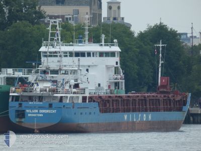
WILSON DORDRECHT
General Cargo
Current Trip
| Time Travelled | 1 day |
|---|---|
| Remaining Time | 1 day |
| Distance Travelled | 135.82 nm |
| Remaining Distance | 228.16 nm |
| AVG Speed | 8.9 Knop |
| MAX Speed | 10 Knop |
| AVG Wind | 26.9 knots |
| MAX Wind | 33 knots |
| MIN Temp | 6.4°C / 43.52°F |
| MAX Temp | 7.8°C / 46.04°F |
| Djupgående | 3.6 m |
| Position mottagen | 16 h, 15 m sen |
Current Position
| Longitud | -1.08593° |
|---|---|
| Latitude | 55.63589° |
| Status | Under way using engine |
| Fart | 8.7 Knop |
| Kurs | 145.3° |
| Område | North Sea |
| Station | T-AIS |
| Position mottagen | 16 h, 15 m sen |
Info
Information
The current position of WILSON DORDRECHT is in North Sea with coordinates 55.63589° / -1.08593° as reported on 2024-04-16 03:23 by AIS to our vessel tracker app. The vessel's current speed is 8.7 Knop and is heading at the port of ANTWERP. The estimated time of arrival as calculated by MyShipTracking vessel tracking app is 2024-04-17 23:09 LT
The vessel WILSON DORDRECHT (IMO: 9145140, MMSI: 314474000) is a General Cargo that was built in 1996 ( 28 År gammal ). It's sailing under the flag of [BB] Barbados.
In this page you can find informations about the vessels current position, last detected port calls, and current voyage information. If the vessels is not in coverage by AIS you will find the latest position.
The current position of WILSON DORDRECHT is detected by our AIS receivers and we are not responsible for the reliability of the data. The last position was recorded while the vessel was in Coverage by the Ais receivers of our vessel tracking app.
The current draught of WILSON DORDRECHT as reported by AIS is 3.6 meters
Weather
| Temperature | 7.2°C / 44.96°F |
|---|---|
| Wind Speed | 15 knots |
| Direction | 351° N |
| Pressure | 1013.7 hPa |
| Humidity | 67.9 % |
| Cloud Coverage | --- |
Featured Company
Last Port Calls
| Port | Arrival | Departure | Time In Port |
|---|---|---|---|
| 2024-04-13 17:11 | 2024-04-15 18:50 | 2 d | |
| 2024-04-11 20:35 | 2024-04-12 17:35 | 21 h | |
| 2024-04-05 15:36 | 2024-04-08 18:34 | 3 d | |
| 2024-04-04 21:14 | 2024-04-04 21:38 | 23 m | |
| 2024-04-04 03:07 | 2024-04-04 19:17 | 16 h | |
| 2024-03-28 22:07 | 2024-04-02 15:20 | 4 d | |
| 2024-03-24 17:54 | 2024-03-26 22:41 | 2 d | |
| 2024-03-20 02:15 | 2024-03-22 19:33 | 2 d | |
| 2024-03-17 17:49 | 2024-03-18 15:05 | 21 h | |
| 2024-03-07 10:53 | 2024-03-07 19:59 | 9 h |
Most Visited Ports (Last year)
| Port | Arrivals | |
|---|---|---|
| 6 | ||
| 4 | ||
| 3 | ||
| 2 | ||
| 2 | ||
| 2 |
Last Trips
| Origin | Departure | Destination | Arrival | Distance | |
|---|---|---|---|---|---|
| 2024-04-12 18:35 | 2024-04-13 18:11 | 145.88 nm | |||
| 2024-04-08 20:34 | 2024-04-11 21:35 | 541.74 nm | |||
| 2024-04-04 23:38 | 2024-04-05 17:36 | 135.71 nm | |||
| 2024-04-04 21:17 | 2024-04-04 23:14 | 9.77 nm | |||
| 2024-04-02 16:20 | 2024-04-04 05:07 | 260.48 nm | |||
| 2024-03-26 22:41 | 2024-03-28 22:07 | 267.45 nm | |||
| 2024-03-22 19:33 | 2024-03-24 17:54 | 267.12 nm | |||
| 2024-03-18 16:05 | 2024-03-20 02:15 | 265.70 nm | |||
| 2024-03-07 20:59 | 2024-03-17 18:49 | 1649.54 nm | |||
| 2024-02-28 19:42 | 2024-03-07 11:53 | 1298.71 nm |
Events
| Tid | Event | Detaljer | Position / Dest | Information |
|---|---|---|---|---|
| 2024-04-16 03:29 | Status ändrad | Default Under way using engine |
55.62333 / -1.07167
BEANR
|
Fart: 8.7 kn Kurs: 145.3° |
| 2024-04-16 03:23 | UTANFÖR täckningsområde |
55.63589 / -1.08593
North Sea
BEANR
|
Fart: 8.7 kn Kurs: 145.3° |
|
| 2024-04-15 22:41 | Djupgående ändrat | 3.6 4.7 |
56.21277 / -1.80226
BEANR
|
Fart: 9.2 kn Kurs: 144.2° |
| 2024-04-15 22:41 | Destination ändrad | BEANR GBMON |
56.21277 / -1.80226
BEANR
|
Fart: 9.2 kn Kurs: 144.2° |
| 2024-04-15 22:41 | ETA ändrat | 2024/04/17 22:00 2024/04/13 09:00 |
56.21277 / -1.80226
BEANR
|
Fart: 9.2 kn Kurs: 144.2° |
| 2024-04-15 22:26 | Status ändrad | Under way using engine Default |
56.24353 / -1.83984
GBMON
|
Fart: 9.2 kn Kurs: 146° |
| 2024-04-15 22:20 | I täckningsområde |
56.24353 / -1.83984
North Sea
|
Fart: 9.1 kn Kurs: 145.3° |
|
| 2024-04-15 18:50 | STARTAR förflyttning | 1.05 nm, East of MONTROSE |
56.70334 / -2.43667
GBMON
|
Fart: 8 kn Kurs: -1° |
| 2024-04-15 18:50 | AVGÅTT HAMN |
|
56.70334 / -2.43667
GBMON
|
Fart: 3 kn Kurs: -1° |
| 2024-04-13 17:17 | STOPPAR förflyttning |
56.70334 / -2.46667
[GB] MONTROSE
|
Fart: Kurs: -1° |