
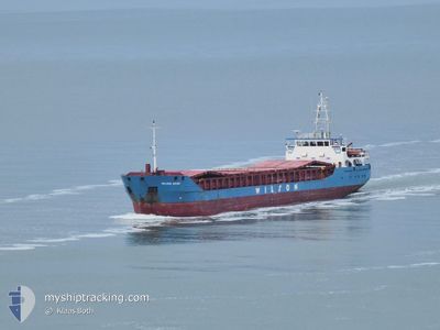
WILSON AVEIRO
General Cargo
Current Trip
GBCYP
| Time Travelled | 1 day |
|---|---|
| Remaining Time | --- |
| Distance Travelled | 276.69 nm |
| Remaining Distance | --- |
| AVG Speed | 7.6 Knop |
| MAX Speed | 8.7 Knop |
| AVG Wind | 11 knots |
| MAX Wind | 16.8 knots |
| MIN Temp | 8.3°C / 46.94°F |
| MAX Temp | 11.4°C / 52.52°F |
| Djupgående | 5.3 m |
| Position mottagen | 4 m sen |
Current Position
| Longitud | -7.00317° |
|---|---|
| Latitude | 55.46848° |
| Status | Under way using engine |
| Fart | 7 Knop |
| Kurs | 100.4° |
| Område | Inner Seas off the West Coast of Scotland |
| Station | T-AIS |
| Position mottagen | 4 m sen |
Info
Information
The current position of WILSON AVEIRO is in Inner Seas off the West Coast of Scotland with coordinates 55.46848° / -7.00317° as reported on 2024-04-20 00:09 by AIS to our vessel tracker app. The vessel's current speed is 7 Knop
The vessel WILSON AVEIRO (IMO: 9375850, MMSI: 314464000) is a General Cargo that was built in 2008 ( 16 År gammal ). It's sailing under the flag of [BB] Barbados.
In this page you can find informations about the vessels current position, last detected port calls, and current voyage information. If the vessels is not in coverage by AIS you will find the latest position.
The current position of WILSON AVEIRO is detected by our AIS receivers and we are not responsible for the reliability of the data. The last position was recorded while the vessel was in Coverage by the Ais receivers of our vessel tracking app.
The current draught of WILSON AVEIRO as reported by AIS is 5.3 meters
Weather
| Temperature | 8.3°C / 46.94°F |
|---|---|
| Wind Speed | 5 knots |
| Direction | 343° NNW |
| Pressure | 1027.8 hPa |
| Humidity | 77 % |
| Cloud Coverage | 42 % |
Featured Company
Last Port Calls
| Port | Arrival | Departure | Time In Port |
|---|---|---|---|
| 2024-04-17 10:38 | 2024-04-18 12:13 | 1 d | |
| 2024-04-14 09:07 | 2024-04-16 10:34 | 2 d | |
| 2024-04-01 12:53 | 2024-04-03 15:23 | 2 d | |
| 2024-04-01 12:08 | 2024-04-01 12:38 | 29 m | |
| 2024-03-29 06:35 | 2024-03-31 09:14 | 2 d | |
| 2024-03-26 12:39 | 2024-03-27 15:32 | 1 d | |
| 2024-03-16 17:55 | 2024-03-16 18:19 | 24 m | |
| 2024-03-14 09:38 | 2024-03-16 16:28 | 2 d | |
| 2024-03-14 07:52 | 2024-03-14 08:21 | 29 m | |
| 2024-03-07 20:28 | 2024-03-13 17:34 | 5 d |
Last Trips
| Origin | Departure | Destination | Arrival | Distance | |
|---|---|---|---|---|---|
| 2024-04-16 11:34 | 2024-04-17 11:38 | 175.56 nm | |||
| 2024-04-03 15:23 | 2024-04-14 10:07 | 1219.38 nm | |||
| 2024-04-01 12:38 | 2024-04-01 12:53 | 0.33 nm | |||
| 2024-03-31 09:14 | 2024-04-01 12:08 | 174.08 nm | |||
| 2024-03-27 15:32 | 2024-03-29 06:35 | 332.28 nm | |||
| 2024-03-16 19:19 | 2024-03-26 12:39 | 1480.97 nm | |||
| 2024-03-16 17:28 | 2024-03-16 18:55 | 10.66 nm | |||
| 2024-03-14 09:21 | 2024-03-14 10:38 | 9.60 nm | |||
| 2024-03-13 18:34 | 2024-03-14 08:52 | 110.21 nm | |||
| 2024-02-23 21:22 | 2024-03-07 21:28 | 1912.32 nm |
Events
| Tid | Event | Detaljer | Position / Dest | Information |
|---|---|---|---|---|
| 2024-04-19 23:56 | Status ändrad | Under way using engine Default |
55.47335 / -7.04963
GBCYP
|
Fart: 7.4 kn Kurs: 103° |
| 2024-04-19 23:33 | Status ändrad | Default Under way using engine |
55.48257 / -7.13004
GBCYP
|
Fart: 7 kn Kurs: 103.9° |
| 2024-04-19 23:28 | Upptäckt i hav | Irish part of the Inner Seas off the West Coast of Scotland |
55.48447 / -7.14655
Inner Seas off the West Coast of Scotland
GBCYP
|
Fart: 7 kn Kurs: 103.9° |
| 2024-04-19 23:28 | Status ändrad | Under way using engine Default |
55.48447 / -7.14655
GBCYP
|
Fart: 6.9 kn Kurs: 103° |
| 2024-04-19 23:14 | I täckningsområde |
55.48447 / -7.14655
Inner Seas off the West Coast of Scotland
GBCYP
|
Fart: 7 kn Kurs: 103.9° |
|
| 2024-04-18 13:16 | Status ändrad | Default Under way using engine |
53.21500 / -9.23667
GBCYP
|
Fart: 8.5 kn Kurs: 262.3° |
| 2024-04-18 13:07 | UTANFÖR täckningsområde |
53.21931 / -9.20143
North Atlantic Ocean
GBCYP
|
Fart: 8.5 kn Kurs: 262.3° |
|
| 2024-04-18 12:13 | AVGÅTT HAMN |
|
53.26593 / -9.04414
GBCYP
|
Fart: 5.1 kn Kurs: 145° |
| 2024-04-18 12:11 | STARTAR förflyttning |
53.26818 / -9.04681
[IE] GALWAY
|
Fart: 3.2 kn Kurs: 143° |
|
| 2024-04-18 11:53 | Status ändrad | Under way using engine Moored |
53.26998 / -9.04928
[IE] GALWAY
|
Fart: Kurs: 132° |