
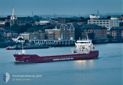
WAALDIJK
General Cargo
Current Trip
| Time Travelled | 4 days |
|---|---|
| Remaining Time | 3 days |
| Distance Travelled | 964.84 nm |
| Remaining Distance | 719.91 nm |
| AVG Speed | 7.9 Knop |
| MAX Speed | 11.1 Knop |
| AVG Wind | 14.4 knots |
| MAX Wind | 32.8 knots |
| MIN Temp | 8.1°C / 46.58°F |
| MAX Temp | 19.5°C / 67.1°F |
| Djupgående | 6.2 m |
| Position mottagen | 15 h, 49 m sen |
Current Position
| Longitud | 11.67967° |
|---|---|
| Latitude | 38.17672° |
| Status | Under way using engine |
| Fart | 5.6 Knop |
| Kurs | 256.7° |
| Område | Tyrrhenian Sea |
| Station | T-AIS |
| Position mottagen | 15 h, 49 m sen |
Info
Information
The current position of WAALDIJK is in Tyrrhenian Sea with coordinates 38.17672° / 11.67967° as reported on 2024-04-25 04:50 by AIS to our vessel tracker app. The vessel's current speed is 5.6 Knop and is heading at the port of CEUTA. The estimated time of arrival as calculated by MyShipTracking vessel tracking app is 2024-04-29 00:19 LT
The vessel WAALDIJK (IMO: 9514937, MMSI: 245726000) is a General Cargo that was built in 2010 ( 14 År gammal ). It's sailing under the flag of [NL] Netherlands.
In this page you can find informations about the vessels current position, last detected port calls, and current voyage information. If the vessels is not in coverage by AIS you will find the latest position.
The current position of WAALDIJK is detected by our AIS receivers and we are not responsible for the reliability of the data. The last position was recorded while the vessel was in Coverage by the Ais receivers of our vessel tracking app.
The current draught of WAALDIJK as reported by AIS is 6.2 meters
Weather
| Temperature | 15°C / 59°F |
|---|---|
| Wind Speed | 11 knots |
| Direction | 105° ESE |
| Pressure | 1011.8 hPa |
| Humidity | 61.6 % |
| Cloud Coverage | 9 % |
Featured Company
Last Port Calls
| Port | Arrival | Departure | Time In Port |
|---|---|---|---|
| 2024-04-18 05:52 | 2024-04-21 03:09 | 2 d | |
| 2024-04-11 03:50 | 2024-04-13 06:53 | 2 d | |
| 2024-03-22 16:05 | 2024-03-23 05:27 | 13 h | |
| 2024-03-21 14:58 | 2024-03-22 15:42 | 1 d | |
| 2024-03-18 23:48 | 2024-03-19 19:05 | 19 h | |
| 2024-03-17 13:05 | 2024-03-17 13:09 | 3 m | |
| 2024-03-14 22:55 | 2024-03-15 19:16 | 20 h | |
| 2024-03-10 06:42 | 2024-03-12 20:27 | 2 d | |
| 2024-03-06 20:49 | 2024-03-07 20:03 | 23 h | |
| 2024-03-04 22:27 | 2024-03-06 01:05 | 1 d |
Last Trips
| Origin | Departure | Destination | Arrival | Distance | |
|---|---|---|---|---|---|
| 2024-04-13 09:53 | 2024-04-18 08:52 | 219.39 nm | |||
| 2024-03-23 06:27 | 2024-04-11 06:50 | 3662.31 nm | |||
| 2024-03-22 16:42 | 2024-03-22 17:05 | 0.69 nm | |||
| 2024-03-19 20:05 | 2024-03-21 15:58 | 514.30 nm | |||
| 2024-03-17 14:09 | 2024-03-19 00:48 | 354.69 nm | |||
| 2024-03-15 20:16 | 2024-03-17 14:05 | 359.32 nm | |||
| 2024-03-12 20:27 | 2024-03-14 23:55 | 304.94 nm | |||
| 2024-03-07 21:03 | 2024-03-10 06:42 | 368.04 nm | |||
| 2024-03-06 01:05 | 2024-03-06 21:49 | 189.63 nm | |||
| 2024-02-29 19:23 | 2024-03-04 22:27 | 547.50 nm |
Events
| Tid | Event | Detaljer | Position / Dest | Information |
|---|---|---|---|---|
| 2024-04-25 04:56 | Status ändrad | Default Under way using engine |
38.17333 / 11.66667
CEUTA
|
Fart: 5.6 kn Kurs: 256.7° |
| 2024-04-25 04:50 | UTANFÖR täckningsområde |
38.17672 / 11.67967
Tyrrhenian Sea
CEUTA
|
Fart: 5.6 kn Kurs: 256.7° |
|
| 2024-04-25 04:24 | Status ändrad | Under way using engine Default |
38.18223 / 11.73213
CEUTA
|
Fart: 6 kn Kurs: 270° |
| 2024-04-25 04:05 | Status ändrad | Default Under way using engine |
38.18167 / 11.77333
CEUTA
|
Fart: 5.9 kn Kurs: 268.2° |
| 2024-04-24 22:15 | Status ändrad | Under way using engine Default |
38.23942 / 12.62289
CEUTA
|
Fart: 9 kn Kurs: 267° |
| 2024-04-24 22:15 | I täckningsområde |
38.23911 / 12.61904
Tyrrhenian Sea
CEUTA
|
Fart: 7.8 kn Kurs: 263.7° |
|
| 2024-04-24 21:20 | Status ändrad | Default Under way using engine |
38.24500 / 12.79500
CEUTA
|
Fart: 9.3 kn Kurs: 270.1° |
| 2024-04-24 21:06 | UTANFÖR täckningsområde |
38.24777 / 12.84341
Tyrrhenian Sea
CEUTA
|
Fart: 9.3 kn Kurs: 270.1° |
|
| 2024-04-24 20:55 | Status ändrad | Under way using engine Default |
38.24910 / 12.87821
CEUTA
|
Fart: 9 kn Kurs: 267° |
| 2024-04-24 20:50 | Status ändrad | Default Under way using engine |
38.24833 / 12.89333
CEUTA
|
Fart: 9.3 kn Kurs: 266.2° |