
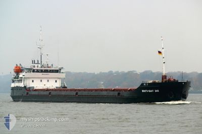
VODLA-2
General Cargo
Current Trip
| Time Travelled | 7 days |
|---|---|
| Remaining Time | --- |
| Distance Travelled | 583.12 nm |
| Remaining Distance | --- |
| AVG Speed | 6.4 Knop |
| MAX Speed | 9.1 Knop |
| AVG Wind | 5.6 knots |
| MAX Wind | 22 knots |
| MIN Temp | 11.3°C / 52.34°F |
| MAX Temp | 17.8°C / 64.04°F |
| Djupgående | 2.8 m |
| Position mottagen | 5 d sen |
Current Position
| Longitud | 29.60785° |
|---|---|
| Latitude | 41.28178° |
| Status | Under way using engine |
| Fart | 8.8 Knop |
| Kurs | 89.2° |
| Område | Black Sea |
| Station | T-AIS |
| Position mottagen | 5 d sen |
Info
Information
The current position of VODLA-2 is in Black Sea with coordinates 41.28178° / 29.60785° as reported on 2024-04-14 01:07 by AIS to our vessel tracker app. The vessel's current speed is 8.8 Knop and is heading at the port of AZOV. The estimated time of arrival as calculated by MyShipTracking vessel tracking app is 2024-04-18 17:00 LT
The vessel VODLA-2 (IMO: 8230572, MMSI: 273328100) is a General Cargo that was built in 1983 ( 41 År gammal ). It's sailing under the flag of [RU] Russia.
In this page you can find informations about the vessels current position, last detected port calls, and current voyage information. If the vessels is not in coverage by AIS you will find the latest position.
The current position of VODLA-2 is detected by our AIS receivers and we are not responsible for the reliability of the data. The last position was recorded while the vessel was in Coverage by the Ais receivers of our vessel tracking app.
The current draught of VODLA-2 as reported by AIS is 2.8 meters
Weather
| Temperature | 14.3°C / 57.74°F |
|---|---|
| Wind Speed | 7 knots |
| Direction | 44° NE |
| Pressure | 1000.8 hPa |
| Humidity | 70.6 % |
| Cloud Coverage | 100 % |
Featured Company
Events
| Tid | Event | Detaljer | Position / Dest | Information |
|---|---|---|---|---|
| 2024-04-17 19:24 | STOPPAR förflyttning | 9.6 nm, South of TAMAN |
44.96583 / 36.62265
AZOV
|
Fart: 0.1 kn Kurs: 142° |
| 2024-04-14 01:09 | Status ändrad | Default Under way using engine |
41.28183 / 29.61221
AZOV
|
Fart: 8.8 kn Kurs: 89.2° |
| 2024-04-14 01:07 | UTANFÖR täckningsområde |
41.28178 / 29.60785
Black Sea
AZOV
|
Fart: 8.8 kn Kurs: 89.2° |
|
| 2024-04-14 00:51 | Status ändrad | Under way using engine Default |
41.28182 / 29.55653
AZOV
|
Fart: 8.9 kn Kurs: 91° |
| 2024-04-14 00:51 | I täckningsområde |
41.28182 / 29.55653
Black Sea
AZOV
|
Fart: 8.8 kn Kurs: 90.9° |
|
| 2024-04-13 23:53 | Status ändrad | Default Under way using engine |
41.28273 / 29.36716
AZOV
|
Fart: 9 kn Kurs: 90.8° |
| 2024-04-13 23:48 | UTANFÖR täckningsområde |
41.28284 / 29.35130
Black Sea
AZOV
|
Fart: 9 kn Kurs: 90.8° |
|
| 2024-04-13 23:30 | Status ändrad | Under way using engine Default |
41.28307 / 29.29093
AZOV
|
Fart: 8.3 kn Kurs: 87° |
| 2024-04-13 23:22 | Status ändrad | Default Under way using engine |
41.28312 / 29.26715
AZOV
|
Fart: 8.6 kn Kurs: 60.6° |
| 2024-04-13 22:38 | Byter havsområde | Turkish part of the Black Sea Turkish part of the Sea of Marmara |
41.22863 / 29.15405
Black Sea
AZOV
|
Fart: 7.5 kn Kurs: 56.5° |