
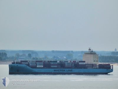
VISTULA MAERSK
Cargo A
Current Trip
| Time Travelled | 5 days |
|---|---|
| Remaining Time | 2 days |
| Distance Travelled | 2146.43 nm |
| Remaining Distance | 1125.89 nm |
| AVG Speed | 14.9 Knop |
| MAX Speed | 20.1 Knop |
| AVG Wind | 19.2 knots |
| MAX Wind | 30 knots |
| MIN Temp | 3.1°C / 37.58°F |
| MAX Temp | 13.3°C / 55.94°F |
| Djupgående | 11.4 m |
| Position mottagen | 4 d sen |
Current Position
| Longitud | -11.51768° |
|---|---|
| Latitude | 50.25046° |
| Status | Under way using engine |
| Fart | 16.5 Knop |
| Kurs | 275.8° |
| Område | North Atlantic Ocean |
| Station | T-AIS |
| Position mottagen | 4 d sen |
Info
Information
The current position of VISTULA MAERSK is in North Atlantic Ocean with coordinates 50.25046° / -11.51768° as reported on 2024-04-21 00:14 by AIS to our vessel tracker app. The vessel's current speed is 16.5 Knop and is heading at the port of MONTREAL. The estimated time of arrival as calculated by MyShipTracking vessel tracking app is 2024-04-28 00:30 LT
The vessel VISTULA MAERSK (IMO: 9775737, MMSI: 219678000) is a Cargo A It's sailing under the flag of [DK] Denmark.
In this page you can find informations about the vessels current position, last detected port calls, and current voyage information. If the vessels is not in coverage by AIS you will find the latest position.
The current position of VISTULA MAERSK is detected by our AIS receivers and we are not responsible for the reliability of the data. The last position was recorded while the vessel was in Coverage by the Ais receivers of our vessel tracking app.
The current draught of VISTULA MAERSK as reported by AIS is 11.4 meters
Weather
| Temperature | 4.6°C / 40.28°F |
|---|---|
| Wind Speed | 19 knots |
| Direction | 166° SSE |
| Pressure | 1020.6 hPa |
| Humidity | 99.6 % |
| Cloud Coverage | 100 % |
Featured Company
Last Port Calls
| Port | Arrival | Departure | Time In Port |
|---|---|---|---|
| 2024-04-18 19:22 | 2024-04-19 08:47 | 13 h | |
| 2024-04-17 11:19 | 2024-04-18 09:02 | 21 h | |
| 2024-04-15 06:32 | 2024-04-16 05:51 | 23 h | |
| 2024-04-01 09:55 | 2024-04-02 01:53 | 15 h | |
| 2024-03-26 09:15 | 2024-03-29 10:50 | 3 d | |
| 2024-03-15 17:17 | 2024-03-17 00:44 | 1 d | |
| 2024-03-14 12:59 | 2024-03-15 01:35 | 12 h | |
| 2024-03-11 19:01 | 2024-03-12 21:17 | 1 d | |
| 2024-03-03 21:37 | 2024-03-04 08:00 | 10 h | |
| 2024-02-25 22:00 | 2024-02-29 13:08 | 3 d |
Most Visited Ports (Last year)
| Port | Arrivals | |
|---|---|---|
| 12 | ||
| 12 | ||
| 12 | ||
| 12 | ||
| 12 |
Last Trips
| Origin | Departure | Destination | Arrival | Distance | |
|---|---|---|---|---|---|
| 2024-04-18 11:02 | 2024-04-18 21:22 | 126.63 nm | |||
| 2024-04-16 07:51 | 2024-04-17 13:19 | 294.64 nm | |||
| 2024-04-01 22:53 | 2024-04-15 08:32 | 3157.36 nm | |||
| 2024-03-29 06:50 | 2024-04-01 06:55 | 970.90 nm | |||
| 2024-03-17 01:44 | 2024-03-26 05:15 | 3524.01 nm | |||
| 2024-03-15 02:35 | 2024-03-15 18:17 | 150.40 nm | |||
| 2024-03-12 22:17 | 2024-03-14 13:59 | 382.97 nm | |||
| 2024-03-04 04:00 | 2024-03-11 20:01 | 2892.37 nm | |||
| 2024-02-29 08:08 | 2024-03-03 17:37 | 967.65 nm | |||
| 2024-02-16 14:42 | 2024-02-25 17:00 | 3692.31 nm |
Events
| Tid | Event | Detaljer | Position / Dest | Information |
|---|---|---|---|---|
| 2024-04-21 00:25 | Status ändrad | Default Under way using engine |
50.25500 / -11.59666
BEANR->CAMTR
|
Fart: 16.5 kn Kurs: 275.8° |
| 2024-04-21 00:14 | Byter havsområde | Irish part of the North Atlantic Ocean Irish part of the Celtic Sea |
50.25046 / -11.51768
North Atlantic Ocean
BEANR->CAMTR
|
Fart: 16.5 kn Kurs: 275.8° |
| 2024-04-21 00:14 | Status ändrad | Under way using engine Default |
50.25046 / -11.51768
BEANR->CAMTR
|
Fart: 16.5 kn Kurs: 275° |
| 2024-04-21 00:14 | UTANFÖR täckningsområde |
50.25046 / -11.51768
North Atlantic Ocean
BEANR->CAMTR
|
Fart: 16.5 kn Kurs: 275.8° |
|
| 2024-04-20 23:52 | Status ändrad | Default Under way using engine |
50.24166 / -11.36167
BEANR->CAMTR
|
Fart: 16.5 kn Kurs: 275.3° |
| 2024-04-20 23:41 | Byter havsområde | Irish part of the Celtic Sea United Kingdom part of the Celtic Sea |
50.23635 / -11.28230
Celtic Sea
BEANR->CAMTR
|
Fart: 16.5 kn Kurs: 275.3° |
| 2024-04-20 23:41 | Status ändrad | Under way using engine Default |
50.23635 / -11.28230
BEANR->CAMTR
|
Fart: 16 kn Kurs: 276° |
| 2024-04-20 23:28 | I täckningsområde |
50.23635 / -11.28230
Celtic Sea
BEANR->CAMTR
|
Fart: 16.5 kn Kurs: 275.3° |
|
| 2024-04-20 16:22 | Status ändrad | Default Under way using engine |
49.87815 / -8.24935
BEANR->CAMTR
|
Fart: 15.9 kn Kurs: 279.4° |
| 2024-04-20 16:01 | UTANFÖR täckningsområde |
49.86133 / -8.10590
Celtic Sea
BEANR->CAMTR
|
Fart: 15.9 kn Kurs: 279.4° |