
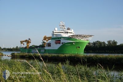
VIKING NEPTUN
Other Type
Current Trip
LE BARCARES FR
| Time Travelled | 31 days |
|---|---|
| Remaining Time | --- |
| Distance Travelled | 2615.97 nm |
| Remaining Distance | --- |
| AVG Speed | 8.5 Knop |
| MAX Speed | 14.9 Knop |
| AVG Wind | 18.2 knots |
| MAX Wind | 35 knots |
| MIN Temp | 5.2°C / 41.36°F |
| MAX Temp | 17.5°C / 63.5°F |
| Djupgående | 7 m |
| Position mottagen | Nu |
Current Position
| Longitud | 3.11463° |
|---|---|
| Latitude | 42.81237° |
| Status | Restricted manoeuverability |
| Fart | 1.9 Knop |
| Kurs | 250° |
| Område | Mediterranean Sea - Western Basin |
| Station | T-AIS |
| Position mottagen | Nu |
Info
Information
The current position of VIKING NEPTUN is in Mediterranean Sea - Western Basin with coordinates 42.81237° / 3.11463° as reported on 2024-04-25 05:11 by AIS to our vessel tracker app. The vessel's current speed is 1.9 Knop
The vessel VIKING NEPTUN (IMO: 9664902, MMSI: 258789000) is a Other Type It's sailing under the flag of [NO] Norway.
In this page you can find informations about the vessels current position, last detected port calls, and current voyage information. If the vessels is not in coverage by AIS you will find the latest position.
The current position of VIKING NEPTUN is detected by our AIS receivers and we are not responsible for the reliability of the data. The last position was recorded while the vessel was in Coverage by the Ais receivers of our vessel tracking app.
The current draught of VIKING NEPTUN as reported by AIS is 7 meters
Weather
| Temperature | 10.9°C / 51.62°F |
|---|---|
| Wind Speed | 11 knots |
| Direction | 316° NW |
| Pressure | 1012 hPa |
| Humidity | 66.5 % |
| Cloud Coverage | 85 % |
Featured Company
Most Visited Ports (Last year)
| Port | Arrivals | |
|---|---|---|
| 7 | ||
| 5 | ||
| 3 | ||
| 1 | ||
| 1 |
Events
| Tid | Event | Detaljer | Position / Dest | Information |
|---|---|---|---|---|
| 2024-04-25 04:00 | I täckningsområde |
42.81329 / 3.11676
Mediterranean Sea - Western Basin
|
Fart: Kurs: 216.9° |
|
| 2024-04-24 23:00 | UTANFÖR täckningsområde |
42.86101 / 3.24610
Mediterranean Sea - Western Basin
|
Fart: Kurs: 180.9° |
|
| 2024-04-24 10:13 | STOPPAR förflyttning | 12.63 nm, South East of PORT LA NOUVELLE |
42.86110 / 3.24615
LE BARCARES FR
|
Fart: Kurs: 340° |
| 2024-04-24 07:56 | STARTAR förflyttning | 5.76 nm, North of CANET EN ROUSSILLON |
42.79687 / 3.06458
LE BARCARES FR
|
Fart: 3.9 kn Kurs: 46° |
| 2024-04-24 05:42 | I täckningsområde |
42.79492 / 3.05663
Mediterranean Sea - Western Basin
|
Fart: Kurs: 104.9° |
|
| 2024-04-23 14:48 | UTANFÖR täckningsområde |
42.84268 / 3.24203
Mediterranean Sea - Western Basin
|
Fart: Kurs: 308.9° |
|
| 2024-04-23 13:17 | STOPPAR förflyttning | 12.35 nm, North East of CANET EN ROUSSILLON |
42.84212 / 3.24313
LE BARCARES FR
|
Fart: Kurs: 2° |
| 2024-04-23 11:54 | STARTAR förflyttning | 6.74 nm, North East of CANET EN ROUSSILLON |
42.78999 / 3.13362
LE BARCARES FR
|
Fart: 3.9 kn Kurs: 32° |
| 2024-04-23 11:19 | STOPPAR förflyttning | 6.62 nm, North East of CANET EN ROUSSILLON |
42.78891 / 3.13106
LE BARCARES FR
|
Fart: Kurs: 258° |
| 2024-04-23 09:43 | STARTAR förflyttning | 13.06 nm, North East of CANET EN ROUSSILLON |
42.85303 / 3.25151
LE BARCARES FR
|
Fart: 3.9 kn Kurs: 231° |