
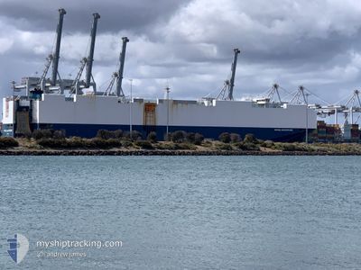
VIKING ADVENTURE
Cargo
Current Trip
MX LZC
| Time Travelled | 2 days |
|---|---|
| Remaining Time | --- |
| Distance Travelled | 818.47 nm |
| Remaining Distance | --- |
| AVG Speed | 16.8 Knop |
| MAX Speed | 20 Knop |
| AVG Wind | 14.6 knots |
| MAX Wind | 20.1 knots |
| MIN Temp | 9.5°C / 49.1°F |
| MAX Temp | 18.1°C / 64.58°F |
| Djupgående | 9.6 m |
| Position mottagen | 1 d sen |
Current Position
| Longitud | 141.27934° |
|---|---|
| Latitude | 35.20047° |
| Status | Under way using engine |
| Fart | 17.8 Knop |
| Kurs | 64.5° |
| Område | North Pacific Ocean |
| Station | T-AIS |
| Position mottagen | 1 d sen |
Info
Information
The current position of VIKING ADVENTURE is in North Pacific Ocean with coordinates 35.20047° / 141.27934° as reported on 2024-04-22 13:10 by AIS to our vessel tracker app. The vessel's current speed is 17.8 Knop
The vessel VIKING ADVENTURE (IMO: 9673018, MMSI: 538009728) is a Cargo It's sailing under the flag of [MH] Marshall Is.
In this page you can find informations about the vessels current position, last detected port calls, and current voyage information. If the vessels is not in coverage by AIS you will find the latest position.
The current position of VIKING ADVENTURE is detected by our AIS receivers and we are not responsible for the reliability of the data. The last position was recorded while the vessel was in Coverage by the Ais receivers of our vessel tracking app.
The current draught of VIKING ADVENTURE as reported by AIS is 9.6 meters
Weather
| Temperature | 9.7°C / 49.46°F |
|---|---|
| Wind Speed | 11 knots |
| Direction | 44° NE |
| Pressure | 1023.2 hPa |
| Humidity | 64.1 % |
| Cloud Coverage | 18 % |
Featured Company
Last Port Calls
| Port | Arrival | Departure | Time In Port |
|---|---|---|---|
| 2024-04-21 21:04 | 2024-04-22 06:04 | 9 h | |
| 2024-04-20 21:24 | 2024-04-21 04:28 | 7 h | |
| 2024-04-12 23:10 | 2024-04-13 13:50 | 14 h | |
| 2024-04-07 00:24 | 2024-04-08 17:48 | 1 d | |
| 2024-03-23 15:32 | 2024-03-24 10:04 | 18 h | |
| 2024-03-19 04:52 | 2024-03-20 03:00 | 22 h | |
| 2024-03-15 00:05 | 2024-03-15 22:22 | 22 h | |
| 2024-03-06 21:51 | 2024-03-10 08:21 | 3 d | |
| 2024-02-25 21:15 | 2024-02-26 06:36 | 9 h | |
| 2024-02-24 21:10 | 2024-02-25 05:31 | 8 h |
Last Trips
| Origin | Departure | Destination | Arrival | Distance | |
|---|---|---|---|---|---|
| 2024-04-21 13:28 | 2024-04-22 06:04 | 209.03 nm | |||
| 2024-04-13 20:50 | 2024-04-21 06:24 | 2901.52 nm | |||
| 2024-04-09 00:48 | 2024-04-13 06:10 | 1385.81 nm | |||
| 2024-03-24 20:34 | 2024-04-07 07:24 | 3388.11 nm | |||
| 2024-03-20 14:00 | 2024-03-24 02:02 | 545.57 nm | |||
| 2024-03-16 08:22 | 2024-03-19 15:52 | 1114.29 nm | |||
| 2024-03-10 18:21 | 2024-03-15 10:05 | 833.52 nm | |||
| 2024-02-26 15:36 | 2024-03-07 07:51 | 3382.22 nm | |||
| 2024-02-25 14:31 | 2024-02-26 06:15 | 201.81 nm | |||
| 2024-02-24 15:27 | 2024-02-25 06:10 | 44.22 nm |
Events
| Tid | Event | Detaljer | Position / Dest | Information |
|---|---|---|---|---|
| 2024-04-22 13:18 | Status ändrad | Default Under way using engine |
35.21667 / 141.32333
MX LZC
|
Fart: 17.8 kn Kurs: 64.5° |
| 2024-04-22 13:10 | UTANFÖR täckningsområde |
35.20047 / 141.27934
North Pacific Ocean
|
Fart: 17.8 kn Kurs: 64.5° |
|
| 2024-04-22 08:42 | Destination ändrad | MX LZC JP YOK |
34.85156 / 139.75743
MX LZC
|
Fart: 18 kn Kurs: 112.3° |
| 2024-04-22 08:42 | ETA ändrat | 2024/04/07 18:00 2024/04/21 19:25 |
34.85156 / 139.75743
MX LZC
|
Fart: 18 kn Kurs: 112.3° |
| 2024-04-22 08:39 | Byter havsområde | Japanese part of the North Pacific Ocean Japanese part of the Philippine Sea |
34.85608 / 139.74334
North Pacific Ocean
|
Fart: 17.7 kn Kurs: 114.2° |
| 2024-04-22 08:39 | Status ändrad | Under way using engine Default |
34.85738 / 139.74001
JP YOK
|
Fart: 17.7 kn Kurs: 136° |
| 2024-04-22 08:20 | I täckningsområde |
34.85608 / 139.74334
North Pacific Ocean
|
Fart: 17.7 kn Kurs: 114.2° |
|
| 2024-04-22 06:04 | AVGÅTT HAMN |
|
35.43927 / 139.72723
JP YOK
|
Fart: 9.7 kn Kurs: 140° |
| 2024-04-22 05:56 | STARTAR förflyttning |
35.45916 / 139.70795
[JP] YOKOHAMA
|
Fart: 8.5 kn Kurs: 139° |
|
| 2024-04-21 21:32 | STOPPAR förflyttning |
35.46265 / 139.69629
[JP] YOKOHAMA
|
Fart: 0.3 kn Kurs: 44° |