
VIERWALDSTAETTERSEE
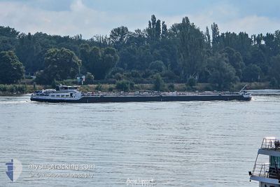
Tanker
Current Trip
HAFEN TRIER
| Time Travelled | 1 day |
|---|---|
| Remaining Time | --- |
| Distance Travelled | 147.49 nm |
| Remaining Distance | --- |
| AVG Speed | 5.2 Knop |
| MAX Speed | 7.4 Knop |
| AVG Wind | 9.7 knots |
| MAX Wind | 15.7 knots |
| MIN Temp | 5.5°C / 41.9°F |
| MAX Temp | 10°C / 50°F |
| Djupgående | 1.6 m |
| Position mottagen | 15 h, 40 m sen |
Current Position
| Longitud | --- |
|---|---|
| Latitude | --- |
| Status | Under way using engine |
| Fart | 5.8 Knop |
| Kurs | 139.2° |
| Område | North Sea |
| Station | T-AIS |
| Position mottagen | 15 h, 40 m sen |
Info
Information
The current position of VIERWALDSTAETTERSEE is in North Sea with coordinates 50.50245° / 7.31166° as reported on 2025-12-07 05:54 by AIS to our vessel tracker app. The vessel's current speed is 5.8 Knop
The vessel VIERWALDSTAETTERSEE (MMSI: 211806570) is a Tanker It's sailing under the flag of [DE] Germany.
In this page you can find informations about the vessels current position, last detected port calls, and current voyage information. If the vessels is not in coverage by AIS you will find the latest position.
The current position of VIERWALDSTAETTERSEE is detected by our AIS receivers and we are not responsible for the reliability of the data. The last position was recorded while the vessel was in Coverage by the Ais receivers of our vessel tracking app.
The current draught of VIERWALDSTAETTERSEE as reported by AIS is 1.6 meters
Weather
| Temperature | 8.5°C / 47.3°F |
|---|---|
| Wind Speed | 6 knots |
| Direction | 175° S |
| Pressure | 1009.3 hPa |
| Humidity | 93.1 % |
| Cloud Coverage | 100 % |
Featured Company
Last Port Calls
| Port | Arrival | Departure | Time In Port |
|---|---|---|---|
| 2025-12-06 04:34 | 2025-12-06 05:22 | 47 m | |
| 2025-12-04 19:11 | 2025-12-05 16:51 | 21 h | |
| 2025-11-28 19:19 | 2025-12-04 17:02 | 5 d | |
| 2025-11-27 05:51 | 2025-11-27 16:38 | 10 h | |
| 2025-11-26 14:23 | 2025-11-26 14:37 | 14 m | |
| 2025-11-24 21:43 | 2025-11-24 22:12 | 29 m | |
| 2025-11-22 10:13 | 2025-11-24 21:41 | 2 d | |
| 2025-11-21 17:41 | 2025-11-21 18:46 | 1 h | |
| 2025-11-21 11:10 | 2025-11-21 11:37 | 27 m | |
| 2025-11-19 04:08 | 2025-11-21 06:56 | 2 d |
Most Visited Ports (Last year)
| Port | Arrivals | |
|---|---|---|
| 24 | ||
| 21 | ||
| 20 | ||
| 19 | ||
| 18 | ||
| 16 |
Last Trips
| Origin | Departure | Destination | Arrival | Distance | |
|---|---|---|---|---|---|
| 2025-12-05 16:51 | 2025-12-06 04:34 | 73.38 nm | |||
| 2025-12-04 17:02 | 2025-12-04 19:11 | 16.38 nm | |||
| 2025-11-27 16:38 | 2025-11-28 19:19 | 289.06 nm | |||
| 2025-11-26 14:37 | 2025-11-27 05:51 | 1.00 nm | |||
| 2025-11-24 22:12 | 2025-11-26 14:23 | 191.49 nm | |||
| 2025-11-24 21:41 | 2025-11-24 21:43 | 0.08 nm | |||
| 2025-11-21 18:46 | 2025-11-22 10:13 | 68.76 nm | |||
| 2025-11-21 11:37 | 2025-11-21 17:41 | 28.77 nm | |||
| 2025-11-21 06:56 | 2025-11-21 11:10 | 31.24 nm | |||
| 2025-11-19 03:45 | 2025-11-19 04:08 | 1.30 nm |
Events
| Tid | Event | Detaljer | Position / Dest | Information |
|---|---|---|---|---|
| 2025-12-07 15:11 | STARTAR förflyttning | 1.28 nm, North East of TREIS KARDEN |
50.18500 / 7.32167
HAFEN TRIER
|
Fart: 5 kn Kurs: 288° |
| 2025-12-07 14:59 | STOPPAR förflyttning | 1.62 nm, North East of TREIS KARDEN |
50.18333 / 7.33333
HAFEN TRIER
|
Fart: Kurs: -1° |
| 2025-12-07 06:50 | Status ändrad | Default Under way using engine |
50.44500 / 7.39500
HAFEN TRIER
|
Fart: 5.8 kn Kurs: 139.2° |
| 2025-12-07 05:54 | UTANFÖR täckningsområde |
50.50245 / 7.31166
North Sea
HAFEN TRIER
|
Fart: 5.8 kn Kurs: 139.2° |
|
| 2025-12-06 18:44 | Status ändrad | Under way using engine Default |
51.16384 / 6.79659
HAFEN TRIER
|
Fart: 5.4 kn Kurs: 185° |
| 2025-12-06 18:41 | Status ändrad | Default Under way using engine |
51.16861 / 6.79897
HAFEN TRIER
|
Fart: 5.4 kn Kurs: 170.2° |
| 2025-12-06 08:53 | Status ändrad | Under way using engine Default |
51.66161 / 6.51207
HAFEN TRIER
|
Fart: 5 kn Kurs: 100° |
| 2025-12-06 08:47 | Status ändrad | Default Under way using engine |
51.66167 / 6.49500
HAFEN TRIER
|
Fart: 5.3 kn Kurs: 164.8° |
| 2025-12-06 08:28 | Status ändrad | Under way using engine Default |
51.68257 / 6.47069
HAFEN TRIER
|
Fart: 5 kn Kurs: 166° |
| 2025-12-06 08:11 | I täckningsområde |
51.68257 / 6.47069
North Sea
HAFEN TRIER
|
Fart: 5.5 kn Kurs: 169° |