
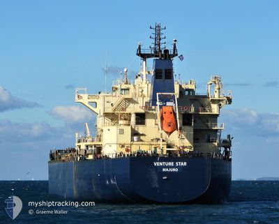
SALTWIND EXPLORER
Bulk Carrier
Current Trip
| Time Travelled | 8 days |
|---|---|
| Remaining Time | 2 days |
| Distance Travelled | 2440.07 nm |
| Remaining Distance | 643.44 nm |
| AVG Speed | 11.6 Knop |
| MAX Speed | 13.2 Knop |
| AVG Wind | 7.6 knots |
| MAX Wind | 20.9 knots |
| MIN Temp | 25.9°C / 78.62°F |
| MAX Temp | 30.2°C / 86.36°F |
| Djupgående | 13.1 m |
| Position mottagen | 2 d sen |
Current Position
| Longitud | 77.17532° |
|---|---|
| Latitude | 7.68804° |
| Status | Under way using engine |
| Fart | 11 Knop |
| Kurs | 128.8° |
| Område | Laccadive Sea |
| Station | T-AIS |
| Position mottagen | 2 d sen |
Info
Information
The current position of SALTWIND EXPLORER is in Laccadive Sea with coordinates 7.68804° / 77.17532° as reported on 2024-04-17 07:48 by AIS to our vessel tracker app. The vessel's current speed is 11 Knop and is heading at the port of CHITTAGONG. The estimated time of arrival as calculated by MyShipTracking vessel tracking app is 2024-04-22 14:45 LT
The vessel SALTWIND EXPLORER (IMO: 9483243, MMSI: 538009786) is a Bulk Carrier that was built in 2011 ( 13 År gammal ). It's sailing under the flag of [MH] Marshall Is.
In this page you can find informations about the vessels current position, last detected port calls, and current voyage information. If the vessels is not in coverage by AIS you will find the latest position.
The current position of SALTWIND EXPLORER is detected by our AIS receivers and we are not responsible for the reliability of the data. The last position was recorded while the vessel was in Coverage by the Ais receivers of our vessel tracking app.
The current draught of SALTWIND EXPLORER as reported by AIS is 13.1 meters
Weather
| Temperature | 29.2°C / 84.56°F |
|---|---|
| Wind Speed | 13 knots |
| Direction | 193° SSW |
| Pressure | 1009.2 hPa |
| Humidity | 72.9 % |
| Cloud Coverage | 96 % |
Featured Company
Last Port Calls
| Port | Arrival | Departure | Time In Port |
|---|---|---|---|
| 2024-04-08 20:48 | 2024-04-11 11:31 | 2 d | |
| 2024-03-20 14:08 | 2024-03-22 22:06 | 2 d | |
| 2024-02-24 21:47 | 2024-02-26 08:40 | 1 d | |
| 2024-02-17 07:45 | 2024-02-22 21:07 | 5 d |
Most Visited Ports (Last year)
| Port | Arrivals | |
|---|---|---|
| 2 | ||
| 2 | ||
| 1 | ||
| 1 | ||
| 1 | ||
| 1 |
Last Trips
| Origin | Departure | Destination | Arrival | Distance | |
|---|---|---|---|---|---|
| 2024-03-23 03:36 | 2024-04-09 00:48 | 2981.13 nm | |||
| 2024-02-26 12:40 | 2024-03-20 19:38 | 3659.14 nm | |||
| 2024-02-23 01:07 | 2024-02-25 01:47 | 134.91 nm | |||
| 2024-01-25 21:26 | 2024-02-17 11:45 | 6423.88 nm |
Events
| Tid | Event | Detaljer | Position / Dest | Information |
|---|---|---|---|---|
| 2024-04-17 07:49 | Status ändrad | Default Under way using engine |
7.68710 / 77.17654
BD CGP
|
Fart: 11 kn Kurs: 128.8° |
| 2024-04-17 07:48 | UTANFÖR täckningsområde |
7.68804 / 77.17532
Laccadive Sea
BD CGP
|
Fart: 11 kn Kurs: 128.8° |
|
| 2024-04-17 06:33 | Status ändrad | Under way using engine Default |
7.83378 / 76.99116
BD CGP
|
Fart: 11 kn Kurs: 131° |
| 2024-04-17 06:27 | Status ändrad | Default Under way using engine |
7.84500 / 76.97667
BD CGP
|
Fart: 11.3 kn Kurs: 117.6° |
| 2024-04-17 06:18 | Status ändrad | Under way using engine Default |
7.86179 / 76.95349
BD CGP
|
Fart: 11 kn Kurs: 132° |
| 2024-04-17 06:00 | Status ändrad | Default Under way using engine |
7.89667 / 76.90833
BD CGP
|
Fart: 11.4 kn Kurs: 131.3° |
| 2024-04-17 05:50 | Djupgående ändrat | 13.1 8.9 |
7.91789 / 76.88492
BD CGP
|
Fart: 11.5 kn Kurs: 128.3° |
| 2024-04-17 05:50 | Destination ändrad | BD CGP OM KHS |
7.91789 / 76.88492
BD CGP
|
Fart: 11.5 kn Kurs: 128.3° |
| 2024-04-17 05:50 | ETA ändrat | 2024/04/22 04:00 2024/04/08 09:00 |
7.91789 / 76.88492
BD CGP
|
Fart: 11.5 kn Kurs: 128.3° |
| 2024-04-17 05:40 | Status ändrad | Under way using engine Default |
7.93813 / 76.85903
OM KHS
|
Fart: 11 kn Kurs: 128° |