
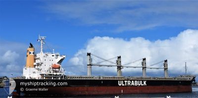
ULTRA ESTERHAZY
Cargo
Current Trip
| Time Travelled | 8 days |
|---|---|
| Remaining Time | 13 days |
| Distance Travelled | 2425.22 nm |
| Remaining Distance | 4178.60 nm |
| AVG Speed | 11.6 Knop |
| MAX Speed | 16 Knop |
| AVG Wind | 12.5 knots |
| MAX Wind | 31 knots |
| MIN Temp | 7.9°C / 46.22°F |
| MAX Temp | 21°C / 69.8°F |
| Djupgående | 10.2 m |
| Position mottagen | 1 d sen |
Current Position
| Longitud | -19.95059° |
|---|---|
| Latitude | 29.49618° |
| Status | Under way using engine |
| Fart | 12.4 Knop |
| Kurs | 206.4° |
| Område | North Atlantic Ocean |
| Station | T-AIS |
| Position mottagen | 1 d sen |
Info
Information
The current position of ULTRA ESTERHAZY is in North Atlantic Ocean with coordinates 29.49618° / -19.95059° as reported on 2024-04-17 08:59 by AIS to our vessel tracker app. The vessel's current speed is 12.4 Knop and is heading at the port of MONTEVIDEO. The estimated time of arrival as calculated by MyShipTracking vessel tracking app is 2024-05-02 12:55 LT
The vessel ULTRA ESTERHAZY (IMO: 9643946, MMSI: 373821000) is a Cargo It's sailing under the flag of [PA] Panama.
In this page you can find informations about the vessels current position, last detected port calls, and current voyage information. If the vessels is not in coverage by AIS you will find the latest position.
The current position of ULTRA ESTERHAZY is detected by our AIS receivers and we are not responsible for the reliability of the data. The last position was recorded while the vessel was in Coverage by the Ais receivers of our vessel tracking app.
The current draught of ULTRA ESTERHAZY as reported by AIS is 10.2 meters
Weather
| Temperature | 21°C / 69.8°F |
|---|---|
| Wind Speed | 10 knots |
| Direction | 17° NNE |
| Pressure | 1018.3 hPa |
| Humidity | 76.8 % |
| Cloud Coverage | 100 % |
Featured Company
Last Port Calls
| Port | Arrival | Departure | Time In Port |
|---|---|---|---|
| 2024-04-06 05:14 | 2024-04-09 22:23 | 3 d | |
| 2024-03-23 20:21 | 2024-03-28 23:48 | 5 d | |
| 2024-03-08 05:58 | |||
| 2024-03-02 00:16 | |||
| 2024-02-18 19:05 | 2024-02-21 22:13 | 3 d | |
| 2024-02-01 07:07 |
Most Visited Ports (Last year)
| Port | Arrivals | |
|---|---|---|
| 2 | ||
| 1 | ||
| 1 | ||
| 1 | ||
| 1 | ||
| 1 |
Last Trips
| Origin | Departure | Destination | Arrival | Distance | |
|---|---|---|---|---|---|
| 2024-03-28 23:48 | 2024-04-06 07:14 | 1428.38 nm | |||
| 2024-03-08 00:58 | 2024-03-23 20:21 | 3905.68 nm | |||
| 2024-02-01 01:07 | 2024-02-18 13:05 | 1170.86 nm |
Events
| Tid | Event | Detaljer | Position / Dest | Information |
|---|---|---|---|---|
| 2024-04-17 09:05 | Status ändrad | Default Under way using engine |
29.47606 / -19.96202
UY MVD
|
Fart: 12.4 kn Kurs: 206.4° |
| 2024-04-17 08:59 | UTANFÖR täckningsområde |
29.49618 / -19.95059
North Atlantic Ocean
UY MVD
|
Fart: 12.4 kn Kurs: 206.4° |
|
| 2024-04-17 08:56 | Status ändrad | Under way using engine Default |
29.50389 / -19.94611
UY MVD
|
Fart: 12.4 kn Kurs: 207° |
| 2024-04-17 08:51 | Status ändrad | Default Under way using engine |
29.52040 / -19.93655
UY MVD
|
Fart: 12.5 kn Kurs: 206.7° |
| 2024-04-17 08:13 | Status ändrad | Under way using engine Default |
29.63781 / -19.86704
UY MVD
|
Fart: 12.8 kn Kurs: 209° |
| 2024-04-17 08:07 | Status ändrad | Default Under way using engine |
29.65384 / -19.85720
UY MVD
|
Fart: 12.8 kn Kurs: 207° |
| 2024-04-17 08:03 | Status ändrad | Under way using engine Default |
29.66794 / -19.84861
UY MVD
|
Fart: 12.8 kn Kurs: 208° |
| 2024-04-17 07:58 | Status ändrad | Default Under way using engine |
29.68309 / -19.83947
UY MVD
|
Fart: 12.8 kn Kurs: 207.7° |
| 2024-04-17 07:54 | Status ändrad | Under way using engine Default |
29.69729 / -19.83087
UY MVD
|
Fart: 12.9 kn Kurs: 207° |
| 2024-04-17 07:45 | Status ändrad | Default Under way using engine |
29.72452 / -19.81449
UY MVD
|
Fart: 12.6 kn Kurs: 207.9° |