
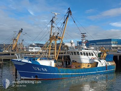
UK68 JELLE-KORNELIS
Trawler
Current Trip
Unknown
| Time Travelled | 1 day |
|---|---|
| Remaining Time | --- |
| Distance Travelled | 4.75 nm |
| Remaining Distance | --- |
| AVG Speed | 7.6 Knop |
| MAX Speed | 8.3 Knop |
| AVG Wind | 18.2 knots |
| MAX Wind | 18.9 knots |
| MIN Temp | 7.1°C / 44.78°F |
| MAX Temp | 7.3°C / 45.14°F |
| Djupgående | 4 m |
| Position mottagen | 1 d sen |
Current Position
| Longitud | 6.08104° |
|---|---|
| Latitude | 53.44159° |
| Status | Restricted manoeuverability |
| Fart | 8.2 Knop |
| Kurs | 314° |
| Område | North Sea |
| Station | T-AIS |
| Position mottagen | 1 d sen |
Info
Information
The current position of UK68 JELLE-KORNELIS is in North Sea with coordinates 53.44159° / 6.08104° as reported on 2024-04-22 05:30 by AIS to our vessel tracker app. The vessel's current speed is 8.2 Knop
The vessel UK68 JELLE-KORNELIS (IMO: 9056181, MMSI: 244075000) is a Trawler that was built in 1992 ( 32 År gammal ). It's sailing under the flag of [NL] Netherlands.
In this page you can find informations about the vessels current position, last detected port calls, and current voyage information. If the vessels is not in coverage by AIS you will find the latest position.
The current position of UK68 JELLE-KORNELIS is detected by our AIS receivers and we are not responsible for the reliability of the data. The last position was recorded while the vessel was in Coverage by the Ais receivers of our vessel tracking app.
The current draught of UK68 JELLE-KORNELIS as reported by AIS is 4 meters
Weather
| Temperature | 7.3°C / 45.14°F |
|---|---|
| Wind Speed | 18 knots |
| Direction | 41° NE |
| Pressure | 1026.3 hPa |
| Humidity | 64.3 % |
| Cloud Coverage | 100 % |
Featured Company
Last Port Calls
| Port | Arrival | Departure | Time In Port |
|---|---|---|---|
| 2024-04-19 04:18 | 2024-04-22 04:50 | 3 d | |
| 2024-04-10 06:10 | 2024-04-15 00:01 | 4 d | |
| 2024-04-05 21:43 | 2024-04-07 22:34 | 2 d | |
| 2024-03-29 23:31 | 2024-04-01 16:12 | 2 d | |
| 2024-03-22 22:01 | 2024-03-25 08:08 | 2 d | |
| 2024-03-19 00:46 | 2024-03-19 01:30 | 44 m | |
| 2024-03-16 18:12 | 2024-03-18 00:40 | 1 d | |
| 2024-02-29 16:14 | 2024-03-16 07:10 | 15 d | |
| 2024-02-29 04:36 | 2024-02-29 09:37 | 5 h | |
| 2024-02-21 12:05 | 2024-02-26 22:47 | 5 d |
Most Visited Ports (Last year)
| Port | Arrivals | |
|---|---|---|
| 25 | ||
| 21 | ||
| 10 | ||
| 9 | ||
| 7 | ||
| 3 |
Last Trips
| Origin | Departure | Destination | Arrival | Distance | |
|---|---|---|---|---|---|
| 2024-04-15 02:01 | 2024-04-19 06:18 | 122.17 nm | |||
| 2024-04-08 00:34 | 2024-04-10 08:10 | 164.12 nm | |||
| 2024-04-01 18:12 | 2024-04-05 23:43 | 110.46 nm | |||
| 2024-03-25 09:08 | 2024-03-30 00:31 | 126.16 nm | |||
| 2024-03-19 02:30 | 2024-03-22 23:01 | 19.12 nm | |||
| 2024-03-18 01:40 | 2024-03-19 01:46 | 113.97 nm | |||
| 2024-03-16 08:10 | 2024-03-16 19:12 | 86.65 nm | |||
| 2024-02-29 10:37 | 2024-02-29 17:14 | 55.22 nm | |||
| 2024-02-26 23:47 | 2024-02-29 05:36 | 224.69 nm | |||
| 2024-02-19 00:46 | 2024-02-21 13:05 | 131.07 nm |
Events
| Tid | Event | Detaljer | Position / Dest | Information |
|---|---|---|---|---|
| 2024-04-22 05:30 | UTANFÖR täckningsområde |
53.44159 / 6.08104
North Sea
|
Fart: 8.2 kn Kurs: 314° |
|
| 2024-04-22 04:50 | AVGÅTT HAMN |
|
53.41329 / 6.20167
|
Fart: 6.9 kn Kurs: 331° |
| 2024-04-22 04:46 | STARTAR förflyttning |
53.40877 / 6.20082
[NL] LAUWERSOOG
|
Fart: 4.3 kn Kurs: 280° |
|
| 2024-04-22 04:30 | I täckningsområde |
53.40920 / 6.20382
North Sea
[NL] LAUWERSOOG
|
Fart: Kurs: 242° |
|
| 2024-04-19 05:26 | UTANFÖR täckningsområde |
53.40912 / 6.20379
North Sea
[NL] LAUWERSOOG
|
Fart: 0.7 kn Kurs: 9° |
|
| 2024-04-19 04:19 | STOPPAR förflyttning |
53.40951 / 6.20854
[NL] LAUWERSOOG
|
Fart: 0.2 kn Kurs: 91° |
|
| 2024-04-19 04:18 | ANLÄNDER HAMN |
|
53.40951 / 6.20854
[NL] LAUWERSOOG
|
Fart: 1.3 kn Kurs: 59° |
| 2024-04-19 03:49 | I täckningsområde |
53.43145 / 6.14611
North Sea
|
Fart: 9.5 kn Kurs: 99° |
|
| 2024-04-19 00:47 | UTANFÖR täckningsområde |
53.74804 / 6.16679
North Sea
|
Fart: 7.6 kn Kurs: 175° |
|
| 2024-04-18 23:41 | Byter havsområde | Dutch part of the North Sea German part of the North Sea |
53.87799 / 6.20802
North Sea
|
Fart: 7.2 kn Kurs: 205° |