
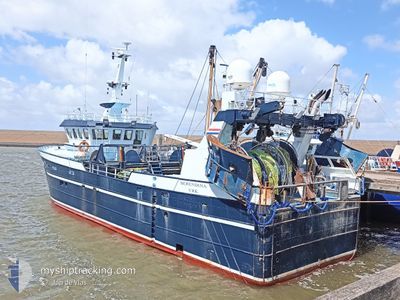
UK642 BERENDINA
Fishing
Current Trip
Unknown
| Time Travelled | 3 days |
|---|---|
| Remaining Time | --- |
| Distance Travelled | 6.78 nm |
| Remaining Distance | --- |
| AVG Speed | 7.6 Knop |
| MAX Speed | 8.3 Knop |
| AVG Wind | 17.3 knots |
| MAX Wind | 18 knots |
| MIN Temp | 7.1°C / 44.78°F |
| MAX Temp | 7.3°C / 45.14°F |
| Djupgående | 0 m |
| Position mottagen | 2 d sen |
Current Position
| Longitud | 6.08210° |
|---|---|
| Latitude | 53.47988° |
| Status | Under way sailing |
| Fart | 7.2 Knop |
| Kurs | 24.9° |
| Område | North Sea |
| Station | T-AIS |
| Position mottagen | 2 d sen |
Info
Information
The current position of UK642 BERENDINA is in North Sea with coordinates 53.47988° / 6.08210° as reported on 2024-04-22 05:23 by AIS to our vessel tracker app. The vessel's current speed is 7.2 Knop
The vessel UK642 BERENDINA (IMO: 9568079, MMSI: 244150302) is a Fishing It's sailing under the flag of [NL] Netherlands.
In this page you can find informations about the vessels current position, last detected port calls, and current voyage information. If the vessels is not in coverage by AIS you will find the latest position.
The current position of UK642 BERENDINA is detected by our AIS receivers and we are not responsible for the reliability of the data. The last position was recorded while the vessel was in Coverage by the Ais receivers of our vessel tracking app.
Weather
| Temperature | 7.3°C / 45.14°F |
|---|---|
| Wind Speed | 18 knots |
| Direction | 41° NE |
| Pressure | 1026.3 hPa |
| Humidity | 64.3 % |
| Cloud Coverage | 100 % |
Featured Company
Last Port Calls
| Port | Arrival | Departure | Time In Port |
|---|---|---|---|
| 2024-04-19 06:08 | 2024-04-22 04:26 | 2 d | |
| 2024-04-11 20:24 | 2024-04-16 16:03 | 4 d | |
| 2024-04-05 06:18 | 2024-04-07 23:23 | 2 d | |
| 2024-03-14 17:15 | 2024-04-04 17:38 | 21 d | |
| 2024-03-14 02:47 | 2024-03-14 02:59 | 11 m | |
| 2024-03-07 20:31 | 2024-03-11 04:20 | 3 d | |
| 2024-02-29 18:52 | 2024-03-04 03:07 | 3 d | |
| 2024-02-22 00:37 | 2024-02-26 22:48 | 4 d | |
| 2024-02-13 20:35 | 2024-02-19 03:28 | 5 d | |
| 2024-02-13 19:00 |
Most Visited Ports (Last year)
| Port | Arrivals | |
|---|---|---|
| 14 | ||
| 13 | ||
| 5 | ||
| 4 | ||
| 2 | ||
| 1 |
Last Trips
| Origin | Departure | Destination | Arrival | Distance | |
|---|---|---|---|---|---|
| 2024-04-16 18:03 | 2024-04-19 08:08 | 111.61 nm | |||
| 2024-04-08 01:23 | 2024-04-11 22:24 | 221.07 nm | |||
| 2024-04-04 19:38 | 2024-04-05 08:18 | 129.47 nm | |||
| 2024-03-14 03:59 | 2024-03-14 18:15 | 131.06 nm | |||
| 2024-03-11 05:20 | 2024-03-14 03:47 | 348.13 nm | |||
| 2024-03-04 04:07 | 2024-03-07 21:31 | 337.90 nm | |||
| 2024-02-26 23:48 | 2024-02-29 19:52 | 219.18 nm | |||
| 2024-02-19 04:28 | 2024-02-22 01:37 | 260.78 nm | |||
| 2024-02-13 20:00 | 2024-02-13 21:35 | 7.14 nm |
Events
| Tid | Event | Detaljer | Position / Dest | Information |
|---|---|---|---|---|
| 2024-04-22 05:23 | UTANFÖR täckningsområde |
53.47988 / 6.08210
North Sea
|
Fart: 7.2 kn Kurs: 24.9° |
|
| 2024-04-22 04:26 | AVGÅTT HAMN |
|
53.41367 / 6.20139
|
Fart: 6.9 kn Kurs: 340° |
| 2024-04-22 04:22 | STARTAR förflyttning |
53.40897 / 6.20015
[NL] LAUWERSOOG
|
Fart: 4.4 kn Kurs: 288° |
|
| 2024-04-22 03:38 | I täckningsområde |
53.40876 / 6.20321
North Sea
[NL] LAUWERSOOG
|
Fart: Kurs: 219.8° |
|
| 2024-04-22 00:58 | UTANFÖR täckningsområde |
53.40879 / 6.20323
North Sea
[NL] LAUWERSOOG
|
Fart: Kurs: 39.8° |
|
| 2024-04-22 00:58 | I täckningsområde |
53.40879 / 6.20323
North Sea
[NL] LAUWERSOOG
|
Fart: Kurs: 39.8° |
|
| 2024-04-19 08:04 | UTANFÖR täckningsområde |
53.40846 / 6.20449
North Sea
[NL] LAUWERSOOG
|
Fart: 1 kn Kurs: 255.1° |
|
| 2024-04-19 06:57 | I täckningsområde |
53.40831 / 6.20448
North Sea
[NL] LAUWERSOOG
|
Fart: Kurs: 294.2° |
|
| 2024-04-19 06:08 | ANLÄNDER HAMN |
|
53.40831 / 6.20448
[NL] LAUWERSOOG
|
Fart: 10.1 kn Kurs: 149.3° |
| 2024-04-19 05:37 | UTANFÖR täckningsområde |
53.44740 / 6.07423
North Sea
|
Fart: 10.1 kn Kurs: 149.3° |