
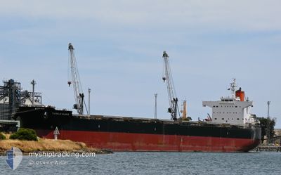
TWINKLE ISLAND
Bulk Carrier
Current Trip
VNPHY
| Time Travelled | 37 days |
|---|---|
| Remaining Time | --- |
| Distance Travelled | 9773.72 nm |
| Remaining Distance | --- |
| AVG Speed | 10.6 Knop |
| MAX Speed | 14.2 Knop |
| AVG Wind | 13.2 knots |
| MAX Wind | 31.7 knots |
| MIN Temp | 14.9°C / 58.82°F |
| MAX Temp | 30.7°C / 87.26°F |
| Djupgående | 13.4 m |
| Position mottagen | 4 h, 0 m sen |
Current Position
| Longitud | 104.22199° |
|---|---|
| Latitude | 1.27202° |
| Status | Under way using engine |
| Fart | 11.9 Knop |
| Kurs | 84.6° |
| Område | Singapore Strait |
| Station | T-AIS |
| Position mottagen | 4 h, 0 m sen |
Info
Information
The current position of TWINKLE ISLAND is in Singapore Strait with coordinates 1.27202° / 104.22199° as reported on 2024-04-25 16:43 by AIS to our vessel tracker app. The vessel's current speed is 11.9 Knop
The vessel TWINKLE ISLAND (IMO: 9512367, MMSI: 538004652) is a Bulk Carrier that was built in 2012 ( 12 År gammal ). It's sailing under the flag of [MH] Marshall Is.
In this page you can find informations about the vessels current position, last detected port calls, and current voyage information. If the vessels is not in coverage by AIS you will find the latest position.
The current position of TWINKLE ISLAND is detected by our AIS receivers and we are not responsible for the reliability of the data. The last position was recorded while the vessel was in Coverage by the Ais receivers of our vessel tracking app.
The current draught of TWINKLE ISLAND as reported by AIS is 13.4 meters
Weather
| Temperature | 29.2°C / 84.56°F |
|---|---|
| Wind Speed | 3 knots |
| Direction | 101° E |
| Pressure | 1006 hPa |
| Humidity | 75.5 % |
| Cloud Coverage | 100 % |
Featured Company
Last Port Calls
| Port | Arrival | Departure | Time In Port |
|---|---|---|---|
| 2024-03-19 15:53 | |||
| 2024-02-20 16:37 | 2024-02-29 11:34 | 8 d |
Last Trips
| Origin | Departure | Destination | Arrival | Distance | |
|---|---|---|---|---|---|
| 2024-01-14 13:37 | 2024-02-20 13:37 | 8215.59 nm |
Events
| Tid | Event | Detaljer | Position / Dest | Information |
|---|---|---|---|---|
| 2024-04-25 16:48 | Status ändrad | Default Under way using engine |
1.27361 / 104.23857
VNPHY
|
Fart: 11.9 kn Kurs: 84.6° |
| 2024-04-25 16:43 | UTANFÖR täckningsområde |
1.27202 / 104.22199
Singapore Strait
VNPHY
|
Fart: 11.9 kn Kurs: 84.6° |
|
| 2024-04-25 16:15 | Byter havsområde | Malaysian part of the Singapore Strait Indonesian part of the Singapore Strait |
1.26302 / 104.13020
Singapore Strait
VNPHY
|
Fart: 11.3 kn Kurs: 83.1° |
| 2024-04-25 15:32 | Byter havsområde | Indonesian part of the Singapore Strait Singaporean part of the Singapore Strait |
1.25300 / 104.00731
Singapore Strait
VNPHY
|
Fart: 9.7 kn Kurs: 129.3° |
| 2024-04-25 15:03 | STARTAR förflyttning | 2.19 nm, South West of TANAH MERAH |
1.29053 / 103.98849
VNPHY
|
Fart: 3.1 kn Kurs: 183° |
| 2024-04-25 15:01 | Status ändrad | Under way using engine At anchor |
1.29134 / 103.98794
VNPHY
|
Fart: 2.3 kn Kurs: 152° |
| 2024-04-25 14:07 | Status ändrad | At anchor Default |
1.29168 / 103.98467
VNPHY
|
Fart: 0.1 kn Kurs: 86° |
| 2024-04-25 14:04 | Status ändrad | Default At anchor |
1.29165 / 103.98465
VNPHY
|
Fart: 0.1 kn Kurs: 78° |
| 2024-04-25 12:11 | ETA ändrat | 2024/04/27 23:00 2024/04/28 10:30 |
1.29162 / 103.98455
VNPHY
|
Fart: Kurs: 88° |
| 2024-04-25 10:56 | Djupgående ändrat | 13.4 13.5 |
1.29188 / 103.98457
VNPHY
|
Fart: Kurs: 92° |