
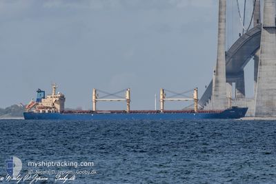
TULPAR
Bulk Carrier
Current Trip
| Time Travelled | 7 days |
|---|---|
| Remaining Time | --- |
| Distance Travelled | 2057.34 nm |
| Remaining Distance | --- |
| AVG Speed | 11.4 Knop |
| MAX Speed | 13.9 Knop |
| AVG Wind | 13.4 knots |
| MAX Wind | 28.9 knots |
| MIN Temp | 2.2°C / 35.96°F |
| MAX Temp | 12°C / 53.6°F |
| Djupgående | 10.9 m |
| Position mottagen | 17 h, 32 m sen |
Current Position
| Longitud | -5.87092° |
|---|---|
| Latitude | 48.81040° |
| Status | Under way using engine |
| Fart | 13.1 Knop |
| Kurs | 211.3° |
| Område | Celtic Sea |
| Station | T-AIS |
| Position mottagen | 17 h, 32 m sen |
Info
Information
The current position of TULPAR is in Celtic Sea with coordinates 48.81040° / -5.87092° as reported on 2024-04-19 07:26 by AIS to our vessel tracker app. The vessel's current speed is 13.1 Knop and is heading at the port of PANAMBUR. The estimated time of arrival as calculated by MyShipTracking vessel tracking app is 2024-05-10 20:00 LT
The vessel TULPAR (IMO: 9285407, MMSI: 538007583) is a Bulk Carrier that was built in 2003 ( 21 År gammal ). It's sailing under the flag of [MH] Marshall Is.
In this page you can find informations about the vessels current position, last detected port calls, and current voyage information. If the vessels is not in coverage by AIS you will find the latest position.
The current position of TULPAR is detected by our AIS receivers and we are not responsible for the reliability of the data. The last position was recorded while the vessel was in Coverage by the Ais receivers of our vessel tracking app.
The current draught of TULPAR as reported by AIS is 10.9 meters
Weather
| Temperature | 12°C / 53.6°F |
|---|---|
| Wind Speed | 18 knots |
| Direction | 69° ENE |
| Pressure | 1023.3 hPa |
| Humidity | 79.1 % |
| Cloud Coverage | --- |
Featured Company
Last Port Calls
| Port | Arrival | Departure | Time In Port |
|---|---|---|---|
| 2024-03-29 07:09 | 2024-04-12 10:04 | 14 d | |
| 2024-03-14 21:47 | 2024-03-21 03:02 | 6 d | |
| 2024-03-05 13:11 | 2024-03-06 00:35 | 11 h |
Most Visited Ports (Last year)
| Port | Arrivals | |
|---|---|---|
| 2 | ||
| 1 | ||
| 1 | ||
| 1 | ||
| 1 | ||
| 1 |
Last Trips
| Origin | Departure | Destination | Arrival | Distance | |
|---|---|---|---|---|---|
| 2024-03-21 03:02 | 2024-03-29 10:09 | 1886.54 nm | |||
| 2024-03-06 00:35 | 2024-03-14 21:47 | 1578.40 nm | |||
| 2024-01-31 18:58 | 2024-03-05 13:11 | 9635.08 nm |
Events
| Tid | Event | Detaljer | Position / Dest | Information |
|---|---|---|---|---|
| 2024-04-19 07:40 | Status ändrad | Default Under way using engine |
48.76500 / -5.91167
IN NML
|
Fart: 13.1 kn Kurs: 211.3° |
| 2024-04-19 07:26 | UTANFÖR täckningsområde |
48.81040 / -5.87092
Celtic Sea
IN NML
|
Fart: 13.1 kn Kurs: 211.3° |
|
| 2024-04-19 06:47 | Status ändrad | Under way using engine Default |
48.92326 / -5.74729
IN NML
|
Fart: 12 kn Kurs: 240° |
| 2024-04-19 06:47 | I täckningsområde |
48.92326 / -5.74729
Celtic Sea
IN NML
|
Fart: 12.9 kn Kurs: 238.9° |
|
| 2024-04-19 06:07 | Status ändrad | Default Under way using engine |
48.99333 / -5.55833
IN NML
|
Fart: 12.7 kn Kurs: 240.9° |
| 2024-04-19 05:46 | UTANFÖR täckningsområde |
49.03132 / -5.46049
Celtic Sea
IN NML
|
Fart: 12.7 kn Kurs: 240.9° |
|
| 2024-04-19 04:12 | Upptäckt i hav | French part of the Celtic Sea |
49.19518 / -5.02688
Celtic Sea
IN NML
|
Fart: 12.1 kn Kurs: 241.2° |
| 2024-04-19 02:03 | Status ändrad | Under way using engine Default |
49.40299 / -4.47243
IN NML
|
Fart: 11 kn Kurs: 237° |
| 2024-04-19 01:55 | Status ändrad | Default Under way using engine |
49.41500 / -4.43833
IN NML
|
Fart: 11.5 kn Kurs: 239.7° |
| 2024-04-19 01:20 | Status ändrad | Under way using engine Default |
49.47561 / -4.29011
IN NML
|
Fart: 11.7 kn Kurs: 237° |