
TRUSTEE
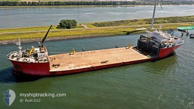
Heavy Lift Vessel
Current Trip
REV. WIND FARM USA
| Time Travelled | 5 days |
|---|---|
| Remaining Time | --- |
| Distance Travelled | 1587.26 nm |
| Remaining Distance | --- |
| AVG Speed | 12 Knop |
| MAX Speed | 13.9 Knop |
| AVG Wind | 18.3 knots |
| MAX Wind | 32 knots |
| MIN Temp | 5.9°C / 42.62°F |
| MAX Temp | 14.5°C / 58.1°F |
| Djupgående | 10.7 m |
| Position mottagen | 3 d sen |
Current Position
| Longitud | -4.60730° |
|---|---|
| Latitude | 49.62251° |
| Status | Under way using engine |
| Fart | 12.3 Knop |
| Kurs | 251.3° |
| Område | English Channel |
| Station | T-AIS |
| Position mottagen | 3 d sen |
Info
Information
The current position of TRUSTEE is in English Channel with coordinates 49.62251° / -4.60730° as reported on 2024-04-17 02:21 by AIS to our vessel tracker app. The vessel's current speed is 12.3 Knop
The vessel TRUSTEE (IMO: 8902955, MMSI: 306009000) is a Heavy Lift Vessel that was built in 1991 ( 33 År gammal ). It's sailing under the flag of [CW] Curacao.
In this page you can find informations about the vessels current position, last detected port calls, and current voyage information. If the vessels is not in coverage by AIS you will find the latest position.
The current position of TRUSTEE is detected by our AIS receivers and we are not responsible for the reliability of the data. The last position was recorded while the vessel was in Coverage by the Ais receivers of our vessel tracking app.
The current draught of TRUSTEE as reported by AIS is 10.7 meters
Weather
| Temperature | 14.1°C / 57.38°F |
|---|---|
| Wind Speed | 17 knots |
| Direction | 152° SSE |
| Pressure | 1016.6 hPa |
| Humidity | 85.6 % |
| Cloud Coverage | 100 % |
Featured Company
Last Port Calls
| Port | Arrival | Departure | Time In Port |
|---|---|---|---|
| 2024-04-12 17:28 | 2024-04-14 21:32 | 2 d | |
| 2024-04-11 11:19 | 2024-04-12 17:01 | 1 d | |
| 2024-04-10 15:14 | 2024-04-11 11:10 | 19 h | |
| 2024-04-03 08:39 |
Most Visited Ports (Last year)
| Port | Arrivals | |
|---|---|---|
| 4 | ||
| 3 | ||
| 3 | ||
| 2 | ||
| 1 | ||
| 1 |
Last Trips
| Origin | Departure | Destination | Arrival | Distance | |
|---|---|---|---|---|---|
| 2024-04-12 19:01 | 2024-04-12 19:28 | 2.69 nm | |||
| 2024-04-11 13:10 | 2024-04-11 13:19 | 0.25 nm | |||
| 2024-01-30 20:57 | 2024-04-10 17:14 | 390.78 nm | |||
| 2024-01-30 20:57 | 2024-04-03 10:39 | 383.61 nm |
Events
| Tid | Event | Detaljer | Position / Dest | Information |
|---|---|---|---|---|
| 2024-04-17 02:26 | Status ändrad | Default Under way using engine |
49.61652 / -4.63401
REV. WIND FARM USA
|
Fart: 12.3 kn Kurs: 251.3° |
| 2024-04-17 02:21 | UTANFÖR täckningsområde |
49.62251 / -4.60730
English Channel
REV. WIND FARM USA
|
Fart: 12.3 kn Kurs: 251.3° |
|
| 2024-04-16 22:15 | Status ändrad | Under way using engine Default |
49.90183 / -3.38734
REV. WIND FARM USA
|
Fart: 12.5 kn Kurs: 251° |
| 2024-04-16 22:14 | Status ändrad | Default Under way using engine |
49.90339 / -3.38051
REV. WIND FARM USA
|
Fart: 12.6 kn Kurs: 250.3° |
| 2024-04-16 21:27 | Upptäckt i hav | United Kingdom part of the English Channel |
49.95864 / -3.13748
English Channel
REV. WIND FARM USA
|
Fart: 13 kn Kurs: 251.1° |
| 2024-04-16 21:27 | Status ändrad | Under way using engine Default |
49.95864 / -3.13748
REV. WIND FARM USA
|
Fart: 13.1 kn Kurs: 251° |
| 2024-04-16 21:17 | I täckningsområde |
49.95864 / -3.13748
English Channel
REV. WIND FARM USA
|
Fart: 13 kn Kurs: 251.1° |
|
| 2024-04-16 20:25 | Status ändrad | Default Under way using engine |
50.02683 / -2.79796
REV. WIND FARM USA
|
Fart: 13.5 kn Kurs: 254.6° |
| 2024-04-16 20:18 | UTANFÖR täckningsområde |
50.03446 / -2.75569
English Channel
REV. WIND FARM USA
|
Fart: 13.5 kn Kurs: 254.6° |
|
| 2024-04-16 20:08 | Status ändrad | Under way using engine Default |
50.04480 / -2.69848
REV. WIND FARM USA
|
Fart: 13.6 kn Kurs: 254° |