
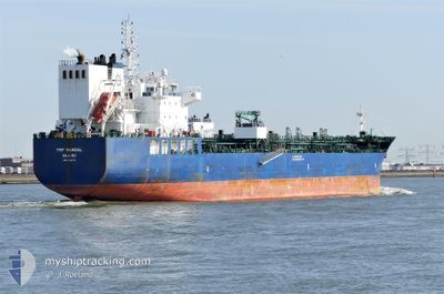
TRF MANDAL
Tanker B
Current Trip
| Trip Time | 8 days |
|---|---|
| Trip Distance | 937.50 nm |
| AVG Speed | 7.6 Knop |
| MAX Speed | 7.6 Knop |
| Djupgående | 8.6 m |
| AVG Wind | 16 knots |
| MAX Wind | 28 knots |
| MIN Temp | 20.8°C / 69.44°F |
| MAX Temp | 27.1°C / 80.78°F |
| Position mottagen | 3 h, 12 m sen |
Current Position
| Longitud | -94.91537° |
|---|---|
| Latitude | 29.36000° |
| Status | Moored |
| Fart | |
| Kurs | 91° |
| Område | Gulf of Mexico |
| Station | T-AIS |
| Position mottagen | 3 h, 12 m sen |
Info
Information
The current position of TRF MANDAL is in Gulf of Mexico with coordinates 29.36000° / -94.91537° as reported on 2024-04-19 07:48 by AIS to our vessel tracker app. The vessel's current speed is 0 Knop and is currently inside the port of TEXAS CITY.
The vessel TRF MANDAL (IMO: 9732773, MMSI: 538006542) is a Tanker B It's sailing under the flag of [MH] Marshall Is.
In this page you can find informations about the vessels current position, last detected port calls, and current voyage information. If the vessels is not in coverage by AIS you will find the latest position.
The current position of TRF MANDAL is detected by our AIS receivers and we are not responsible for the reliability of the data. The last position was recorded while the vessel was in Coverage by the Ais receivers of our vessel tracking app.
The current draught of TRF MANDAL as reported by AIS is 8.6 meters
Weather
| Temperature | 23°C / 73.4°F |
|---|---|
| Wind Speed | 7 knots |
| Direction | 172° S |
| Pressure | 1014.2 hPa |
| Humidity | 94.9 % |
| Cloud Coverage | 99 % |
Featured Company
Last Port Calls
| Port | Arrival | Departure | Time In Port |
|---|---|---|---|
| 2024-04-18 00:59 | |||
| 2024-03-05 21:19 | 2024-04-09 05:47 | ||
| 2024-02-06 22:25 | 2024-02-07 17:53 | 19 h |
Most Visited Ports (Last year)
| Port | Arrivals | |
|---|---|---|
| 2 | ||
| 2 | ||
| 2 | ||
| 1 | ||
| 1 | ||
| 1 |
Last Trips
| Origin | Departure | Destination | Arrival | Distance | |
|---|---|---|---|---|---|
| 2024-04-09 00:47 | 2024-04-17 19:59 | 937.50 nm | |||
| 2024-02-07 19:53 | 2024-03-05 15:19 | 8265.13 nm | |||
| 2023-12-31 14:47 | 2024-02-07 00:25 | 7891.32 nm |
Events
| Tid | Event | Detaljer | Position / Dest | Information |
|---|---|---|---|---|
| 2024-04-19 07:48 | UTANFÖR täckningsområde |
29.36000 / -94.91537
Gulf of Mexico
[US] TEXAS CITY
|
Fart: Kurs: 129° |
|
| 2024-04-19 07:48 | Status ändrad | Moored Default |
29.36000 / -94.91537
[US] TEXAS CITY
|
Fart: Kurs: 91° |
| 2024-04-19 07:39 | I täckningsområde |
29.36000 / -94.91537
Gulf of Mexico
[US] TEXAS CITY
|
Fart: Kurs: 129° |
|
| 2024-04-18 02:36 | Status ändrad | Default Moored |
29.36000 / -94.91542
[US] TEXAS CITY
|
Fart: Kurs: 91° |
| 2024-04-18 02:33 | Status ändrad | Moored Under way using engine |
29.36001 / -94.91541
[US] TEXAS CITY
|
Fart: Kurs: 91° |
| 2024-04-18 02:33 | UTANFÖR täckningsområde |
29.36001 / -94.91541
Gulf of Mexico
[US] TEXAS CITY
|
Fart: Kurs: 129° |
|
| 2024-04-18 01:39 | STOPPAR förflyttning |
29.36010 / -94.91558
[US] TEXAS CITY
|
Fart: 0.2 kn Kurs: 94° |
|
| 2024-04-18 00:59 | ANLÄNDER HAMN |
|
29.37938 / -94.88468
[US] TEXAS CITY
|
Fart: 7.1 kn Kurs: 257.4° |
| 2024-04-18 00:19 | Djupgående ändrat | 8.6 7.6 |
29.34335 / -94.77143
USTXT
|
Fart: 13.3 kn Kurs: 287.1° |
| 2024-04-18 00:12 | Status ändrad | Under way using engine Default |
29.34419 / -94.74197
USTXT
|
Fart: 13.4 kn Kurs: 264° |