
TORTUGAS
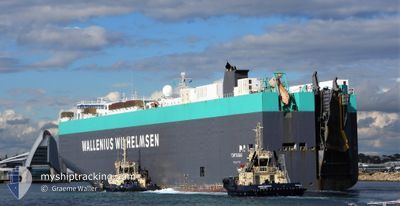
Vehicles Carrier
Current Trip
| Time Travelled | 18 days |
|---|---|
| Remaining Time | --- |
| Distance Travelled | 6959.35 nm |
| Remaining Distance | --- |
| AVG Speed | 15.1 Knop |
| MAX Speed | 17.8 Knop |
| AVG Wind | 13.7 knots |
| MAX Wind | 29.9 knots |
| MIN Temp | 6°C / 42.8°F |
| MAX Temp | 28.3°C / 82.94°F |
| Djupgående | 10.1 m |
| Position mottagen | 1 d sen |
Current Position
| Longitud | -106.20848° |
|---|---|
| Latitude | 17.12535° |
| Status | Under way using engine |
| Fart | 14.2 Knop |
| Kurs | 132° |
| Område | North Pacific Ocean |
| Station | T-AIS |
| Position mottagen | 1 d sen |
Info
Information
The current position of TORTUGAS is in North Pacific Ocean with coordinates 17.12535° / -106.20848° as reported on 2024-04-22 02:07 by AIS to our vessel tracker app. The vessel's current speed is 14.2 Knop and is heading at the port of BALBOA. The estimated time of arrival as calculated by MyShipTracking vessel tracking app is 2024-04-27 17:00 LT
The vessel TORTUGAS (IMO: 9319765, MMSI: 249757000) is a Vehicles Carrier that was built in 2006 ( 18 År gammal ). It's sailing under the flag of [MT] Malta.
In this page you can find informations about the vessels current position, last detected port calls, and current voyage information. If the vessels is not in coverage by AIS you will find the latest position.
The current position of TORTUGAS is detected by our AIS receivers and we are not responsible for the reliability of the data. The last position was recorded while the vessel was in Coverage by the Ais receivers of our vessel tracking app.
The current draught of TORTUGAS as reported by AIS is 10.1 meters
Weather
| Temperature | 28.1°C / 82.58°F |
|---|---|
| Wind Speed | 4 knots |
| Direction | 19° NNE |
| Pressure | 1012.2 hPa |
| Humidity | 71.9 % |
| Cloud Coverage | 35 % |
Featured Company
Last Port Calls
| Port | Arrival | Departure | Time In Port |
|---|---|---|---|
| 2024-04-01 05:41 | 2024-04-04 13:55 | 3 d | |
| 2024-03-05 19:42 | |||
| 2024-03-03 07:20 | 2024-03-03 23:01 | 15 h | |
| 2024-02-29 20:29 | 2024-03-01 03:17 | 6 h | |
| 2024-02-25 11:05 | 2024-02-25 20:48 | 9 h | |
| 2024-02-23 20:43 | 2024-02-24 05:54 | 9 h | |
| 2024-02-21 02:41 | 2024-02-22 01:41 | 23 h | |
| 2024-02-19 11:08 | 2024-02-20 04:51 | 17 h |
Most Visited Ports (Last year)
| Port | Arrivals | |
|---|---|---|
| 5 | ||
| 3 | ||
| 2 | ||
| 2 | ||
| 2 | ||
| 2 |
Last Trips
| Origin | Departure | Destination | Arrival | Distance | |
|---|---|---|---|---|---|
| 2024-03-05 14:42 | 2024-04-01 14:41 | 9599.48 nm | |||
| 2024-02-29 21:17 | 2024-03-03 02:20 | 740.20 nm | |||
| 2024-02-25 14:48 | 2024-02-29 14:29 | 179.94 nm | |||
| 2024-02-23 23:54 | 2024-02-25 05:05 | 222.77 nm | |||
| 2024-02-21 19:41 | 2024-02-23 14:43 | 734.60 nm | |||
| 2024-02-19 22:51 | 2024-02-20 20:41 | 181.99 nm | |||
| 2024-02-01 05:23 | 2024-02-19 05:08 | 7314.66 nm |
Events
| Tid | Event | Detaljer | Position / Dest | Information |
|---|---|---|---|---|
| 2024-04-22 02:14 | Status ändrad | Default Under way using engine |
17.10613 / -106.18684
PA BLB
|
Fart: 14.2 kn Kurs: 132° |
| 2024-04-22 02:07 | Status ändrad | Under way using engine Default |
17.12535 / -106.20848
PA BLB
|
Fart: 14.2 kn Kurs: 132° |
| 2024-04-22 02:07 | UTANFÖR täckningsområde |
17.12535 / -106.20848
North Pacific Ocean
PA BLB
|
Fart: 14.2 kn Kurs: 132° |
|
| 2024-04-22 02:02 | Status ändrad | Default Under way using engine |
17.13778 / -106.22266
PA BLB
|
Fart: 14.1 kn Kurs: 131° |
| 2024-04-22 01:52 | Status ändrad | Under way using engine Default |
17.16422 / -106.25392
PA BLB
|
Fart: 14.1 kn Kurs: 131° |
| 2024-04-22 01:45 | I täckningsområde |
17.16422 / -106.25392
North Pacific Ocean
PA BLB
|
Fart: 14.2 kn Kurs: 131° |
|
| 2024-04-21 23:38 | Status ändrad | Default Under way using engine |
17.49912 / -106.65943
PA BLB
|
Fart: 13.4 kn Kurs: 133° |
| 2024-04-21 23:33 | UTANFÖR täckningsområde |
17.51235 / -106.67383
North Pacific Ocean
PA BLB
|
Fart: 13.4 kn Kurs: 133° |
|
| 2024-04-21 23:29 | Status ändrad | Under way using engine Default |
17.52255 / -106.68503
PA BLB
|
Fart: 13.1 kn Kurs: 133° |
| 2024-04-21 23:15 | Status ändrad | Default Under way using engine |
17.55773 / -106.72438
PA BLB
|
Fart: 13.3 kn Kurs: 132° |