
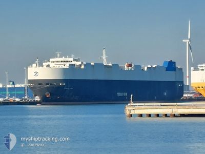
TOKYO CAR
Vehicles Carrier
Current Trip
CNSGH
| Time Travelled | 1 day |
|---|---|
| Remaining Time | --- |
| Distance Travelled | 404.01 nm |
| Remaining Distance | --- |
| AVG Speed | 15.3 Knop |
| MAX Speed | 18.7 Knop |
| AVG Wind | 11.1 knots |
| MAX Wind | 16.8 knots |
| MIN Temp | 13.3°C / 55.94°F |
| MAX Temp | 16.4°C / 61.52°F |
| Djupgående | 7.6 m |
| Position mottagen | 3 d sen |
Current Position
| Longitud | 125.93973° |
|---|---|
| Latitude | 36.75985° |
| Status | Under way using engine |
| Fart | 15.3 Knop |
| Kurs | 216° |
| Område | Yellow Sea |
| Station | T-AIS |
| Position mottagen | 3 d sen |
Info
Information
The current position of TOKYO CAR is in Yellow Sea with coordinates 36.75985° / 125.93973° as reported on 2024-04-21 13:04 by AIS to our vessel tracker app. The vessel's current speed is 15.3 Knop
The vessel TOKYO CAR (IMO: 9432907, MMSI: 636016248) is a Vehicles Carrier that was built in 2008 ( 16 År gammal ). It's sailing under the flag of [LR] Liberia.
In this page you can find informations about the vessels current position, last detected port calls, and current voyage information. If the vessels is not in coverage by AIS you will find the latest position.
The current position of TOKYO CAR is detected by our AIS receivers and we are not responsible for the reliability of the data. The last position was recorded while the vessel was in Coverage by the Ais receivers of our vessel tracking app.
The current draught of TOKYO CAR as reported by AIS is 7.6 meters
Weather
| Temperature | 13.4°C / 56.12°F |
|---|---|
| Wind Speed | 12 knots |
| Direction | 298° WNW |
| Pressure | 1010.2 hPa |
| Humidity | 78.3 % |
| Cloud Coverage | 2 % |
Featured Company
Last Port Calls
| Port | Arrival | Departure | Time In Port |
|---|---|---|---|
| 2024-04-23 09:28 | 2024-04-23 16:00 | 6 h | |
| 2024-04-21 02:31 | 2024-04-21 09:31 | 7 h | |
| 2024-04-14 21:15 | 2024-04-16 11:35 | 1 d | |
| 2024-04-12 06:03 | 2024-04-13 08:21 | 1 d | |
| 2024-03-10 03:12 | 2024-03-12 02:24 | 1 d | |
| 2024-02-02 02:54 | 2024-02-03 00:34 | 21 h |
Most Visited Ports (Last year)
| Port | Arrivals | |
|---|---|---|
| 4 | ||
| 3 | ||
| 3 | ||
| 2 | ||
| 2 | ||
| 2 |
Last Trips
| Origin | Departure | Destination | Arrival | Distance | |
|---|---|---|---|---|---|
| 2024-04-21 18:31 | 2024-04-23 17:28 | 519.85 nm | |||
| 2024-04-16 20:35 | 2024-04-21 11:31 | 992.52 nm | |||
| 2024-04-13 16:21 | 2024-04-15 06:15 | 472.95 nm | |||
| 2024-03-11 23:24 | 2024-04-12 14:03 | 11128.86 nm | |||
| 2024-02-03 08:34 | 2024-03-10 00:12 | 11681.10 nm | |||
| 2024-01-30 20:05 | 2024-02-02 10:54 | 641.15 nm |
Events
| Tid | Event | Detaljer | Position / Dest | Information |
|---|---|---|---|---|
| 2024-04-23 16:00 | STARTAR förflyttning | 4.9 nm, South East of SHANGHAI |
31.32375 / 121.68687
CNSGH
|
Fart: 3.5 kn Kurs: -1° |
| 2024-04-23 16:00 | AVGÅTT HAMN |
|
31.32375 / 121.68687
CNSGH
|
Fart: 0.7 kn Kurs: 128° |
| 2024-04-23 09:28 | ANLÄNDER HAMN |
|
31.32213 / 121.68163
[CN] SHANGHAI
|
Fart: 0.3 kn Kurs: 128° |
| 2024-04-23 04:16 | STOPPAR förflyttning | 4.61 nm, South East of SHANGHAI |
31.32903 / 121.68387
CNSGH
|
Fart: 0.2 kn Kurs: 129° |
| 2024-04-22 18:11 | STARTAR förflyttning |
31.47683 / 122.63623
CNSGH
|
Fart: 3.4 kn Kurs: 185° |
|
| 2024-04-22 17:44 | STOPPAR förflyttning |
31.47560 / 122.62949
CNSGH
|
Fart: 0.2 kn Kurs: 208° |
|
| 2024-04-22 16:59 | STARTAR förflyttning |
31.47850 / 122.63268
CNSGH
|
Fart: 3.2 kn Kurs: 198° |
|
| 2024-04-22 16:11 | STOPPAR förflyttning |
31.48585 / 122.63180
CNSGH
|
Fart: 0.3 kn Kurs: 181° |
|
| 2024-04-21 13:12 | Status ändrad | Default Under way using engine |
36.73127 / 125.92242
CNSGH
|
Fart: 15.3 kn Kurs: 216° |
| 2024-04-21 13:04 | UTANFÖR täckningsområde |
36.75985 / 125.93973
Yellow Sea
CNSGH
|
Fart: 15.3 kn Kurs: 216° |