
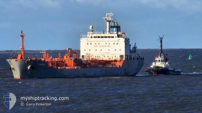
TIGRIS
Oil/Chemical Tanker
Current Trip
| Time Travelled | 7 days |
|---|---|
| Remaining Time | 7 h, 51 mins |
| Distance Travelled | 954.79 nm |
| Remaining Distance | 20.90 nm |
| AVG Speed | 8.6 Knop |
| MAX Speed | 16.2 Knop |
| AVG Wind | 19 knots |
| MAX Wind | 36.4 knots |
| MIN Temp | 6.7°C / 44.06°F |
| MAX Temp | 13.7°C / 56.66°F |
| Djupgående | 5.8 m |
| Position mottagen | Nu |
Current Position
| Longitud | 3.65312° |
|---|---|
| Latitude | 51.83977° |
| Status | Under way using engine |
| Fart | 9 Knop |
| Kurs | 348° |
| Område | North Sea |
| Station | T-AIS |
| Position mottagen | Nu |
Info
Information
The current position of TIGRIS is in North Sea with coordinates 51.83977° / 3.65312° as reported on 2024-04-19 09:47 by AIS to our vessel tracker app. The vessel's current speed is 9 Knop and is heading at the port of ROTTERDAM. The estimated time of arrival as calculated by MyShipTracking vessel tracking app is 2024-04-19 17:39 LT
The vessel TIGRIS (IMO: 9443841, MMSI: 538003615) is a Oil/Chemical Tanker that was built in 2009 ( 15 År gammal ). It's sailing under the flag of [MH] Marshall Is.
In this page you can find informations about the vessels current position, last detected port calls, and current voyage information. If the vessels is not in coverage by AIS you will find the latest position.
The current position of TIGRIS is detected by our AIS receivers and we are not responsible for the reliability of the data. The last position was recorded while the vessel was in Coverage by the Ais receivers of our vessel tracking app.
The current draught of TIGRIS as reported by AIS is 5.8 meters
Weather
| Temperature | 9.5°C / 49.1°F |
|---|---|
| Wind Speed | 26 knots |
| Direction | 300° WNW |
| Pressure | 1010.2 hPa |
| Humidity | 85 % |
| Cloud Coverage | 100 % |
Featured Company
Last Port Calls
| Port | Arrival | Departure | Time In Port |
|---|---|---|---|
| 2024-04-10 11:23 | 2024-04-11 17:27 | 1 d | |
| 2024-04-10 01:29 | 2024-04-10 08:57 | 7 h | |
| 2024-04-05 21:39 | 2024-04-06 21:12 | 23 h | |
| 2024-04-03 15:52 | 2024-04-05 08:43 | 1 d | |
| 2024-03-30 00:16 | 2024-03-30 00:57 | 41 m | |
| 2024-03-28 15:18 | 2024-03-29 23:43 | 1 d | |
| 2024-03-28 14:00 | 2024-03-28 14:52 | 51 m | |
| 2024-03-26 13:09 | 2024-03-28 10:12 | 1 d | |
| 2024-03-25 07:30 | 2024-03-26 11:16 | 1 d | |
| 2024-03-25 00:41 | 2024-03-25 05:13 | 4 h |
Most Visited Ports (Last year)
| Port | Arrivals | |
|---|---|---|
| 27 | ||
| 21 | ||
| 18 | ||
| 17 | ||
| 8 | ||
| 7 |
Last Trips
| Origin | Departure | Destination | Arrival | Distance | |
|---|---|---|---|---|---|
| 2024-04-06 23:12 | 2024-04-10 12:23 | 713.35 nm | |||
| 2024-04-06 23:12 | 2024-04-10 02:29 | 692.21 nm | |||
| 2024-04-05 10:43 | 2024-04-05 23:39 | 107.07 nm | |||
| 2024-03-30 00:57 | 2024-04-03 17:52 | 775.29 nm | |||
| 2024-03-29 23:43 | 2024-03-30 00:16 | 1.90 nm | |||
| 2024-03-28 14:52 | 2024-03-28 15:18 | 1.82 nm | |||
| 2024-03-26 11:16 | 2024-03-28 14:00 | 50.11 nm | |||
| 2024-03-26 11:16 | 2024-03-26 13:09 | 19.82 nm | |||
| 2024-03-22 06:12 | 2024-03-25 07:30 | 715.15 nm | |||
| 2024-03-22 06:12 | 2024-03-25 00:41 | 696.18 nm |
Events
| Tid | Event | Detaljer | Position / Dest | Information |
|---|---|---|---|---|
| 2024-04-19 05:42 | STARTAR förflyttning | 7.92 nm, North West of BROUWERSDAM |
51.86050 / 3.71245
NLRTM
|
Fart: 3.1 kn Kurs: 297° |
| 2024-04-19 03:26 | STOPPAR förflyttning | 9.98 nm, North West of BROUWERSDAM |
51.86125 / 3.63123
NLRTM
|
Fart: 0.3 kn Kurs: 277° |
| 2024-04-18 15:35 | STARTAR förflyttning | 5.03 nm, North of SCHEVENINGEN |
52.18170 / 4.26153
NLRTM
|
Fart: 3.2 kn Kurs: 214° |
| 2024-04-18 14:36 | STOPPAR förflyttning | 5.76 nm, North of SCHEVENINGEN |
52.19383 / 4.25772
NLRTM
|
Fart: 0.3 kn Kurs: 322° |
| 2024-04-18 09:11 | STARTAR förflyttning | 9.77 nm, North West of BROUWERSDAM |
51.87150 / 3.65512
NLRTM
|
Fart: 3.2 kn Kurs: 348° |
| 2024-04-18 08:37 | STOPPAR förflyttning | 9.66 nm, North West of BROUWERSDAM |
51.86955 / 3.65598
NLRTM
|
Fart: 0.3 kn Kurs: 262° |
| 2024-04-18 06:54 | STARTAR förflyttning | 8.95 nm, West of BROUWERSDAM |
51.79982 / 3.60540
NLRTM
|
Fart: 3.5 kn Kurs: 21° |
| 2024-04-17 23:42 | STOPPAR förflyttning | 10.44 nm, North West of BROUWERSDAM |
51.89030 / 3.66360
NLRTM
|
Fart: 0.3 kn Kurs: 180° |
| 2024-04-17 19:21 | STARTAR förflyttning | 8.02 nm, North West of BROUWERSDAM |
51.82965 / 3.65785
NLRTM
|
Fart: 3.2 kn Kurs: 343° |
| 2024-04-17 17:20 | STOPPAR förflyttning | 10.36 nm, North West of BROUWERSDAM |
51.87433 / 3.63692
NLRTM
|
Fart: 0.3 kn Kurs: 48° |