
TIANJIN HIGHWAY
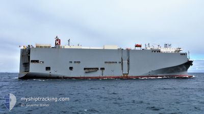
Vehicles Carrier
Current Trip
| Time Travelled | 1 day |
|---|---|
| Remaining Time | 6 h, 59 mins |
| Distance Travelled | 454.67 nm |
| Remaining Distance | 119.93 nm |
| AVG Speed | 15.7 Knop |
| MAX Speed | 18.9 Knop |
| AVG Wind | 10.6 knots |
| MAX Wind | 22.8 knots |
| MIN Temp | 19.4°C / 66.92°F |
| MAX Temp | 23.2°C / 73.76°F |
| Djupgående | 8.5 m |
| Position mottagen | 1 m sen |
Current Position
| Longitud | 152.47090° |
|---|---|
| Latitude | -33.08890° |
| Status | Under way using engine |
| Fart | 16 Knop |
| Kurs | 214° |
| Område | Tasman Sea |
| Station | T-AIS |
| Position mottagen | 1 m sen |
Info
Information
The current position of TIANJIN HIGHWAY is in Tasman Sea with coordinates -33.08890° / 152.47090° as reported on 2024-04-25 01:09 by AIS to our vessel tracker app. The vessel's current speed is 16 Knop and is heading at the port of PORT KEMBLA. The estimated time of arrival as calculated by MyShipTracking vessel tracking app is 2024-04-25 08:09 LT
The vessel TIANJIN HIGHWAY (IMO: 9294355, MMSI: 371559000) is a Vehicles Carrier that was built in 2005 ( 19 År gammal ). It's sailing under the flag of [PA] Panama.
In this page you can find informations about the vessels current position, last detected port calls, and current voyage information. If the vessels is not in coverage by AIS you will find the latest position.
The current position of TIANJIN HIGHWAY is detected by our AIS receivers and we are not responsible for the reliability of the data. The last position was recorded while the vessel was in Coverage by the Ais receivers of our vessel tracking app.
The current draught of TIANJIN HIGHWAY as reported by AIS is 8.5 meters
Weather
| Temperature | 19.4°C / 66.92°F |
|---|---|
| Wind Speed | 15 knots |
| Direction | 185° S |
| Pressure | 1019.4 hPa |
| Humidity | 61.4 % |
| Cloud Coverage | 100 % |
Featured Company
Last Port Calls
| Port | Arrival | Departure | Time In Port |
|---|---|---|---|
| 2024-04-23 11:27 | 2024-04-23 21:29 | 10 h | |
| 2024-04-20 20:24 | 2024-04-21 11:43 | 15 h | |
| 2024-04-10 23:54 | 2024-04-11 06:46 | 6 h | |
| 2024-04-08 22:04 | 2024-04-09 08:24 | 10 h | |
| 2024-04-07 22:00 | 2024-04-08 05:33 | 7 h | |
| 2024-04-04 21:22 | 2024-04-06 03:57 | 1 d | |
| 2024-03-22 21:16 | 2024-03-23 06:21 | 9 h | |
| 2024-03-17 03:23 | 2024-03-19 02:43 | 1 d | |
| 2024-03-01 20:19 | 2024-03-03 00:47 | 1 d | |
| 2024-02-27 21:29 | 2024-02-28 10:16 | 12 h |
Last Trips
| Origin | Departure | Destination | Arrival | Distance | |
|---|---|---|---|---|---|
| 2024-04-21 21:43 | 2024-04-23 21:27 | 701.00 nm | |||
| 2024-04-11 15:46 | 2024-04-21 06:24 | 3655.68 nm | |||
| 2024-04-09 17:24 | 2024-04-11 08:54 | 397.57 nm | |||
| 2024-04-08 14:33 | 2024-04-09 07:04 | 241.00 nm | |||
| 2024-04-06 12:57 | 2024-04-08 07:00 | 44.15 nm | |||
| 2024-03-22 23:21 | 2024-04-05 06:22 | 5324.46 nm | |||
| 2024-03-18 19:43 | 2024-03-22 14:16 | 909.93 nm | |||
| 2024-03-03 09:47 | 2024-03-16 20:23 | 5677.82 nm | |||
| 2024-02-28 19:16 | 2024-03-02 05:19 | 588.87 nm | |||
| 2024-01-30 17:04 | 2024-02-28 06:29 | 11046.42 nm |
Events
| Tid | Event | Detaljer | Position / Dest | Information |
|---|---|---|---|---|
| 2024-04-25 00:44 | Status ändrad | Under way using engine Default |
-32.99847 / 152.54805
AU PKL
|
Fart: 16.5 kn Kurs: 215° |
| 2024-04-25 00:43 | Status ändrad | Default Under way using engine |
-32.99140 / 152.55421
AU PKL
|
Fart: 16 kn Kurs: 215° |
| 2024-04-24 23:52 | ETA ändrat | 2024/04/25 09:00 2024/04/25 10:00 |
-32.80697 / 152.72192
AU PKL
|
Fart: 16.4 kn Kurs: 218° |
| 2024-04-24 22:38 | Status ändrad | Under way using engine Default |
-32.53812 / 152.93977
AU PKL
|
Fart: 15.7 kn Kurs: 196° |
| 2024-04-24 22:22 | I täckningsområde |
-32.54018 / 152.93888
Tasman Sea
AU PKL
|
Fart: 15.7 kn Kurs: 199° |
|
| 2024-04-24 18:52 | Status ändrad | Default Under way using engine |
-31.55657 / 153.25064
AU PKL
|
Fart: 16.4 kn Kurs: 192° |
| 2024-04-24 18:44 | UTANFÖR täckningsområde |
-31.52435 / 153.25860
Tasman Sea
AU PKL
|
Fart: 16.4 kn Kurs: 192° |
|
| 2024-04-24 18:20 | Status ändrad | Under way using engine Default |
-31.41663 / 153.28740
AU PKL
|
Fart: 15.8 kn Kurs: 193° |
| 2024-04-24 18:11 | Status ändrad | Default Under way using engine |
-31.37952 / 153.29717
AU PKL
|
Fart: 15.8 kn Kurs: 191° |
| 2024-04-24 17:44 | Status ändrad | Under way using engine Default |
-31.26321 / 153.32482
AU PKL
|
Fart: 15.7 kn Kurs: 191° |