
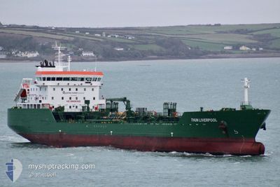
THUN LIVERPOOL
Tanker
Current Trip
| Trip Time | 21 h, 44 mins |
|---|---|
| Trip Distance | 229.52 nm |
| AVG Speed | 10.2 Knop |
| MAX Speed | 13.6 Knop |
| Djupgående | 8.3 m |
| AVG Wind | 13.6 knots |
| MAX Wind | 22 knots |
| MIN Temp | 6.6°C / 43.88°F |
| MAX Temp | 11.5°C / 52.7°F |
| Position mottagen | 1 d sen |
Current Position
| Longitud | -5.88757° |
|---|---|
| Latitude | 54.62640° |
| Status | Under way using engine |
| Fart | 5.2 Knop |
| Kurs | 190° |
| Område | Inner Seas off the West Coast of Scotland |
| Station | T-AIS |
| Position mottagen | 1 d sen |
Info
Information
The current position of THUN LIVERPOOL is in Inner Seas off the West Coast of Scotland with coordinates 54.62640° / -5.88757° as reported on 2024-04-18 18:44 by AIS to our vessel tracker app. The vessel's current speed is 5.2 Knop and is currently inside the port of BELFAST.
The vessel THUN LIVERPOOL (IMO: 9828998, MMSI: 244066000) is a Tanker It's sailing under the flag of [NL] Netherlands.
In this page you can find informations about the vessels current position, last detected port calls, and current voyage information. If the vessels is not in coverage by AIS you will find the latest position.
The current position of THUN LIVERPOOL is detected by our AIS receivers and we are not responsible for the reliability of the data. The last position was recorded while the vessel was in Coverage by the Ais receivers of our vessel tracking app.
The current draught of THUN LIVERPOOL as reported by AIS is 8.3 meters
Weather
| Temperature | 2.6°C / 36.68°F |
|---|---|
| Wind Speed | 4 knots |
| Direction | 306° NW |
| Pressure | 1027.8 hPa |
| Humidity | 93.1 % |
| Cloud Coverage | 15 % |
Featured Company
Last Port Calls
| Port | Arrival | Departure | Time In Port |
|---|---|---|---|
| 2024-04-18 18:34 | |||
| 2024-04-16 18:10 | 2024-04-17 20:50 | 1 d | |
| 2024-04-14 13:28 | 2024-04-15 21:05 | 1 d | |
| 2024-04-12 23:01 | 2024-04-13 16:23 | 17 h | |
| 2024-04-10 20:06 | 2024-04-11 22:27 | 1 d | |
| 2024-04-08 09:36 | 2024-04-10 01:38 | 1 d | |
| 2024-04-06 04:22 | 2024-04-07 06:15 | 1 d | |
| 2024-04-04 10:36 | 2024-04-05 09:30 | 22 h | |
| 2024-04-02 11:38 | 2024-04-04 01:20 | 1 d | |
| 2024-04-01 01:43 | 2024-04-01 22:51 | 21 h |
Last Trips
| Origin | Departure | Destination | Arrival | Distance | |
|---|---|---|---|---|---|
| 2024-04-17 21:50 | 2024-04-18 19:34 | 229.52 nm | |||
| 2024-04-15 22:05 | 2024-04-16 19:10 | 207.06 nm | |||
| 2024-04-13 17:23 | 2024-04-14 14:28 | 229.14 nm | |||
| 2024-04-11 23:27 | 2024-04-13 00:01 | 150.64 nm | |||
| 2024-04-10 02:38 | 2024-04-10 21:06 | 108.48 nm | |||
| 2024-04-07 07:15 | 2024-04-08 10:36 | 115.45 nm | |||
| 2024-04-05 10:30 | 2024-04-06 05:22 | 94.19 nm | |||
| 2024-04-04 02:20 | 2024-04-04 11:36 | 108.07 nm | |||
| 2024-04-01 23:51 | 2024-04-02 12:38 | 110.08 nm | |||
| 2024-03-31 00:12 | 2024-04-01 02:43 | 128.25 nm |
Events
| Tid | Event | Detaljer | Position / Dest | Information |
|---|---|---|---|---|
| 2024-04-18 19:12 | STOPPAR förflyttning |
54.61366 / -5.88788
[GB] BELFAST
|
Fart: Kurs: 180° |
|
| 2024-04-18 18:56 | Status ändrad | Default Under way using engine |
54.61461 / -5.88804
[GB] BELFAST
|
Fart: 5.2 kn Kurs: 190° |
| 2024-04-18 18:44 | UTANFÖR täckningsområde |
54.62640 / -5.88757
Inner Seas off the West Coast of Scotland
[GB] BELFAST
|
Fart: 5.2 kn Kurs: 198.4° |
|
| 2024-04-18 18:34 | ANLÄNDER HAMN |
|
54.64120 / -5.86996
[GB] BELFAST
|
Fart: 12.2 kn Kurs: 234.7° |
| 2024-04-18 15:50 | ETA ändrat | 2024/04/18 18:15 2024/04/18 18:00 |
54.51384 / -5.35123
GB BEL
|
Fart: 10.9 kn Kurs: 1.4° |
| 2024-04-18 15:26 | Byter havsområde | United Kingdom part of the Inner Seas off the West Coast of Scotland United Kingdom part of the Irish Sea and St. George's Channel |
54.44096 / -5.34490
Inner Seas off the West Coast of Scotland
GB BEL
|
Fart: 10.7 kn Kurs: 348.5° |
| 2024-04-18 13:16 | Status ändrad | Under way using engine Default |
54.06987 / -5.33443
GB BEL
|
Fart: 10.5 kn Kurs: 2° |
| 2024-04-18 12:57 | Status ändrad | Default Under way using engine |
54.01532 / -5.33813
GB BEL
|
Fart: 10.5 kn Kurs: 2.2° |
| 2024-04-18 12:50 | Upptäckt i hav | United Kingdom part of the Irish Sea and St. George's Channel |
53.99502 / -5.33980
Irish Sea and St. George's Channel
GB BEL
|
Fart: 10.5 kn Kurs: 2.2° |
| 2024-04-18 12:50 | Status ändrad | Under way using engine Default |
53.99502 / -5.33980
GB BEL
|
Fart: 10.3 kn Kurs: 2° |