
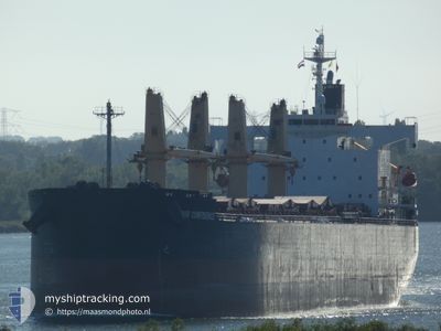
THOR CONFIDENCE
Bulk Carrier
Current Trip
| Time Travelled | 23 days |
|---|---|
| Remaining Time | --- |
| Distance Travelled | 5381.45 nm |
| Remaining Distance | --- |
| AVG Speed | 10 Knop |
| MAX Speed | 12.2 Knop |
| AVG Wind | 11.7 knots |
| MAX Wind | 27 knots |
| MIN Temp | 12°C / 53.6°F |
| MAX Temp | 23°C / 73.4°F |
| Djupgående | 11.9 m |
| Position mottagen | 2 h, 18 m sen |
Current Position
| Longitud | -76.08531° |
|---|---|
| Latitude | 27.39218° |
| Status | Under way using engine |
| Fart | 10.5 Knop |
| Kurs | 281.4° |
| Område | North Atlantic Ocean |
| Station | T-AIS |
| Position mottagen | 2 h, 18 m sen |
Info
Information
The current position of THOR CONFIDENCE is in North Atlantic Ocean with coordinates 27.39218° / -76.08531° as reported on 2024-04-17 23:00 by AIS to our vessel tracker app. The vessel's current speed is 10.5 Knop and is heading at the port of TAMPA. The estimated time of arrival as calculated by MyShipTracking vessel tracking app is 2024-04-21 12:00 LT
The vessel THOR CONFIDENCE (IMO: 9403023, MMSI: 563029200) is a Bulk Carrier that was built in 2008 ( 16 År gammal ). It's sailing under the flag of [SG] Singapore.
In this page you can find informations about the vessels current position, last detected port calls, and current voyage information. If the vessels is not in coverage by AIS you will find the latest position.
The current position of THOR CONFIDENCE is detected by our AIS receivers and we are not responsible for the reliability of the data. The last position was recorded while the vessel was in Coverage by the Ais receivers of our vessel tracking app.
The current draught of THOR CONFIDENCE as reported by AIS is 11.9 meters
Weather
| Temperature | 22.2°C / 71.96°F |
|---|---|
| Wind Speed | 9 knots |
| Direction | 88° E |
| Pressure | 1021.1 hPa |
| Humidity | 64 % |
| Cloud Coverage | --- |
Featured Company
Most Visited Ports (Last year)
| Port | Arrivals | |
|---|---|---|
| 3 | ||
| 2 | ||
| 1 | ||
| 1 | ||
| 1 | ||
| 1 |
Events
| Tid | Event | Detaljer | Position / Dest | Information |
|---|---|---|---|---|
| 2024-04-17 23:06 | Status ändrad | Default Under way using engine |
27.39500 / -76.10500
TAMPA,USA
|
Fart: 10.5 kn Kurs: 281.4° |
| 2024-04-17 23:00 | UTANFÖR täckningsområde |
27.39218 / -76.08531
North Atlantic Ocean
TAMPA,USA
|
Fart: 10.5 kn Kurs: 281.4° |
|
| 2024-04-17 22:55 | Status ändrad | Under way using engine Default |
27.38933 / -76.07015
TAMPA,USA
|
Fart: 10 kn Kurs: 281° |
| 2024-04-17 22:42 | Status ändrad | Default Under way using engine |
27.38167 / -76.02666
TAMPA,USA
|
Fart: 10.7 kn Kurs: 281.2° |
| 2024-04-17 22:32 | Status ändrad | Under way using engine Default |
27.37624 / -75.99615
TAMPA,USA
|
Fart: 10 kn Kurs: 281° |
| 2024-04-17 22:18 | Status ändrad | Default Under way using engine |
27.36667 / -75.94833
TAMPA,USA
|
Fart: 10.8 kn Kurs: 279.5° |
| 2024-04-17 21:54 | ETA ändrat | 2024/04/21 12:00 2024/04/25 06:00 |
27.35616 / -75.86599
TAMPA,USA
|
Fart: 10.6 kn Kurs: 278.2° |
| 2024-04-17 21:52 | Status ändrad | Under way using engine Default |
27.35556 / -75.86093
TAMPA,USA
|
Fart: 10 kn Kurs: 275° |
| 2024-04-17 21:22 | Status ändrad | Default Under way using engine |
27.34598 / -75.76242
TAMPA,USA
|
Fart: 10.6 kn Kurs: 282.4° |
| 2024-04-17 21:16 | Upptäckt i hav | Bahamas part of the North Atlantic Ocean |
27.34214 / -75.74276
North Atlantic Ocean
TAMPA,USA
|
Fart: 10.6 kn Kurs: 282.4° |