
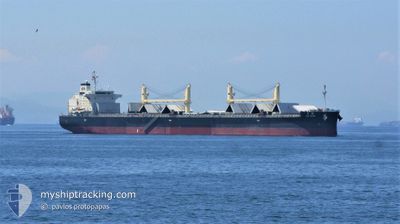
TAI STAR
Cargo
Current Trip
KR TGH
| Time Travelled | 43 mins |
|---|---|
| Remaining Time | --- |
| Distance Travelled | 1.03 nm |
| Remaining Distance | --- |
| AVG Speed | 6 Knop |
| MAX Speed | 6 Knop |
| AVG Wind | 7 knots |
| MAX Wind | 7 knots |
| MIN Temp | 16.5°C / 61.7°F |
| MAX Temp | 16.6°C / 61.88°F |
| Djupgående | 7.4 m |
| Position mottagen | 6 d sen |
Current Position
| Longitud | 129.69052° |
|---|---|
| Latitude | 35.64247° |
| Status | Under way using engine |
| Fart | 15.7 Knop |
| Kurs | 9.7° |
| Område | Japan Sea |
| Station | T-AIS |
| Position mottagen | 6 d sen |
Info
Information
The current position of TAI STAR is in Japan Sea with coordinates 35.64247° / 129.69052° as reported on 2024-04-19 08:10 by AIS to our vessel tracker app. The vessel's current speed is 15.7 Knop
The vessel TAI STAR (IMO: 9774460, MMSI: 354857000) is a Cargo It's sailing under the flag of [PA] Panama.
In this page you can find informations about the vessels current position, last detected port calls, and current voyage information. If the vessels is not in coverage by AIS you will find the latest position.
The current position of TAI STAR is detected by our AIS receivers and we are not responsible for the reliability of the data. The last position was recorded while the vessel was in Coverage by the Ais receivers of our vessel tracking app.
The current draught of TAI STAR as reported by AIS is 7.4 meters
Weather
| Temperature | 16.7°C / 62.06°F |
|---|---|
| Wind Speed | 7 knots |
| Direction | 217° SW |
| Pressure | 1008.5 hPa |
| Humidity | 68.2 % |
| Cloud Coverage | --- |
Featured Company
Last Port Calls
| Port | Arrival | Departure | Time In Port |
|---|---|---|---|
| 2024-04-19 16:59 | 2024-04-25 11:10 | 5 d | |
| 2024-04-07 08:01 | 2024-04-17 05:27 | 9 d | |
| 2024-04-03 21:09 | 2024-04-05 22:19 | 2 d | |
| 2024-03-14 03:36 | 2024-03-18 01:18 | 3 d | |
| 2024-03-10 04:57 | 2024-03-11 20:58 | 1 d |
Last Trips
| Origin | Departure | Destination | Arrival | Distance | |
|---|---|---|---|---|---|
| 2024-04-17 13:27 | 2024-04-20 01:59 | 831.80 nm | |||
| 2024-04-06 06:19 | 2024-04-07 16:01 | 153.05 nm | |||
| 2024-03-18 06:48 | 2024-04-04 05:09 | 4444.22 nm | |||
| 2024-03-12 02:28 | 2024-03-14 09:06 | 319.11 nm | |||
| 2024-01-16 15:24 | 2024-03-10 10:27 | 2414.94 nm |
Events
| Tid | Event | Detaljer | Position / Dest | Information |
|---|---|---|---|---|
| 2024-04-25 11:10 | STARTAR förflyttning | 0.7 nm, East of DONGHAE |
37.50050 / 129.15393
KR TGH
|
Fart: 5.6 kn Kurs: 75° |
| 2024-04-25 11:10 | AVGÅTT HAMN |
|
37.50050 / 129.15393
KR TGH
|
Fart: 3 kn Kurs: -1° |
| 2024-04-19 16:59 | STOPPAR förflyttning |
37.49333 / 129.13834
[KR] DONGHAE
|
Fart: Kurs: -1° |
|
| 2024-04-19 16:59 | ANLÄNDER HAMN |
|
37.49333 / 129.13834
[KR] DONGHAE
|
Fart: 5.3 kn Kurs: 246° |
| 2024-04-19 08:10 | UTANFÖR täckningsområde |
35.64247 / 129.69052
Japan Sea
KR TGH
|
Fart: 15.7 kn Kurs: 9.7° |
|
| 2024-04-19 02:14 | Djupgående ändrat | 7.4 13.4 |
34.48994 / 128.61903
KR TGH
|
Fart: 14.9 kn Kurs: 52.4° |
| 2024-04-19 02:14 | Destination ändrad | KR TGH JINZHOU |
34.48994 / 128.61903
KR TGH
|
Fart: 14.9 kn Kurs: 52.4° |
| 2024-04-19 02:14 | ETA ändrat | 2024/04/19 16:00 2024/04/04 07:00 |
34.48994 / 128.61903
KR TGH
|
Fart: 14.9 kn Kurs: 52.4° |
| 2024-04-19 01:41 | Byter havsområde | South Korean part of the Japan Sea Malaysian part of the Singapore Strait |
34.40939 / 128.48297
Japan Sea
|
Fart: 15 kn Kurs: 55.5° |
| 2024-04-19 01:41 | I täckningsområde |
34.40939 / 128.48297
Japan Sea
|
Fart: 15 kn Kurs: 55.5° |