
HIN LEONG NO.1
Cargo
Current Trip
| Time Travelled | 5 h, 15 mins |
|---|---|
| Remaining Time | 5 days |
| Distance Travelled | 14.66 nm |
| Remaining Distance | 890.70 nm |
| AVG Speed | 7.2 Knop |
| MAX Speed | 8 Knop |
| AVG Wind | 7.8 knots |
| MAX Wind | 10 knots |
| MIN Temp | 26.1°C / 78.98°F |
| MAX Temp | 28.1°C / 82.58°F |
| Djupgående | 4 m |
| Position mottagen | 4 h, 12 m sen |
Current Position
| Longitud | 120.14719° |
|---|---|
| Latitude | 22.69879° |
| Status | Under way using engine |
| Fart | 7.1 Knop |
| Kurs | 341.4° |
| Område | South China Sea |
| Station | T-AIS |
| Position mottagen | 4 h, 12 m sen |
Info
Information
The current position of HIN LEONG NO.1 is in South China Sea with coordinates 22.69879° / 120.14719° as reported on 2024-04-16 11:06 by AIS to our vessel tracker app. The vessel's current speed is 7.1 Knop and is heading at the port of BUSAN. The estimated time of arrival as calculated by MyShipTracking vessel tracking app is 2024-04-21 19:09 LT
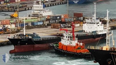
The vessel HIN LEONG NO.1 (IMO: 9140619, MMSI: 667001746) is a Cargo It's sailing under the flag of [SL] Sierra Leone.
In this page you can find informations about the vessels current position, last detected port calls, and current voyage information. If the vessels is not in coverage by AIS you will find the latest position.
The current position of HIN LEONG NO.1 is detected by our AIS receivers and we are not responsible for the reliability of the data. The last position was recorded while the vessel was in Coverage by the Ais receivers of our vessel tracking app.
The current draught of HIN LEONG NO.1 as reported by AIS is 4 meters
Weather
| Temperature | 25.2°C / 77.36°F |
|---|---|
| Wind Speed | 4 knots |
| Direction | 271° W |
| Pressure | 1011.8 hPa |
| Humidity | 82.3 % |
| Cloud Coverage | 2 % |
Featured Company
Events
| Tid | Event | Detaljer | Position / Dest | Information |
|---|---|---|---|---|
| 2024-04-16 11:08 | Status ändrad | Default Under way using engine |
22.70159 / 120.14616
KR PUS
|
Fart: 7.1 kn Kurs: 341.4° |
| 2024-04-16 11:06 | UTANFÖR täckningsområde |
22.69879 / 120.14719
South China Sea
KR PUS
|
Fart: 7.1 kn Kurs: 341.4° |
|
| 2024-04-16 10:29 | ETA ändrat | 2024/04/22 06:00 2024/04/06 06:00 |
22.64545 / 120.20154
KR PUS
|
Fart: 7.5 kn Kurs: 305.7° |
| 2024-04-16 10:03 | AVGÅTT HAMN |
|
22.62043 / 120.25320
KR PUS
|
Fart: 8.4 kn Kurs: 290° |
| 2024-04-16 09:48 | STARTAR förflyttning |
22.60984 / 120.28062
[TW] KAOHSIUNG
|
Fart: 3.3 kn Kurs: 336° |
|
| 2024-04-16 09:00 | Destination ändrad | KR PUS TW KHH |
22.60812 / 120.28302
[TW] KAOHSIUNG
|
Fart: Kurs: 330° |
| 2024-04-16 06:11 | STOPPAR förflyttning |
22.60800 / 120.28297
[TW] KAOHSIUNG
|
Fart: 0.3 kn Kurs: 330° |
|
| 2024-04-16 05:49 | STARTAR förflyttning |
22.58089 / 120.29844
[TW] KAOHSIUNG
|
Fart: 3.4 kn Kurs: 327° |
|
| 2024-04-09 23:07 | I täckningsområde |
22.57885 / 120.29827
South China Sea
[TW] KAOHSIUNG
|
Fart: Kurs: 237.7° |
|
| 2024-04-08 23:54 | UTANFÖR täckningsområde |
22.57886 / 120.29827
South China Sea
[TW] KAOHSIUNG
|
Fart: Kurs: 218.5° |