
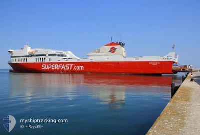
SUPERFAST II
Ro-Ro/Passenger Ship
Current Trip
| Time Travelled | 22 h, 52 mins |
|---|---|
| Remaining Time | --- |
| Distance Travelled | 356.15 nm |
| Remaining Distance | --- |
| AVG Speed | 21 Knop |
| MAX Speed | 23.2 Knop |
| AVG Wind | 6.1 knots |
| MAX Wind | 11.1 knots |
| MIN Temp | 11.8°C / 53.24°F |
| MAX Temp | 14.8°C / 58.64°F |
| Djupgående | 6.1 m |
| Position mottagen | 1 h, 30 m sen |
Current Position
| Longitud | 19.98134° |
|---|---|
| Latitude | 39.79899° |
| Status | Under way using engine |
| Fart | 20.6 Knop |
| Kurs | 184.3° |
| Område | Adriatic Sea |
| Station | T-AIS |
| Position mottagen | 1 h, 30 m sen |
Info
Information
The current position of SUPERFAST II is in Adriatic Sea with coordinates 39.79899° / 19.98134° as reported on 2024-04-19 01:05 by AIS to our vessel tracker app. The vessel's current speed is 20.6 Knop
The vessel SUPERFAST II (IMO: 9458511, MMSI: 240951000) is a Ro-Ro/Passenger Ship that was built in 2009 ( 15 År gammal ). It's sailing under the flag of [GR] Greece.
In this page you can find informations about the vessels current position, last detected port calls, and current voyage information. If the vessels is not in coverage by AIS you will find the latest position.
The current position of SUPERFAST II is detected by our AIS receivers and we are not responsible for the reliability of the data. The last position was recorded while the vessel was in Coverage by the Ais receivers of our vessel tracking app.
The current draught of SUPERFAST II as reported by AIS is 6.1 meters
Weather
| Temperature | 12.2°C / 53.96°F |
|---|---|
| Wind Speed | 3 knots |
| Direction | 123° ESE |
| Pressure | 1010.6 hPa |
| Humidity | 72.6 % |
| Cloud Coverage | --- |
Featured Company
Last Port Calls
| Port | Arrival | Departure | Time In Port |
|---|---|---|---|
| 2024-04-18 03:10 | 2024-04-18 03:43 | 33 m | |
| 2024-04-17 08:50 | 2024-04-17 21:04 | 12 h | |
| 2024-04-16 07:19 | 2024-04-16 17:49 | 10 h | |
| 2024-04-15 20:34 | 2024-04-15 21:21 | 46 m | |
| 2024-04-15 03:41 | 2024-04-15 14:45 | 11 h | |
| 2024-04-14 06:37 | 2024-04-14 11:41 | 5 h | |
| 2024-04-13 09:00 | 2024-04-13 14:38 | 5 h | |
| 2024-04-12 06:47 | 2024-04-12 18:03 | 11 h | |
| 2024-04-11 08:52 | 2024-04-11 14:36 | 5 h | |
| 2024-04-10 06:43 | 2024-04-10 17:49 | 11 h |
Last Trips
| Origin | Departure | Destination | Arrival | Distance | |
|---|---|---|---|---|---|
| 2024-04-18 00:04 | 2024-04-18 06:10 | 127.13 nm | |||
| 2024-04-16 19:49 | 2024-04-17 11:50 | 307.46 nm | |||
| 2024-04-16 00:21 | 2024-04-16 09:19 | 194.06 nm | |||
| 2024-04-15 17:45 | 2024-04-15 23:34 | 124.62 nm | |||
| 2024-04-14 13:41 | 2024-04-15 06:41 | 312.21 nm | |||
| 2024-04-13 17:38 | 2024-04-14 08:37 | 310.82 nm | |||
| 2024-04-12 20:03 | 2024-04-13 12:00 | 310.17 nm | |||
| 2024-04-11 17:36 | 2024-04-12 08:47 | 309.68 nm | |||
| 2024-04-10 19:49 | 2024-04-11 11:52 | 308.80 nm | |||
| 2024-04-09 17:54 | 2024-04-10 08:43 | 311.38 nm |
Events
| Tid | Event | Detaljer | Position / Dest | Information |
|---|---|---|---|---|
| 2024-04-19 01:05 | UTANFÖR täckningsområde |
39.79899 / 19.98134
Adriatic Sea
ITBRI>GRIGO
|
Fart: 20.6 kn Kurs: 184.3° |
|
| 2024-04-19 01:02 | Byter havsområde | Albanian part of the Adriatic Sea Greek part of the Adriatic Sea |
39.81257 / 19.97880
Adriatic Sea
ITBRI>GRIGO
|
Fart: 22.2 kn Kurs: 158.2° |
| 2024-04-19 00:59 | Byter havsområde | Greek part of the Adriatic Sea Albanian part of the Adriatic Sea |
39.82668 / 19.96474
Adriatic Sea
ITBRI>GRIGO
|
Fart: 22.4 kn Kurs: 126.2° |
| 2024-04-19 00:56 | Destination ändrad | ITBRI>GRIGO GRIGO>ITBRI |
39.83738 / 19.94497
ITBRI>GRIGO
|
Fart: 22.2 kn Kurs: 124.5° |
| 2024-04-19 00:56 | ETA ändrat | 2024/04/19 02:30 2024/04/18 12:30 |
39.83738 / 19.94497
ITBRI>GRIGO
|
Fart: 22.2 kn Kurs: 124.5° |
| 2024-04-19 00:50 | Byter havsområde | Albanian part of the Adriatic Sea Italian part of the Adriatic Sea |
39.85968 / 19.90369
Adriatic Sea
|
Fart: 22 kn Kurs: 125.5° |
| 2024-04-19 00:49 | I täckningsområde |
39.85968 / 19.90369
Adriatic Sea
|
Fart: 22 kn Kurs: 125.5° |
|
| 2024-04-18 22:02 | UTANFÖR täckningsområde |
40.41462 / 18.76760
Adriatic Sea
|
Fart: 22.6 kn Kurs: 122° |
|
| 2024-04-18 21:24 | I täckningsområde |
40.54299 / 18.49815
Adriatic Sea
|
Fart: 22.9 kn Kurs: 122.5° |
|
| 2024-04-18 08:30 | UTANFÖR täckningsområde |
40.48187 / 18.64470
Adriatic Sea
GRIGO>ITBRI
|
Fart: 21.7 kn Kurs: 291.8° |