
SUNRISE SERENITY
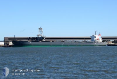
Bulk Carrier
Current Trip
| Time Travelled | 2 days |
|---|---|
| Remaining Time | 5 days |
| Distance Travelled | 694.73 nm |
| Remaining Distance | 1848.46 nm |
| AVG Speed | 13.3 Knop |
| MAX Speed | 15.2 Knop |
| AVG Wind | 10.7 knots |
| MAX Wind | 32.5 knots |
| MIN Temp | 16.7°C / 62.06°F |
| MAX Temp | 26.4°C / 79.52°F |
| Djupgående | 8.3 m |
| Position mottagen | 2 d sen |
Current Position
| Longitud | 134.91270° |
|---|---|
| Latitude | 33.95362° |
| Status | Under way using engine |
| Fart | 13.6 Knop |
| Kurs | 188° |
| Område | Philippine Sea |
| Station | T-AIS |
| Position mottagen | 2 d sen |
Info
Information
The current position of SUNRISE SERENITY is in Philippine Sea with coordinates 33.95362° / 134.91270° as reported on 2024-04-23 05:01 by AIS to our vessel tracker app. The vessel's current speed is 13.6 Knop and is heading at the port of TANJUNG BARA. The estimated time of arrival as calculated by MyShipTracking vessel tracking app is 2024-04-30 10:24 LT
The vessel SUNRISE SERENITY (IMO: 9570462, MMSI: 431836000) is a Bulk Carrier that was built in 2010 ( 14 År gammal ). It's sailing under the flag of [JP] Japan.
In this page you can find informations about the vessels current position, last detected port calls, and current voyage information. If the vessels is not in coverage by AIS you will find the latest position.
The current position of SUNRISE SERENITY is detected by our AIS receivers and we are not responsible for the reliability of the data. The last position was recorded while the vessel was in Coverage by the Ais receivers of our vessel tracking app.
The current draught of SUNRISE SERENITY as reported by AIS is 8.3 meters
Weather
| Temperature | 26.3°C / 79.34°F |
|---|---|
| Wind Speed | 9 knots |
| Direction | 200° SSW |
| Pressure | 1011 hPa |
| Humidity | 83.7 % |
| Cloud Coverage | 100 % |
Featured Company
Events
| Tid | Event | Detaljer | Position / Dest | Information |
|---|---|---|---|---|
| 2024-04-23 05:08 | Status ändrad | Default Under way using engine |
33.92553 / 134.90752
ID TBA
|
Fart: 13.6 kn Kurs: 188° |
| 2024-04-23 05:01 | Status ändrad | Under way using engine Default |
33.95362 / 134.91270
ID TBA
|
Fart: 13.5 kn Kurs: 188° |
| 2024-04-23 05:01 | UTANFÖR täckningsområde |
33.95362 / 134.91270
Philippine Sea
ID TBA
|
Fart: 13.6 kn Kurs: 188° |
|
| 2024-04-23 04:52 | Status ändrad | Default Under way using engine |
33.98600 / 134.91872
ID TBA
|
Fart: 14.1 kn Kurs: 188° |
| 2024-04-23 04:42 | Status ändrad | Under way using engine Default |
34.02445 / 134.92573
ID TBA
|
Fart: 14.4 kn Kurs: 188° |
| 2024-04-23 04:40 | Status ändrad | Default Under way using engine |
34.03205 / 134.92708
ID TBA
|
Fart: 14.5 kn Kurs: 187° |
| 2024-04-23 03:29 | Byter havsområde | Japanese part of the Philippine Sea Japanese part of the Inland Sea |
34.27197 / 134.97295
Philippine Sea
ID TBA
|
Fart: 15.2 kn Kurs: 190° |
| 2024-04-23 01:27 | AVGÅTT HAMN |
|
34.64955 / 135.26375
ID TBA
|
Fart: 11.5 kn Kurs: 149° |
| 2024-04-23 01:05 | STARTAR förflyttning |
34.69567 / 135.24265
[JP] KOBE
|
Fart: 3.1 kn Kurs: 150° |
|
| 2024-04-23 00:49 | Status ändrad | Under way using engine Moored |
34.69962 / 135.24407
[JP] KOBE
|
Fart: Kurs: 296° |