
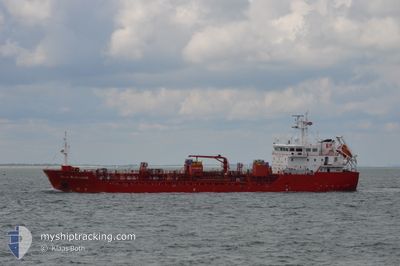
STOLT REDSHANK
Oil/Chemical Tanker
Current Trip
| Time Travelled | 2 days |
|---|---|
| Remaining Time | 2 days |
| Distance Travelled | 594.24 nm |
| Remaining Distance | 634.22 nm |
| AVG Speed | 10.9 Knop |
| MAX Speed | 13.4 Knop |
| AVG Wind | 15.3 knots |
| MAX Wind | 28.2 knots |
| MIN Temp | 2.1°C / 35.78°F |
| MAX Temp | 8°C / 46.4°F |
| Djupgående | 6.1 m |
| Position mottagen | 1 m sen |
Current Position
| Longitud | 1.64407° |
|---|---|
| Latitude | 51.16451° |
| Status | Under way using engine |
| Fart | 11.2 Knop |
| Kurs | 228.9° |
| Område | North Sea |
| Station | T-AIS |
| Position mottagen | 1 m sen |
Info
Information
The current position of STOLT REDSHANK is in North Sea with coordinates 51.16451° / 1.64407° as reported on 2024-04-25 04:44 by AIS to our vessel tracker app. The vessel's current speed is 11.2 Knop and is heading at the port of BORDEAUX. The estimated time of arrival as calculated by MyShipTracking vessel tracking app is 2024-04-27 17:27 LT
The vessel STOLT REDSHANK (IMO: 9566746, MMSI: 235089046) is a Oil/Chemical Tanker that was built in 2011 ( 13 År gammal ). It's sailing under the flag of [GB] United Kingdom.
In this page you can find informations about the vessels current position, last detected port calls, and current voyage information. If the vessels is not in coverage by AIS you will find the latest position.
The current position of STOLT REDSHANK is detected by our AIS receivers and we are not responsible for the reliability of the data. The last position was recorded while the vessel was in Coverage by the Ais receivers of our vessel tracking app.
The current draught of STOLT REDSHANK as reported by AIS is 6.1 meters
Weather
| Temperature | 5.9°C / 42.62°F |
|---|---|
| Wind Speed | 9 knots |
| Direction | 269° W |
| Pressure | 1008.8 hPa |
| Humidity | 73.7 % |
| Cloud Coverage | 100 % |
Featured Company
Last Port Calls
| Port | Arrival | Departure | Time In Port |
|---|---|---|---|
| 2024-04-21 21:44 | 2024-04-23 00:39 | 1 d | |
| 2024-04-20 03:55 | 2024-04-20 18:36 | 14 h | |
| 2024-04-17 20:01 | 2024-04-18 04:17 | 8 h | |
| 2024-04-16 02:46 | 2024-04-16 16:43 | 13 h | |
| 2024-04-11 08:39 | 2024-04-13 18:24 | 2 d | |
| 2024-04-08 16:21 | 2024-04-09 16:26 | 1 d | |
| 2024-04-05 22:17 | 2024-04-07 06:54 | 1 d | |
| 2024-04-03 12:26 | 2024-04-04 14:30 | 1 d | |
| 2024-04-03 09:57 | 2024-04-03 10:01 | 3 m | |
| 2024-03-31 11:40 | 2024-04-01 05:04 | 17 h |
Most Visited Ports (Last year)
| Port | Arrivals | |
|---|---|---|
| 13 | ||
| 11 | ||
| 8 | ||
| 8 | ||
| 7 | ||
| 6 |
Last Trips
| Origin | Departure | Destination | Arrival | Distance | |
|---|---|---|---|---|---|
| 2024-04-20 20:36 | 2024-04-21 23:44 | 306.09 nm | |||
| 2024-04-18 06:17 | 2024-04-20 05:55 | 590.18 nm | |||
| 2024-04-16 18:43 | 2024-04-17 22:01 | 205.39 nm | |||
| 2024-04-13 19:24 | 2024-04-16 04:46 | 643.66 nm | |||
| 2024-04-09 17:26 | 2024-04-11 09:39 | 455.73 nm | |||
| 2024-04-07 08:54 | 2024-04-08 17:21 | 178.10 nm | |||
| 2024-04-04 16:30 | 2024-04-06 00:17 | 216.76 nm | |||
| 2024-04-03 12:01 | 2024-04-03 14:26 | 11.83 nm | |||
| 2024-04-01 07:04 | 2024-04-03 11:57 | 541.27 nm | |||
| 2024-03-31 13:21 | 2024-03-31 13:40 | 0.85 nm |
Events
| Tid | Event | Detaljer | Position / Dest | Information |
|---|---|---|---|---|
| 2024-04-25 01:29 | Status ändrad | Under way using engine Default |
51.60591 / 2.16770
BORDEAUX
|
Fart: 10.4 kn Kurs: 224° |
| 2024-04-25 01:11 | Status ändrad | Default Under way using engine |
51.64208 / 2.22590
BORDEAUX
|
Fart: 10.4 kn Kurs: 224.9° |
| 2024-04-24 23:53 | Byter havsområde | United Kingdom part of the North Sea Belgian part of the North Sea |
51.81395 / 2.48743
North Sea
BORDEAUX
|
Fart: 11.6 kn Kurs: 219.5° |
| 2024-04-24 23:35 | Byter havsområde | Belgian part of the North Sea Dutch part of the North Sea |
51.86189 / 2.54674
North Sea
BORDEAUX
|
Fart: 12 kn Kurs: 216.1° |
| 2024-04-24 22:47 | Byter havsområde | Dutch part of the North Sea Danish part of the North Sea |
51.98130 / 2.72831
North Sea
BORDEAUX
|
Fart: 12.5 kn Kurs: 226.5° |
| 2024-04-24 22:47 | Status ändrad | Under way using engine Default |
51.98130 / 2.72831
BORDEAUX
|
Fart: 12 kn Kurs: 223° |
| 2024-04-24 22:47 | I täckningsområde |
51.98130 / 2.72831
North Sea
BORDEAUX
|
Fart: 12.5 kn Kurs: 226.5° |
|
| 2024-04-24 22:47 | Djupgående ändrat | 6.1 5.5 |
51.99333 / 2.74667
BORDEAUX
|
Fart: 12 kn Kurs: 223° |
| 2024-04-23 19:34 | Status ändrad | Default Under way using engine |
56.51136 / 7.13735
BORDEAUX
|
Fart: 11.5 kn Kurs: 207.9° |
| 2024-04-23 19:22 | UTANFÖR täckningsområde |
56.54500 / 7.17432
North Sea
BORDEAUX
|
Fart: 11.5 kn Kurs: 207.9° |