
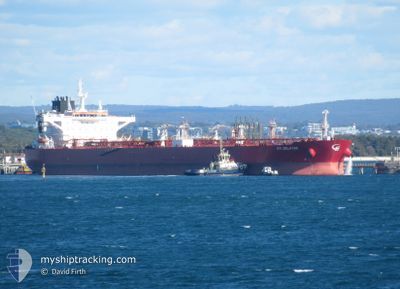
STI SELATAR
Tanker
Current Trip
| Time Travelled | 37 days |
|---|---|
| Remaining Time | --- |
| Distance Travelled | 10680.62 nm |
| Remaining Distance | --- |
| AVG Speed | 11.9 Knop |
| MAX Speed | 14.9 Knop |
| AVG Wind | 10.6 knots |
| MAX Wind | 23.7 knots |
| MIN Temp | 13.6°C / 56.48°F |
| MAX Temp | 29.6°C / 85.28°F |
| Djupgående | 14.3 m |
| Position mottagen | 11 h, 37 m sen |
Current Position
| Longitud | -11.88649° |
|---|---|
| Latitude | 41.81771° |
| Status | Under way sailing |
| Fart | 10.3 Knop |
| Kurs | 32° |
| Område | North Atlantic Ocean |
| Station | T-AIS |
| Position mottagen | 11 h, 37 m sen |
Info
Information
The current position of STI SELATAR is in North Atlantic Ocean with coordinates 41.81771° / -11.88649° as reported on 2024-04-19 00:18 by AIS to our vessel tracker app. The vessel's current speed is 10.3 Knop and is heading at the port of LE HAVRE. The estimated time of arrival as calculated by MyShipTracking vessel tracking app is 2024-04-21 14:00 LT
The vessel STI SELATAR (IMO: 9729245, MMSI: 538005642) is a Tanker It's sailing under the flag of [MH] Marshall Is.
In this page you can find informations about the vessels current position, last detected port calls, and current voyage information. If the vessels is not in coverage by AIS you will find the latest position.
The current position of STI SELATAR is detected by our AIS receivers and we are not responsible for the reliability of the data. The last position was recorded while the vessel was in Coverage by the Ais receivers of our vessel tracking app.
The current draught of STI SELATAR as reported by AIS is 14.3 meters
Weather
| Temperature | 13.4°C / 56.12°F |
|---|---|
| Wind Speed | 16 knots |
| Direction | 68° ENE |
| Pressure | 1016.1 hPa |
| Humidity | 87.5 % |
| Cloud Coverage | --- |
Featured Company
Last Port Calls
| Port | Arrival | Departure | Time In Port |
|---|---|---|---|
| 2024-03-12 04:45 | 2024-03-13 05:11 | 1 d | |
| 2024-03-09 21:20 | 2024-03-10 19:06 | 21 h |
Most Visited Ports (Last year)
| Port | Arrivals | |
|---|---|---|
| 2 | ||
| 2 | ||
| 2 | ||
| 2 | ||
| 1 | ||
| 1 |
Last Trips
| Origin | Departure | Destination | Arrival | Distance | |
|---|---|---|---|---|---|
| 2024-03-10 22:06 | 2024-03-12 08:45 | 262.93 nm | |||
| 2023-12-31 08:24 | 2024-03-10 00:20 | 8481.50 nm |
Events
| Tid | Event | Detaljer | Position / Dest | Information |
|---|---|---|---|---|
| 2024-04-19 00:35 | Status ändrad | Default Under way sailing |
41.85938 / -11.85366
FRLEH
|
Fart: 10.3 kn Kurs: 32° |
| 2024-04-19 00:18 | UTANFÖR täckningsområde |
41.81771 / -11.88649
North Atlantic Ocean
FRLEH
|
Fart: 10.3 kn Kurs: 32° |
|
| 2024-04-18 23:09 | ETA ändrat | 2024/04/21 14:00 2024/04/21 11:00 |
41.64235 / -12.01622
FRLEH
|
Fart: 10.6 kn Kurs: 28° |
| 2024-04-18 22:44 | Upptäckt i hav | Spanish part of the North Atlantic Ocean |
41.57717 / -12.06304
North Atlantic Ocean
FRLEH
|
Fart: 10.6 kn Kurs: 27° |
| 2024-04-18 22:00 | Upptäckt i hav | Portuguese part of the North Atlantic Ocean |
41.46273 / -12.14507
North Atlantic Ocean
FRLEH
|
Fart: 10.4 kn Kurs: 29° |
| 2024-04-18 22:00 | Status ändrad | Under way sailing Default |
41.46273 / -12.14507
FRLEH
|
Fart: 10.1 kn Kurs: 32° |
| 2024-04-18 22:00 | I täckningsområde |
41.46273 / -12.14507
North Atlantic Ocean
FRLEH
|
Fart: 10.4 kn Kurs: 29° |
|
| 2024-04-18 05:12 | Status ändrad | Default Under way sailing |
39.02908 / -13.90515
FRLEH
|
Fart: 10.4 kn Kurs: 28° |
| 2024-04-18 05:03 | UTANFÖR täckningsområde |
39.00802 / -13.91972
North Atlantic Ocean
FRLEH
|
Fart: 10.4 kn Kurs: 28° |
|
| 2024-04-18 03:51 | ETA ändrat | 2024/04/21 11:00 2024/04/21 12:00 |
38.82727 / -14.04863
FRLEH
|
Fart: 10.2 kn Kurs: 28° |