
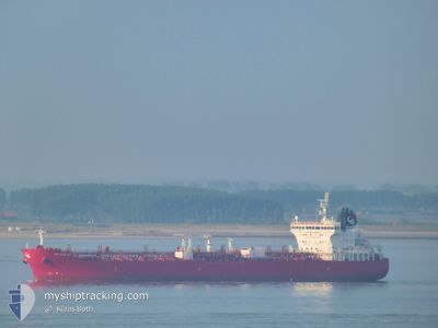
STI PIMLICO
Tanker
Current Trip
| Time Travelled | 20 h, 57 mins |
|---|---|
| Remaining Time | --- |
| Distance Travelled | 1.20 nm |
| Remaining Distance | --- |
| AVG Speed | --- |
| MAX Speed | --- |
| AVG Wind | 22.6 knots |
| MAX Wind | 34.8 knots |
| MIN Temp | 14.2°C / 57.56°F |
| MAX Temp | 15.8°C / 60.44°F |
| Djupgående | 6.9 m |
| Position mottagen | 10 h, 53 m sen |
Current Position
| Longitud | 14.76788° |
|---|---|
| Latitude | 35.88224° |
| Status | At anchor |
| Fart | 0.5 Knop |
| Kurs | 334° |
| Område | Mediterranean Sea - Eastern Basin |
| Station | T-AIS |
| Position mottagen | 10 h, 53 m sen |
Info
Information
The current position of STI PIMLICO is in Mediterranean Sea - Eastern Basin with coordinates 35.88224° / 14.76788° as reported on 2024-04-19 16:43 by AIS to our vessel tracker app. The vessel's current speed is 0.5 Knop
The vessel STI PIMLICO (IMO: 9686871, MMSI: 538005398) is a Tanker It's sailing under the flag of [MH] Marshall Is.
In this page you can find informations about the vessels current position, last detected port calls, and current voyage information. If the vessels is not in coverage by AIS you will find the latest position.
The current position of STI PIMLICO is detected by our AIS receivers and we are not responsible for the reliability of the data. The last position was recorded while the vessel was in Coverage by the Ais receivers of our vessel tracking app.
The current draught of STI PIMLICO as reported by AIS is 6.9 meters
Weather
| Temperature | 14.9°C / 58.82°F |
|---|---|
| Wind Speed | 17 knots |
| Direction | 319° NW |
| Pressure | 1014.6 hPa |
| Humidity | 66 % |
| Cloud Coverage | --- |
Featured Company
Last Port Calls
| Port | Arrival | Departure | Time In Port |
|---|---|---|---|
| 2024-04-18 04:45 | 2024-04-19 06:40 | 1 d | |
| 2024-04-05 09:44 | 2024-04-07 08:14 | 1 d | |
| 2024-03-22 08:53 | 2024-03-23 05:04 | 20 h | |
| 2024-03-12 20:11 | 2024-03-14 14:29 | 1 d | |
| 2024-02-27 12:37 | |||
| 2024-02-27 08:55 | |||
| 2024-02-15 09:41 | 2024-02-15 10:29 | 47 m | |
| 2024-02-07 14:29 | 2024-02-15 08:44 | 7 d | |
| 2024-02-07 12:47 | 2024-02-07 13:32 | 45 m | |
| 2024-02-03 07:38 | 2024-02-05 11:58 | 2 d |
Last Trips
| Origin | Departure | Destination | Arrival | Distance | |
|---|---|---|---|---|---|
| 2024-04-07 10:14 | 2024-04-18 06:45 | 1180.05 nm | |||
| 2024-03-23 07:04 | 2024-04-05 11:44 | 2073.49 nm | |||
| 2024-03-14 15:29 | 2024-03-22 10:53 | 1574.60 nm | |||
| 2024-02-27 13:37 | 2024-03-12 21:11 | 1732.86 nm | |||
| 2024-02-15 09:44 | 2024-02-15 10:41 | 4.27 nm | |||
| 2024-02-07 14:32 | 2024-02-07 15:29 | 6.27 nm | |||
| 2024-02-05 12:58 | 2024-02-07 13:47 | 168.79 nm | |||
| 2024-02-03 07:51 | 2024-02-03 08:38 | 5.56 nm | |||
| 2024-01-28 19:55 | 2024-02-03 07:03 | 1377.67 nm |
Events
| Tid | Event | Detaljer | Position / Dest | Information |
|---|---|---|---|---|
| 2024-04-19 16:49 | Status ändrad | Default At anchor |
35.88250 / 14.76822
ITGHE =>LYZAW
|
Fart: 0.5 kn Kurs: 334° |
| 2024-04-19 16:43 | Status ändrad | At anchor Default |
35.88224 / 14.76788
ITGHE =>LYZAW
|
Fart: 0.5 kn Kurs: 309° |
| 2024-04-19 16:43 | UTANFÖR täckningsområde |
35.88224 / 14.76788
Mediterranean Sea - Eastern Basin
|
Fart: 0.5 kn Kurs: 45.6° |
|
| 2024-04-19 16:31 | I täckningsområde |
35.88224 / 14.76788
Mediterranean Sea - Eastern Basin
|
Fart: 0.5 kn Kurs: 45.6° |
|
| 2024-04-19 14:34 | UTANFÖR täckningsområde |
35.88312 / 14.76808
Mediterranean Sea - Eastern Basin
|
Fart: 0.2 kn Kurs: 124.3° |
|
| 2024-04-19 12:04 | I täckningsområde |
35.88338 / 14.76821
Mediterranean Sea - Eastern Basin
|
Fart: 0.3 kn Kurs: 91.6° |
|
| 2024-04-19 09:25 | UTANFÖR täckningsområde |
35.88355 / 14.76831
Mediterranean Sea - Eastern Basin
|
Fart: 0.2 kn Kurs: 210.2° |
|
| 2024-04-19 09:25 | I täckningsområde |
35.88355 / 14.76831
Mediterranean Sea - Eastern Basin
|
Fart: 0.2 kn Kurs: 210.2° |
|
| 2024-04-19 06:44 | UTANFÖR täckningsområde |
35.88502 / 14.76763
Mediterranean Sea - Eastern Basin
|
Fart: 1.7 kn Kurs: 324° |
|
| 2024-04-19 06:40 | Byter havsområde | Maltese part of the Mediterranean Sea - Eastern Basin Libyan part of the Mediterranean Sea - Eastern Basin |
35.88352 / 14.76888
Mediterranean Sea - Eastern Basin
|
Fart: 1.8 kn Kurs: 339.9° |