
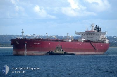
STI LAUREN
Tanker
Current Trip
| Time Travelled | 21 days |
|---|---|
| Remaining Time | --- |
| Distance Travelled | 6074.38 nm |
| Remaining Distance | 11.73 nm |
| AVG Speed | 12.2 Knop |
| MAX Speed | 15.3 Knop |
| AVG Wind | 9.4 knots |
| MAX Wind | 27.3 knots |
| MIN Temp | 7.4°C / 45.32°F |
| MAX Temp | 32.5°C / 90.5°F |
| Djupgående | 8.9 m |
| Position mottagen | 3 m sen |
Current Position
| Longitud | 56.56616° |
|---|---|
| Latitude | 25.38648° |
| Status | At anchor |
| Fart | |
| Kurs | 116° |
| Område | Gulf of Oman |
| Station | T-AIS |
| Position mottagen | 3 m sen |
Info
Information
The current position of STI LAUREN is in Gulf of Oman with coordinates 25.38648° / 56.56616° as reported on 2024-04-19 07:19 by AIS to our vessel tracker app. The vessel's current speed is 0 Knop and is heading at the port of KHORFAKKAN. The estimated time of arrival as calculated by MyShipTracking vessel tracking app is 2024-04-19 03:00 LT
The vessel STI LAUREN (IMO: 9696711, MMSI: 538005512) is a Tanker It's sailing under the flag of [MH] Marshall Is.
In this page you can find informations about the vessels current position, last detected port calls, and current voyage information. If the vessels is not in coverage by AIS you will find the latest position.
The current position of STI LAUREN is detected by our AIS receivers and we are not responsible for the reliability of the data. The last position was recorded while the vessel was in Coverage by the Ais receivers of our vessel tracking app.
The current draught of STI LAUREN as reported by AIS is 8.9 meters
Weather
| Temperature | 24.8°C / 76.64°F |
|---|---|
| Wind Speed | 4 knots |
| Direction | 85° E |
| Pressure | 1010.5 hPa |
| Humidity | 68 % |
| Cloud Coverage | --- |
Featured Company
Events
| Tid | Event | Detaljer | Position / Dest | Information |
|---|---|---|---|---|
| 2024-04-19 05:10 | Status ändrad | At anchor Under way using engine |
25.38743 / 56.56689
KHORFAKKAN
|
Fart: 0.2 kn Kurs: 156° |
| 2024-04-19 04:54 | STOPPAR förflyttning | 11.34 nm, East of KHORFAKKAN |
25.38676 / 56.56805
KHORFAKKAN
|
Fart: 0.3 kn Kurs: 128° |
| 2024-04-19 01:32 | Destination ändrad | KHORFAKKAN ARM GUARDS ONBOARD |
25.19203 / 56.99108
KHORFAKKAN
|
Fart: 12 kn Kurs: 312.7° |
| 2024-04-19 01:32 | ETA ändrat | 2024/04/19 03:00 2024/04/17 12:00 |
25.19203 / 56.99108
KHORFAKKAN
|
Fart: 12 kn Kurs: 312.7° |
| 2024-04-19 00:59 | Byter havsområde | United Arab Emirates part of the Gulf of Oman Iranian part of the Gulf of Oman |
25.14335 / 57.09668
Gulf of Oman
|
Fart: 11.9 kn Kurs: 289.2° |
| 2024-04-19 00:24 | Destination ändrad | ARM GUARDS ONBOARD FUJAIRAH |
25.09036 / 57.21063
ARM GUARDS ONBOARD
|
Fart: 11.6 kn Kurs: 300.4° |
| 2024-04-18 23:47 | Upptäckt i hav | Iranian part of the Gulf of Oman |
25.02887 / 57.32471
Gulf of Oman
|
Fart: 11.9 kn Kurs: 300.2° |
| 2024-04-18 23:46 | I täckningsområde |
25.02887 / 57.32471
Gulf of Oman
|
Fart: 11.9 kn Kurs: 300.2° |
|
| 2024-04-16 22:18 | STARTAR förflyttning |
20.93242 / 63.31793
FUJAIRAH
|
Fart: 3.1 kn Kurs: 132° |
|
| 2024-04-15 18:14 | STOPPAR förflyttning |
20.54667 / 63.32167
FUJAIRAH
|
Fart: Kurs: -1° |