
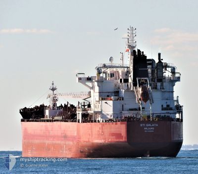
STI GALATA
Tanker
Current Trip
| Time Travelled | 24 days |
|---|---|
| Remaining Time | --- |
| Distance Travelled | 741.23 nm |
| Remaining Distance | --- |
| AVG Speed | 11.1 Knop |
| MAX Speed | 14.5 Knop |
| AVG Wind | 10.7 knots |
| MAX Wind | 25.8 knots |
| MIN Temp | 16°C / 60.8°F |
| MAX Temp | 29.8°C / 85.64°F |
| Djupgående | 10.8 m |
| Position mottagen | 2 d sen |
Current Position
| Longitud | -97.24657° |
|---|---|
| Latitude | 20.96241° |
| Status | At anchor |
| Fart | 0.1 Knop |
| Kurs | 103° |
| Område | Gulf of Mexico |
| Station | T-AIS |
| Position mottagen | 2 d sen |
Info
Information
The current position of STI GALATA is in Gulf of Mexico with coordinates 20.96241° / -97.24657° as reported on 2024-04-17 08:22 by AIS to our vessel tracker app. The vessel's current speed is 0.1 Knop
The vessel STI GALATA (IMO: 9785689, MMSI: 538007037) is a Tanker It's sailing under the flag of [MH] Marshall Is.
In this page you can find informations about the vessels current position, last detected port calls, and current voyage information. If the vessels is not in coverage by AIS you will find the latest position.
The current position of STI GALATA is detected by our AIS receivers and we are not responsible for the reliability of the data. The last position was recorded while the vessel was in Coverage by the Ais receivers of our vessel tracking app.
The current draught of STI GALATA as reported by AIS is 10.8 meters
Weather
| Temperature | 25.3°C / 77.54°F |
|---|---|
| Wind Speed | 9 knots |
| Direction | 103° ESE |
| Pressure | 1011.4 hPa |
| Humidity | 90.3 % |
| Cloud Coverage | 64 % |
Featured Company
Last Port Calls
| Port | Arrival | Departure | Time In Port |
|---|---|---|---|
| 2024-03-23 18:11 | 2024-03-26 16:18 | 2 d | |
| 2024-03-03 00:33 | |||
| 2024-02-25 10:37 | 2024-02-27 13:14 | 2 d | |
| 2024-02-17 19:19 | 2024-02-18 08:25 | 13 h |
Most Visited Ports (Last year)
| Port | Arrivals | |
|---|---|---|
| 3 | ||
| 2 | ||
| 2 | ||
| 2 | ||
| 2 | ||
| 1 |
Last Trips
| Origin | Departure | Destination | Arrival | Distance | |
|---|---|---|---|---|---|
| 2024-02-27 08:14 | 2024-03-02 19:33 | 1401.97 nm | |||
| 2024-02-18 03:25 | 2024-02-25 05:37 | 15.31 nm | |||
| 2024-01-22 22:37 | 2024-02-17 14:19 | 4408.21 nm |
Events
| Tid | Event | Detaljer | Position / Dest | Information |
|---|---|---|---|---|
| 2024-04-17 19:00 | STOPPAR förflyttning | 5.29 nm, North East of TUXPAN |
21.04333 / -97.28833
MXTUX
|
Fart: Kurs: -1° |
| 2024-04-17 17:31 | STARTAR förflyttning | 5.2 nm, East of TUXPAN |
20.96666 / -97.23500
MXTUX
|
Fart: 4 kn Kurs: -1° |
| 2024-04-17 08:28 | Status ändrad | Default At anchor |
20.96167 / -97.24500
MXTUX
|
Fart: 0.1 kn Kurs: 103° |
| 2024-04-17 08:22 | UTANFÖR täckningsområde |
20.96241 / -97.24657
Gulf of Mexico
|
Fart: 0.1 kn Kurs: 5.3° |
|
| 2024-04-17 08:07 | Status ändrad | At anchor Default |
20.96231 / -97.24651
MXTUX
|
Fart: Kurs: -1° |
| 2024-04-17 07:57 | I täckningsområde |
20.96231 / -97.24651
Gulf of Mexico
|
Fart: 0.2 kn Kurs: 189.6° |
|
| 2024-04-17 01:37 | Status ändrad | Default At anchor |
20.96167 / -97.24500
MXTUX
|
Fart: Kurs: 102° |
| 2024-04-17 01:28 | Status ändrad | At anchor Default |
20.96228 / -97.24660
MXTUX
|
Fart: Kurs: -1° |
| 2024-04-17 01:28 | UTANFÖR täckningsområde |
20.96228 / -97.24660
Gulf of Mexico
|
Fart: Kurs: 195.5° |
|
| 2024-04-17 01:07 | Status ändrad | Default At anchor |
20.96256 / -97.24641
MXTUX
|
Fart: 0.2 kn Kurs: 97° |