
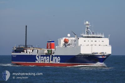
STENA SCOTIA
Ro-Ro Cargo
Current Trip
BEL<>HEY
| Time Travelled | 5 h, 7 mins |
|---|---|
| Remaining Time | --- |
| Distance Travelled | 86.35 nm |
| Remaining Distance | --- |
| AVG Speed | 17.3 Knop |
| MAX Speed | 19 Knop |
| AVG Wind | 9.1 knots |
| MAX Wind | 13.2 knots |
| MIN Temp | 7.1°C / 44.78°F |
| MAX Temp | 7.9°C / 46.22°F |
| Djupgående | 5 m |
| Position mottagen | 2 m sen |
Current Position
| Longitud | -5.02294° |
|---|---|
| Latitude | 54.60973° |
| Status | Under way using engine |
| Fart | 19 Knop |
| Kurs | 295.2° |
| Område | Irish Sea and St. George's Channel |
| Station | T-AIS |
| Position mottagen | 2 m sen |
Info
Information
The current position of STENA SCOTIA is in Irish Sea and St. George's Channel with coordinates 54.60973° / -5.02294° as reported on 2024-04-25 13:10 by AIS to our vessel tracker app. The vessel's current speed is 19 Knop
The vessel STENA SCOTIA (IMO: 9121625, MMSI: 232018002) is a Ro-Ro Cargo that was built in 1996 ( 28 År gammal ). It's sailing under the flag of [GB] United Kingdom.
In this page you can find informations about the vessels current position, last detected port calls, and current voyage information. If the vessels is not in coverage by AIS you will find the latest position.
The current position of STENA SCOTIA is detected by our AIS receivers and we are not responsible for the reliability of the data. The last position was recorded while the vessel was in Coverage by the Ais receivers of our vessel tracking app.
The current draught of STENA SCOTIA as reported by AIS is 5 meters
Weather
| Temperature | 7.9°C / 46.22°F |
|---|---|
| Wind Speed | 4 knots |
| Direction | 22° NNE |
| Pressure | 1003.8 hPa |
| Humidity | 56.3 % |
| Cloud Coverage | 100 % |
Featured Company
Last Port Calls
| Port | Arrival | Departure | Time In Port |
|---|---|---|---|
| 2024-04-25 03:10 | 2024-04-25 08:06 | 4 h | |
| 2024-04-24 14:58 | 2024-04-24 20:14 | 5 h | |
| 2024-04-24 03:10 | 2024-04-24 08:06 | 4 h | |
| 2024-04-23 14:57 | 2024-04-23 19:35 | 4 h | |
| 2024-04-23 03:10 | 2024-04-23 07:50 | 4 h | |
| 2024-04-22 04:27 | 2024-04-22 18:58 | 14 h | |
| 2024-04-20 16:42 | 2024-04-21 19:14 | 1 d | |
| 2024-04-20 03:04 | 2024-04-20 09:32 | 6 h | |
| 2024-04-19 15:54 | 2024-04-19 20:22 | 4 h | |
| 2024-04-19 02:58 | 2024-04-19 08:49 | 5 h |
Most Visited Ports (Last year)
| Port | Arrivals | |
|---|---|---|
| 252 | ||
| 251 | ||
| 2 | ||
| 2 |
Last Trips
| Origin | Departure | Destination | Arrival | Distance | |
|---|---|---|---|---|---|
| 2024-04-24 21:14 | 2024-04-25 04:10 | 118.42 nm | |||
| 2024-04-24 09:06 | 2024-04-24 15:58 | 121.11 nm | |||
| 2024-04-23 20:35 | 2024-04-24 04:10 | 118.84 nm | |||
| 2024-04-23 08:50 | 2024-04-23 15:57 | 119.71 nm | |||
| 2024-04-22 19:58 | 2024-04-23 04:10 | 119.71 nm | |||
| 2024-04-21 20:14 | 2024-04-22 05:27 | 121.25 nm | |||
| 2024-04-20 10:32 | 2024-04-20 17:42 | 118.39 nm | |||
| 2024-04-19 21:22 | 2024-04-20 04:04 | 120.85 nm | |||
| 2024-04-19 09:49 | 2024-04-19 16:54 | 120.26 nm | |||
| 2024-04-18 21:08 | 2024-04-19 03:58 | 110.18 nm |
Events
| Tid | Event | Detaljer | Position / Dest | Information |
|---|---|---|---|---|
| 2024-04-25 13:10 | Byter havsområde | United Kingdom part of the Inner Seas off the West Coast of Scotland United Kingdom part of the Irish Sea and St. George's Channel |
54.60973 / -5.02294
Inner Seas off the West Coast of Scotland
|
Fart: 19 kn Kurs: 295.2° |
| 2024-04-25 13:08 | Status ändrad | Under way using engine Default |
54.60589 / -5.00878
BEL<>HEY
|
Fart: 18.9 kn Kurs: 294° |
| 2024-04-25 13:02 | I täckningsområde |
54.60973 / -5.02294
Inner Seas off the West Coast of Scotland
|
Fart: 19 kn Kurs: 295.2° |
|
| 2024-04-25 08:54 | Status ändrad | Default Under way using engine |
53.94196 / -3.24798
BEL<>HEY
|
Fart: 16 kn Kurs: 264.3° |
| 2024-04-25 08:47 | UTANFÖR täckningsområde |
53.92877 / -3.20266
Irish Sea and St. George's Channel
|
Fart: 16 kn Kurs: 264.3° |
|
| 2024-04-25 08:45 | Status ändrad | Under way using engine Default |
53.93045 / -3.18200
BEL<>HEY
|
Fart: 16 kn Kurs: 260° |
| 2024-04-25 08:06 | Status ändrad | Default Under way using engine |
54.01987 / -2.94931
BEL<>HEY
|
Fart: 4.7 kn Kurs: 283° |
| 2024-04-25 08:06 | AVGÅTT HAMN |
|
54.01987 / -2.94931
BEL<>HEY
|
Fart: 4.7 kn Kurs: 283° |
| 2024-04-25 07:59 | Status ändrad | Under way using engine Default |
54.03258 / -2.92516
[GB] HEYSHAM
|
Fart: 4.8 kn Kurs: 279° |
| 2024-04-25 07:58 | STARTAR förflyttning |
54.03242 / -2.92367
[GB] HEYSHAM
|
Fart: 4.8 kn Kurs: 279° |