
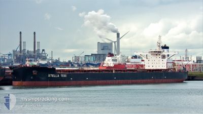
STELLA TESS
Cargo
Current Trip
| Time Travelled | 3 days |
|---|---|
| Remaining Time | 1 day |
| Distance Travelled | 1033.07 nm |
| Remaining Distance | 643.26 nm |
| AVG Speed | 12 Knop |
| MAX Speed | 14 Knop |
| AVG Wind | 9.1 knots |
| MAX Wind | 16 knots |
| MIN Temp | 8.9°C / 48.02°F |
| MAX Temp | 23.5°C / 74.3°F |
| Djupgående | 18.1 m |
| Position mottagen | 3 d sen |
Current Position
| Longitud | 118.79402° |
|---|---|
| Latitude | 38.77782° |
| Status | Under way using engine |
| Fart | 12.9 Knop |
| Kurs | 97° |
| Område | Yellow Sea |
| Station | T-AIS |
| Position mottagen | 3 d sen |
Info
Information
The current position of STELLA TESS is in Yellow Sea with coordinates 38.77782° / 118.79402° as reported on 2024-04-21 08:46 by AIS to our vessel tracker app. The vessel's current speed is 12.9 Knop and is heading at the port of QINGDAO. The estimated time of arrival as calculated by MyShipTracking vessel tracking app is 2024-04-26 20:21 LT
The vessel STELLA TESS (IMO: 9752199, MMSI: 563008300) is a Cargo It's sailing under the flag of [SG] Singapore.
In this page you can find informations about the vessels current position, last detected port calls, and current voyage information. If the vessels is not in coverage by AIS you will find the latest position.
The current position of STELLA TESS is detected by our AIS receivers and we are not responsible for the reliability of the data. The last position was recorded while the vessel was in Coverage by the Ais receivers of our vessel tracking app.
The current draught of STELLA TESS as reported by AIS is 18.1 meters
Weather
| Temperature | 23.5°C / 74.3°F |
|---|---|
| Wind Speed | 12 knots |
| Direction | 76° ENE |
| Pressure | 1010.3 hPa |
| Humidity | 85.4 % |
| Cloud Coverage | 100 % |
Featured Company
Last Port Calls
| Port | Arrival | Departure | Time In Port |
|---|---|---|---|
| 2024-04-21 04:48 | |||
| 2024-03-31 09:11 | 2024-04-01 18:10 | 1 d | |
| 2024-03-14 09:42 | 2024-03-19 09:42 | 5 d |
Most Visited Ports (Last year)
| Port | Arrivals | |
|---|---|---|
| 3 | ||
| 1 | ||
| 1 | ||
| 1 | ||
| 1 | ||
| 1 |
Last Trips
| Origin | Departure | Destination | Arrival | Distance | |
|---|---|---|---|---|---|
| 2024-03-19 17:42 | 2024-03-31 17:11 | 3841.24 nm | |||
| 2023-12-22 08:27 | 2024-03-14 17:42 | 8200.61 nm |
Events
| Tid | Event | Detaljer | Position / Dest | Information |
|---|---|---|---|---|
| 2024-04-21 08:52 | Status ändrad | Default Under way using engine |
38.77525 / 118.82131
QINGDAO.CN
|
Fart: 12.9 kn Kurs: 97° |
| 2024-04-21 08:46 | UTANFÖR täckningsområde |
38.77782 / 118.79402
Yellow Sea
|
Fart: 12.9 kn Kurs: 97° |
|
| 2024-04-21 08:04 | Byter havsområde | Chinese part of the Yellow Sea Australian part of the Indian Ocean |
38.79866 / 118.60707
Yellow Sea
|
Fart: 12.4 kn Kurs: 99.5° |
| 2024-04-21 08:04 | Status ändrad | Under way using engine Default |
38.79885 / 118.60569
QINGDAO.CN
|
Fart: 12.5 kn Kurs: 95° |
| 2024-04-21 08:04 | I täckningsområde |
38.79866 / 118.60707
Yellow Sea
|
Fart: 12.4 kn Kurs: 99.5° |
|
| 2024-04-21 04:48 | AVGÅTT HAMN |
|
38.95704 / 117.87834
QINGDAO.CN
|
Fart: 11.5 kn Kurs: 102° |
| 2024-04-21 04:16 | STARTAR förflyttning |
38.97339 / 117.77258
[CN] TIANJIN
|
Fart: 3.3 kn Kurs: 101° |
|
| 2024-04-16 17:43 | STOPPAR förflyttning | 20.55 nm, South West of CAOFEIDIAN |
38.84515 / 118.19923
QINGDAO.CN
|
Fart: 0.3 kn Kurs: 262° |