
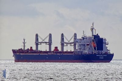
VANCOUVER EAGLE
Cargo
Current Trip
| Time Travelled | 4 days |
|---|---|
| Remaining Time | --- |
| Distance Travelled | 936.76 nm |
| Remaining Distance | --- |
| AVG Speed | 8.8 Knop |
| MAX Speed | 12.5 Knop |
| AVG Wind | 21.6 knots |
| MAX Wind | 44.8 knots |
| MIN Temp | 10.7°C / 51.26°F |
| MAX Temp | 20.4°C / 68.72°F |
| Djupgående | 12.5 m |
| Position mottagen | 4 d sen |
Current Position
| Longitud | -75.96098° |
|---|---|
| Latitude | 36.93323° |
| Status | Under way using engine |
| Fart | 10.3 Knop |
| Kurs | 109.4° |
| Område | North Atlantic Ocean |
| Station | T-AIS |
| Position mottagen | 4 d sen |
Info
Information
The current position of VANCOUVER EAGLE is in North Atlantic Ocean with coordinates 36.93323° / -75.96098° as reported on 2024-04-21 08:56 by AIS to our vessel tracker app. The vessel's current speed is 10.3 Knop and is heading at the port of GENT. The estimated time of arrival as calculated by MyShipTracking vessel tracking app is 2024-05-04 00:00 LT
The vessel VANCOUVER EAGLE (IMO: 9855850, MMSI: 538008697) is a Cargo It's sailing under the flag of [MH] Marshall Is.
In this page you can find informations about the vessels current position, last detected port calls, and current voyage information. If the vessels is not in coverage by AIS you will find the latest position.
The current position of VANCOUVER EAGLE is detected by our AIS receivers and we are not responsible for the reliability of the data. The last position was recorded while the vessel was in Coverage by the Ais receivers of our vessel tracking app.
The current draught of VANCOUVER EAGLE as reported by AIS is 12.5 meters
Weather
| Temperature | 14.3°C / 57.74°F |
|---|---|
| Wind Speed | 10 knots |
| Direction | 320° NW |
| Pressure | 1021.9 hPa |
| Humidity | 88.2 % |
| Cloud Coverage | 100 % |
Featured Company
Last Port Calls
| Port | Arrival | Departure | Time In Port |
|---|---|---|---|
| 2024-04-17 17:35 | 2024-04-21 07:28 | 3 d | |
| 2024-03-26 01:27 | 2024-03-27 00:41 | 23 h | |
| 2024-03-19 20:22 | |||
| 2024-03-14 20:48 | 2024-03-16 04:04 | 1 d | |
| 2024-03-10 23:00 | 2024-03-13 23:35 | 3 d |
Last Trips
| Origin | Departure | Destination | Arrival | Distance | |
|---|---|---|---|---|---|
| 2024-03-26 20:41 | 2024-04-17 13:35 | 464.38 nm | |||
| 2024-03-19 15:22 | 2024-03-25 21:27 | 1214.61 nm | |||
| 2024-03-13 18:35 | 2024-03-14 15:48 | 234.39 nm | |||
| 2024-01-26 23:48 | 2024-03-10 18:00 | 8908.11 nm |
Events
| Tid | Event | Detaljer | Position / Dest | Information |
|---|---|---|---|---|
| 2024-04-21 09:02 | Status ändrad | Default Under way using engine |
36.92392 / -75.94444
BE GNE
|
Fart: 10.3 kn Kurs: 109.4° |
| 2024-04-21 08:56 | UTANFÖR täckningsområde |
36.93323 / -75.96098
North Atlantic Ocean
BE GNE
|
Fart: 10.3 kn Kurs: 109.4° |
|
| 2024-04-21 07:28 | AVGÅTT HAMN |
|
37.00575 / -76.26728
BE GNE
|
Fart: 11.6 kn Kurs: 76° |
| 2024-04-21 07:14 | Djupgående ändrat | 12.5 12.4 |
36.98468 / -76.31765
[US] NORFOLK
|
Fart: 11 kn Kurs: 43° |
| 2024-04-21 06:31 | STARTAR förflyttning |
36.88217 / -76.33334
[US] NORFOLK
|
Fart: 3.2 kn Kurs: 343° |
|
| 2024-04-21 06:19 | Status ändrad | Under way using engine Moored |
36.87985 / -76.32743
[US] NORFOLK
|
Fart: 0.8 kn Kurs: 284° |
| 2024-04-21 06:18 | Status ändrad | Moored Default |
36.87977 / -76.32697
[US] NORFOLK
|
Fart: Kurs: 275° |
| 2024-04-21 06:00 | Status ändrad | Default Moored |
36.87948 / -76.32649
[US] NORFOLK
|
Fart: Kurs: 275° |
| 2024-04-21 05:54 | Status ändrad | Moored Default |
36.87947 / -76.32647
[US] NORFOLK
|
Fart: Kurs: 275° |
| 2024-04-21 05:48 | Status ändrad | Default Moored |
36.87947 / -76.32648
[US] NORFOLK
|
Fart: Kurs: 275° |