
SPOB.JUNEYAOMARU VI
Tanker
Current Trip
PLAJU
| Time Travelled | 9 days |
|---|---|
| Remaining Time | --- |
| Distance Travelled | 749.16 nm |
| Remaining Distance | --- |
| AVG Speed | 7.1 Knop |
| MAX Speed | 10.9 Knop |
| AVG Wind | 4.1 knots |
| MAX Wind | 12.8 knots |
| MIN Temp | 23.4°C / 74.12°F |
| MAX Temp | 33.4°C / 92.12°F |
| Djupgående | 4.6 m |
| Position mottagen | 2024-01-22 02:03 |
Current Position
| Longitud | 105.90776° |
|---|---|
| Latitude | -5.73393° |
| Status | Under way sailing |
| Fart | 6.4 Knop |
| Kurs | 31.4° |
| Område | Java Sea |
| Station | T-AIS |
| Position mottagen | 2024-01-22 02:03 |
Info
Information
The current position of SPOB.JUNEYAOMARU VI is in Java Sea with coordinates -5.73393° / 105.90776° as reported on 2024-01-22 02:03 by AIS to our vessel tracker app. The vessel's current speed is 6.4 Knop
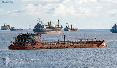
The vessel SPOB.JUNEYAOMARU VI (IMO: 9760902, MMSI: 525003329) is a Tanker It's sailing under the flag of [ID] Indonesia.
In this page you can find informations about the vessels current position, last detected port calls, and current voyage information. If the vessels is not in coverage by AIS you will find the latest position.
The current position of SPOB.JUNEYAOMARU VI is detected by our AIS receivers and we are not responsible for the reliability of the data. The last position was recorded while the vessel was in Coverage by the Ais receivers of our vessel tracking app.
The current draught of SPOB.JUNEYAOMARU VI as reported by AIS is 4.6 meters
Weather
| Temperature | 29.8°C / 85.64°F |
|---|---|
| Wind Speed | 3 knots |
| Direction | 87° E |
| Pressure | 1006.7 hPa |
| Humidity | 69.4 % |
| Cloud Coverage | 100 % |
Featured Company
Last Port Calls
| Port | Arrival | Departure | Time In Port |
|---|---|---|---|
| 2024-04-14 00:47 | 2024-04-15 02:17 | 1 d | |
| 2024-04-04 23:52 | 2024-04-06 02:04 | 1 d | |
| 2024-03-24 06:44 | 2024-03-25 11:12 | 1 d | |
| 2024-03-19 02:00 | 2024-03-20 01:55 | 23 h | |
| 2024-02-18 05:29 | |||
| 2024-02-07 09:18 | 2024-02-08 11:23 | 1 d |
Most Visited Ports (Last year)
| Port | Arrivals | |
|---|---|---|
| 29 |
Last Trips
| Origin | Departure | Destination | Arrival | Distance | |
|---|---|---|---|---|---|
| 2024-04-06 09:04 | 2024-04-14 07:47 | 8.89 nm | |||
| 2024-03-25 18:12 | 2024-04-05 06:52 | 728.66 nm | |||
| 2024-03-20 08:55 | 2024-03-24 13:44 | 7.76 nm | |||
| 2024-02-18 12:29 | 2024-03-19 09:00 | 1193.30 nm | |||
| 2024-01-29 10:17 | 2024-02-07 16:18 | 638.87 nm |
Events
| Tid | Event | Detaljer | Position / Dest | Information |
|---|---|---|---|---|
| 2024-04-21 04:03 | STOPPAR förflyttning | 3.06 nm, South East of PANJANG |
-5.49582 / 105.31263
PLAJU
|
Fart: 0.2 kn Kurs: -1° |
| 2024-04-19 04:14 | STARTAR förflyttning |
-2.98498 / 104.84020
PLAJU
|
Fart: 8.2 kn Kurs: 62° |
|
| 2024-04-17 21:39 | STOPPAR förflyttning |
-2.99088 / 104.83188
PLAJU
|
Fart: Kurs: -1° |
|
| 2024-04-17 12:01 | STARTAR förflyttning | 14.69 nm, South West of MENTOK |
-2.18898 / 104.94607
PLAJU
|
Fart: 5.6 kn Kurs: 229° |
| 2024-04-17 05:15 | STOPPAR förflyttning | 13.63 nm, South West of MENTOK |
-2.17917 / 104.96090
PLAJU
|
Fart: 0.1 kn Kurs: -1° |
| 2024-04-15 02:17 | AVGÅTT HAMN |
|
-5.47215 / 105.30366
PLAJU
|
Fart: 5.5 kn Kurs: -1° |
| 2024-04-15 02:09 | STARTAR förflyttning |
-5.46124 / 105.30845
[ID] PANJANG
|
Fart: 4 kn Kurs: -1° |