
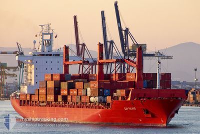
SPIL NIKEN
Container Ship
Current Trip
MYPKG
| Time Travelled | 2 days |
|---|---|
| Remaining Time | --- |
| Distance Travelled | 287.00 nm |
| Remaining Distance | --- |
| AVG Speed | 11.4 Knop |
| MAX Speed | 12.3 Knop |
| AVG Wind | 7.7 knots |
| MAX Wind | 14.9 knots |
| MIN Temp | 26°C / 78.8°F |
| MAX Temp | 29.5°C / 85.1°F |
| Djupgående | 10.9 m |
| Position mottagen | 2024-03-02 03:15 |
Current Position
| Longitud | 101.99761° |
|---|---|
| Latitude | 2.19535° |
| Status | Under way using engine |
| Fart | 16.4 Knop |
| Kurs | 318° |
| Område | Malacca Strait |
| Station | T-AIS |
| Position mottagen | 2024-03-02 03:15 |
Info
Information
The current position of SPIL NIKEN is in Malacca Strait with coordinates 2.19535° / 101.99761° as reported on 2024-03-02 03:15 by AIS to our vessel tracker app. The vessel's current speed is 16.4 Knop
The vessel SPIL NIKEN (IMO: 9273947, MMSI: 352986169) is a Container Ship that was built in 2003 ( 21 År gammal ). It's sailing under the flag of [PA] Panama.
In this page you can find informations about the vessels current position, last detected port calls, and current voyage information. If the vessels is not in coverage by AIS you will find the latest position.
The current position of SPIL NIKEN is detected by our AIS receivers and we are not responsible for the reliability of the data. The last position was recorded while the vessel was in Coverage by the Ais receivers of our vessel tracking app.
The current draught of SPIL NIKEN as reported by AIS is 10.9 meters
Weather
| Temperature | 29.7°C / 85.46°F |
|---|---|
| Wind Speed | 6 knots |
| Direction | 95° E |
| Pressure | 1010.7 hPa |
| Humidity | 71.9 % |
| Cloud Coverage | 99 % |
Featured Company
Last Port Calls
| Port | Arrival | Departure | Time In Port |
|---|---|---|---|
| 2024-04-14 00:46 | 2024-04-14 11:46 | 11 h | |
| 2024-04-02 10:55 | 2024-04-05 04:03 | 2 d | |
| 2024-03-02 08:53 | 2024-03-02 16:45 | 7 h | |
| 2024-03-01 10:43 | 2024-03-01 20:04 | 9 h | |
| 2024-02-28 22:47 | 2024-03-01 03:50 | 1 d | |
| 2024-02-23 10:55 | 2024-02-24 03:31 | 16 h | |
| 2024-02-12 01:25 | 2024-02-15 06:56 | 3 d |
Most Visited Ports (Last year)
| Port | Arrivals | |
|---|---|---|
| 12 | ||
| 8 | ||
| 6 | ||
| 5 | ||
| 5 | ||
| 1 |
Last Trips
| Origin | Departure | Destination | Arrival | Distance | |
|---|---|---|---|---|---|
| 2024-04-05 07:03 | 2024-04-14 06:16 | 2571.31 nm | |||
| 2024-03-03 00:45 | 2024-04-02 13:55 | 3994.62 nm | |||
| 2024-03-02 04:04 | 2024-03-02 16:53 | 180.35 nm | |||
| 2024-03-01 11:50 | 2024-03-01 18:43 | 27.59 nm | |||
| 2024-02-24 09:01 | 2024-02-29 06:47 | 1597.16 nm | |||
| 2024-02-15 09:56 | 2024-02-23 16:25 | 2635.65 nm | |||
| 2023-12-27 07:21 | 2024-02-12 04:25 | 2352.03 nm |
Events
| Tid | Event | Detaljer | Position / Dest | Information |
|---|---|---|---|---|
| 2024-04-14 11:46 | AVGÅTT HAMN |
|
6.96919 / 79.84693
MYPKG
|
Fart: 6.6 kn Kurs: 329° |
| 2024-04-14 11:38 | STARTAR förflyttning |
6.95624 / 79.85210
[LK] COLOMBO
|
Fart: 6.7 kn Kurs: 357° |
|
| 2024-04-14 01:10 | STOPPAR förflyttning |
6.94842 / 79.85231
[LK] COLOMBO
|
Fart: 0.2 kn Kurs: -1° |
|
| 2024-04-14 00:46 | ANLÄNDER HAMN |
|
6.96446 / 79.84121
[LK] COLOMBO
|
Fart: 7.3 kn Kurs: 137° |
| 2024-04-13 23:46 | STARTAR förflyttning | 6.92 nm, North West of COLOMBO |
7.01033 / 79.73434
MYPKG
|
Fart: 6.4 kn Kurs: 104° |
| 2024-04-13 23:38 | STOPPAR förflyttning | 7.28 nm, North West of COLOMBO |
7.01285 / 79.72882
MYPKG
|
Fart: 0.3 kn Kurs: 143° |