
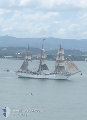
SORLANDET
Sailing Vessel
Current Trip
| Time Travelled | 1 day |
|---|---|
| Remaining Time | --- |
| Distance Travelled | 100.20 nm |
| Remaining Distance | --- |
| AVG Speed | 4.7 Knop |
| MAX Speed | 9.2 Knop |
| AVG Wind | 12.9 knots |
| MAX Wind | 16 knots |
| MIN Temp | 9.1°C / 48.38°F |
| MAX Temp | 11.5°C / 52.7°F |
| Djupgående | 4.5 m |
| Position mottagen | 2 m sen |
Current Position
| Longitud | -6.03102° |
|---|---|
| Latitude | 51.96494° |
| Status | Under way sailing |
| Fart | 4.9 Knop |
| Kurs | 210° |
| Område | Celtic Sea |
| Station | T-AIS |
| Position mottagen | 2 m sen |
Info
Information
The current position of SORLANDET is in Celtic Sea with coordinates 51.96494° / -6.03102° as reported on 2024-04-19 11:54 by AIS to our vessel tracker app. The vessel's current speed is 4.9 Knop and is heading at the port of SCHEVENINGEN. The estimated time of arrival as calculated by MyShipTracking vessel tracking app is 2024-05-05 09:00 LT
The vessel SORLANDET (IMO: 5334561, MMSI: 257165000) is a Sailing Vessel that was built in 1927 ( 97 År gammal ). It's sailing under the flag of [NO] Norway.
In this page you can find informations about the vessels current position, last detected port calls, and current voyage information. If the vessels is not in coverage by AIS you will find the latest position.
The current position of SORLANDET is detected by our AIS receivers and we are not responsible for the reliability of the data. The last position was recorded while the vessel was in Coverage by the Ais receivers of our vessel tracking app.
The current draught of SORLANDET as reported by AIS is 4.5 meters
Weather
| Temperature | 10.9°C / 51.62°F |
|---|---|
| Wind Speed | 11 knots |
| Direction | 296° WNW |
| Pressure | 1021.9 hPa |
| Humidity | 86.4 % |
| Cloud Coverage | 83 % |
Featured Company
Most Visited Ports (Last year)
| Port | Arrivals | |
|---|---|---|
| 11 | ||
| 4 | ||
| 3 | ||
| 2 | ||
| 1 | ||
| 1 |
Last Trips
| Origin | Departure | Destination | Arrival | Distance | |
|---|---|---|---|---|---|
| 2024-02-18 15:05 | 2024-04-12 22:02 | 1639.35 nm | |||
| 2024-01-26 14:17 | 2024-02-05 04:42 | 363.18 nm |
Events
| Tid | Event | Detaljer | Position / Dest | Information |
|---|---|---|---|---|
| 2024-04-19 10:52 | Upptäckt i hav | Irish part of the Celtic Sea |
52.03909 / -5.97357
Celtic Sea
NL SCE
|
Fart: 5 kn Kurs: 200.4° |
| 2024-04-19 07:09 | STARTAR förflyttning |
52.30209 / -5.74671
NL SCE
|
Fart: 3.6 kn Kurs: 195° |
|
| 2024-04-19 06:29 | STOPPAR förflyttning |
52.30533 / -5.75932
NL SCE
|
Fart: 0.3 kn Kurs: 190° |
|
| 2024-04-19 05:51 | STARTAR förflyttning |
52.33364 / -5.75447
NL SCE
|
Fart: 3.3 kn Kurs: 196° |
|
| 2024-04-19 05:47 | STOPPAR förflyttning |
52.33582 / -5.75439
NL SCE
|
Fart: 0.1 kn Kurs: 195° |
|
| 2024-04-19 05:44 | STARTAR förflyttning |
52.33711 / -5.75454
NL SCE
|
Fart: 3.2 kn Kurs: 196° |
|
| 2024-04-19 05:34 | STOPPAR förflyttning |
52.34070 / -5.75501
NL SCE
|
Fart: 0.3 kn Kurs: 200° |
|
| 2024-04-19 05:32 | STARTAR förflyttning |
52.34115 / -5.75505
NL SCE
|
Fart: 3.3 kn Kurs: 199° |
|
| 2024-04-19 05:18 | STOPPAR förflyttning |
52.34367 / -5.75615
NL SCE
|
Fart: 0.3 kn Kurs: 203° |
|
| 2024-04-19 03:35 | I täckningsområde |
52.40952 / -5.75037
Irish Sea and St. George's Channel
NL SCE
|
Fart: 4.2 kn Kurs: 180.4° |