
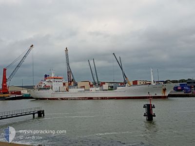
SIERRA LEYRE
Reefer
Current Trip
| Time Travelled | 2 days |
|---|---|
| Remaining Time | --- |
| Distance Travelled | 648.62 nm |
| Remaining Distance | --- |
| AVG Speed | 10.8 Knop |
| MAX Speed | 17.4 Knop |
| AVG Wind | 18.4 knots |
| MAX Wind | 28.6 knots |
| MIN Temp | 15.4°C / 59.72°F |
| MAX Temp | 25.3°C / 77.54°F |
| Djupgående | 6.4 m |
| Position mottagen | 1 d sen |
Current Position
| Longitud | 29.52299° |
|---|---|
| Latitude | 33.88840° |
| Status | Under way using engine |
| Fart | 9.7 Knop |
| Kurs | 138.3° |
| Område | Mediterranean Sea - Eastern Basin |
| Station | T-AIS |
| Position mottagen | 1 d sen |
Info
Information
The current position of SIERRA LEYRE is in Mediterranean Sea - Eastern Basin with coordinates 33.88840° / 29.52299° as reported on 2024-04-23 09:10 by AIS to our vessel tracker app. The vessel's current speed is 9.7 Knop
The vessel SIERRA LEYRE (IMO: 9135822, MMSI: 311000709) is a Reefer that was built in 1997 ( 27 År gammal ). It's sailing under the flag of [BS] Bahamas.
In this page you can find informations about the vessels current position, last detected port calls, and current voyage information. If the vessels is not in coverage by AIS you will find the latest position.
The current position of SIERRA LEYRE is detected by our AIS receivers and we are not responsible for the reliability of the data. The last position was recorded while the vessel was in Coverage by the Ais receivers of our vessel tracking app.
The current draught of SIERRA LEYRE as reported by AIS is 6.4 meters
Weather
| Temperature | 25.9°C / 78.62°F |
|---|---|
| Wind Speed | 16 knots |
| Direction | 68° ENE |
| Pressure | 1006 hPa |
| Humidity | 53 % |
| Cloud Coverage | 100 % |
Featured Company
Last Port Calls
| Port | Arrival | Departure | Time In Port |
|---|---|---|---|
| 2024-04-11 06:37 | 2024-04-21 17:26 | 10 d | |
| 2024-04-06 05:26 | |||
| 2024-02-21 13:38 | |||
| 2024-02-08 23:37 | 2024-02-17 17:57 | 8 d | |
| 2024-02-06 05:53 | 2024-02-06 14:45 | 8 h |
Most Visited Ports (Last year)
| Port | Arrivals | |
|---|---|---|
| 5 | ||
| 3 | ||
| 3 |
Last Trips
| Origin | Departure | Destination | Arrival | Distance | |
|---|---|---|---|---|---|
| 2024-02-17 20:57 | 2024-04-11 09:37 | 2387.93 nm | |||
| 2024-02-17 20:57 | 2024-04-06 07:26 | 1642.12 nm | |||
| 2023-12-17 23:38 | 2024-02-09 02:37 | 4111.82 nm | |||
| 2023-12-17 23:38 | 2024-02-06 07:53 | 3370.19 nm |
Events
| Tid | Event | Detaljer | Position / Dest | Information |
|---|---|---|---|---|
| 2024-04-24 07:04 | STOPPAR förflyttning | 6.38 nm, North of PORT SAID |
31.35745 / 32.32403
SUEZ
|
Fart: 0.3 kn Kurs: 117° |
| 2024-04-23 09:11 | Status ändrad | Default Under way using engine |
33.88806 / 29.52336
SUEZ
|
Fart: 9.7 kn Kurs: 138.3° |
| 2024-04-23 09:10 | UTANFÖR täckningsområde |
33.88840 / 29.52299
Mediterranean Sea - Eastern Basin
SUEZ
|
Fart: 9.7 kn Kurs: 138.3° |
|
| 2024-04-22 19:20 | Byter havsområde | Greek part of the Mediterranean Sea - Eastern Basin Greek part of the Aegean Sea |
35.75817 / 27.51172
Mediterranean Sea - Eastern Basin
SUEZ
|
Fart: 11 kn Kurs: 140.9° |
| 2024-04-22 10:39 | Status ändrad | Under way using engine Default |
36.93090 / 26.23464
SUEZ
|
Fart: 10.2 kn Kurs: 144° |
| 2024-04-22 10:26 | Status ändrad | Default Under way using engine |
36.95894 / 26.20364
SUEZ
|
Fart: 10.4 kn Kurs: 153.2° |
| 2024-04-22 00:21 | Status ändrad | Under way using engine Default |
38.87211 / 25.75476
SUEZ
|
Fart: 11.9 kn Kurs: 179° |
| 2024-04-22 00:04 | Status ändrad | Default Under way using engine |
38.92671 / 25.75456
SUEZ
|
Fart: 11.8 kn Kurs: 181.2° |
| 2024-04-21 18:56 | Byter havsområde | Greek part of the Aegean Sea Turkish part of the Aegean Sea |
39.86063 / 25.85568
Aegean Sea
SUEZ
|
Fart: 10 kn Kurs: 230.1° |
| 2024-04-21 18:56 | Status ändrad | Under way using engine Default |
39.86063 / 25.85568
SUEZ
|
Fart: 10 kn Kurs: 233° |