
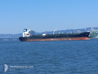
SEAWAYS ATHENS
Oil/Chemical Tanker
Current Trip
| Time Travelled | 46 mins |
|---|---|
| Remaining Time | 55 mins |
| Distance Travelled | 2.00 nm |
| Remaining Distance | 14.90 nm |
| AVG Speed | 10.6 Knop |
| MAX Speed | 10.9 Knop |
| AVG Wind | 2.3 knots |
| MAX Wind | 2.7 knots |
| MIN Temp | 14.9°C / 58.82°F |
| MAX Temp | 15°C / 59°F |
| Djupgående | 10.5 m |
| Position mottagen | 2 d sen |
Current Position
| Longitud | --- |
|---|---|
| Latitude | --- |
| Status | Under way using engine |
| Fart | 12.2 Knop |
| Kurs | 231.5° |
| Område | South Pacific Ocean |
| Station | T-AIS |
| Position mottagen | 2 d sen |
Info
Information
The current position of SEAWAYS ATHENS is in South Pacific Ocean with coordinates -32.92697° / -71.89295° as reported on 2025-12-06 06:45 by AIS to our vessel tracker app. The vessel's current speed is 12.2 Knop and is heading at the port of TALCAHUANO. The estimated time of arrival as calculated by MyShipTracking vessel tracking app is 2025-12-09 02:31 LT
The vessel SEAWAYS ATHENS (IMO: 9470260, MMSI: 538004377) is a Oil/Chemical Tanker that was built in 2012 ( 13 År gammal ). It's sailing under the flag of [MH] Marshall Is.
In this page you can find informations about the vessels current position, last detected port calls, and current voyage information. If the vessels is not in coverage by AIS you will find the latest position.
The current position of SEAWAYS ATHENS is detected by our AIS receivers and we are not responsible for the reliability of the data. The last position was recorded while the vessel was in Coverage by the Ais receivers of our vessel tracking app.
The current draught of SEAWAYS ATHENS as reported by AIS is 10.5 meters
Weather
| Temperature | 14.9°C / 58.82°F |
|---|---|
| Wind Speed | 2 knots |
| Direction | 81° E |
| Pressure | 1012.3 hPa |
| Humidity | 91.8 % |
| Cloud Coverage | 58 % |
Featured Company
Last Port Calls
| Port | Arrival | Departure | Time In Port |
|---|---|---|---|
| 2025-12-08 03:42 | 2025-12-09 00:50 | 21 h | |
| 2025-12-04 13:56 | 2025-12-06 01:49 | 1 d | |
| 2025-11-10 03:57 | 2025-11-12 05:34 | 2 d | |
| 2025-10-08 19:09 | 2025-10-22 05:17 | 13 d |
Most Visited Ports (Last year)
| Port | Arrivals | |
|---|---|---|
| 3 | ||
| 2 | ||
| 2 | ||
| 2 | ||
| 2 | ||
| 2 |
Last Trips
Events
| Tid | Event | Detaljer | Position / Dest | Information |
|---|---|---|---|---|
| 2025-12-09 03:54 | STARTAR förflyttning | 0.84 nm, West of SAN VICENTE |
-36.74077 / -73.16576
CL TAL
|
Fart: 3.2 kn Kurs: 355° |
| 2025-12-09 03:50 | AVGÅTT HAMN |
|
-36.74342 / -73.16551
CL TAL
|
Fart: 0.2 kn Kurs: 319° |
| 2025-12-08 06:42 | STOPPAR förflyttning |
-36.74500 / -73.16333
[CL] SAN VICENTE
|
Fart: Kurs: -1° |
|
| 2025-12-08 06:42 | ANLÄNDER HAMN |
|
-36.74500 / -73.16333
[CL] SAN VICENTE
|
Fart: 1 kn Kurs: -1° |
| 2025-12-08 03:18 | STARTAR förflyttning | 3.17 nm, North East of TALCAHUANO |
-36.66833 / -73.05334
CL TAL
|
Fart: 5 kn Kurs: 48° |
| 2025-12-07 03:18 | STOPPAR förflyttning | 2.98 nm, North East of TALCAHUANO |
-36.67166 / -73.05500
CL TAL
|
Fart: Kurs: -1° |
| 2025-12-06 06:50 | Status ändrad | Default Under way using engine |
-32.93710 / -71.90771
CL TAL
|
Fart: 12.2 kn Kurs: 231.5° |
| 2025-12-06 06:45 | UTANFÖR täckningsområde |
-32.92697 / -71.89295
South Pacific Ocean
CL TAL
|
Fart: 12.2 kn Kurs: 231.5° |
|
| 2025-12-06 05:09 | ETA ändrat | 2025/12/07 02:00 2025/12/07 05:00 |
-32.73624 / -71.57670
CL TAL
|
Fart: 11.2 kn Kurs: 273.5° |
| 2025-12-06 04:49 | AVGÅTT HAMN |
|
-32.75407 / -71.51851
CL TAL
|
Fart: 8.1 kn Kurs: 320° |