
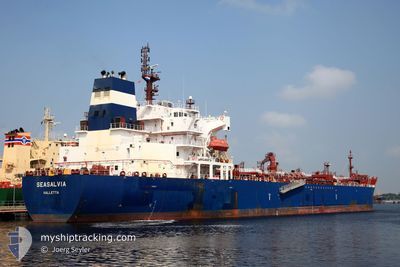
SEASALVIA
Oil/Chemical Tanker
Current Trip
| Time Travelled | 4 days |
|---|---|
| Remaining Time | 1 day |
| Distance Travelled | 655.84 nm |
| Remaining Distance | 320.61 nm |
| AVG Speed | 10.1 Knop |
| MAX Speed | 14.3 Knop |
| AVG Wind | 11.8 knots |
| MAX Wind | 34.7 knots |
| MIN Temp | 10.1°C / 50.18°F |
| MAX Temp | 22°C / 71.6°F |
| Djupgående | 12 m |
| Position mottagen | 7 h, 18 m sen |
Current Position
| Longitud | 22.76632° |
|---|---|
| Latitude | 36.41468° |
| Status | Under way using engine |
| Fart | 12.4 Knop |
| Kurs | 267.1° |
| Område | Mediterranean Sea - Eastern Basin |
| Station | T-AIS |
| Position mottagen | 7 h, 18 m sen |
Info
Information
The current position of SEASALVIA is in Mediterranean Sea - Eastern Basin with coordinates 36.41468° / 22.76632° as reported on 2024-04-24 01:49 by AIS to our vessel tracker app. The vessel's current speed is 12.4 Knop and is heading at the port of MARSAXLOKK. The estimated time of arrival as calculated by MyShipTracking vessel tracking app is 2024-04-25 12:37 LT
The vessel SEASALVIA (IMO: 9629550, MMSI: 229319000) is a Oil/Chemical Tanker that was built in 2013 ( 11 År gammal ). It's sailing under the flag of [MT] Malta.
In this page you can find informations about the vessels current position, last detected port calls, and current voyage information. If the vessels is not in coverage by AIS you will find the latest position.
The current position of SEASALVIA is detected by our AIS receivers and we are not responsible for the reliability of the data. The last position was recorded while the vessel was in Coverage by the Ais receivers of our vessel tracking app.
The current draught of SEASALVIA as reported by AIS is 12 meters
Weather
| Temperature | 16.6°C / 61.88°F |
|---|---|
| Wind Speed | 15 knots |
| Direction | 324° NW |
| Pressure | 1011.4 hPa |
| Humidity | 69.7 % |
| Cloud Coverage | 100 % |
Featured Company
Last Port Calls
| Port | Arrival | Departure | Time In Port |
|---|---|---|---|
| 2024-04-18 11:27 | 2024-04-20 06:32 | 1 d | |
| 2024-04-14 11:14 | 2024-04-14 12:50 | 1 h | |
| 2024-04-11 05:23 | 2024-04-12 17:29 | 1 d | |
| 2024-04-09 16:18 | 2024-04-10 16:02 | 23 h | |
| 2024-04-07 15:04 | 2024-04-09 09:23 | 1 d | |
| 2024-03-30 14:32 | 2024-04-02 03:17 | 2 d | |
| 2024-03-15 03:59 | 2024-03-15 05:10 | 1 h | |
| 2024-03-11 08:09 | 2024-03-13 03:04 | 1 d | |
| 2024-03-05 19:27 | 2024-03-07 09:01 | 1 d | |
| 2024-02-25 09:59 | 2024-02-27 21:28 | 2 d |
Last Trips
| Origin | Departure | Destination | Arrival | Distance | |
|---|---|---|---|---|---|
| 2024-04-14 15:50 | 2024-04-18 14:27 | 128.94 nm | |||
| 2024-04-12 20:29 | 2024-04-14 14:14 | 85.20 nm | |||
| 2024-04-10 19:02 | 2024-04-11 08:23 | 104.45 nm | |||
| 2024-04-09 12:23 | 2024-04-09 19:18 | 17.75 nm | |||
| 2024-04-02 07:17 | 2024-04-07 18:04 | 749.44 nm | |||
| 2024-03-15 08:10 | 2024-03-30 18:32 | 1800.48 nm | |||
| 2024-03-13 05:04 | 2024-03-15 06:59 | 133.35 nm | |||
| 2024-03-07 11:01 | 2024-03-11 10:09 | 611.44 nm | |||
| 2024-02-27 22:28 | 2024-03-05 21:27 | 1536.85 nm | |||
| 2024-02-24 01:53 | 2024-02-25 10:59 | 7.26 nm |
Events
| Tid | Event | Detaljer | Position / Dest | Information |
|---|---|---|---|---|
| 2024-04-24 01:51 | Status ändrad | Default Under way using engine |
36.41451 / 22.76206
MTMAR
|
Fart: 12.4 kn Kurs: 267.1° |
| 2024-04-24 01:49 | Status ändrad | Under way using engine Default |
36.41468 / 22.76632
MTMAR
|
Fart: 12 kn Kurs: 268° |
| 2024-04-24 01:49 | UTANFÖR täckningsområde |
36.41468 / 22.76632
Mediterranean Sea - Eastern Basin
MTMAR
|
Fart: 12.4 kn Kurs: 267.1° |
|
| 2024-04-24 01:09 | Status ändrad | Default Under way using engine |
36.42667 / 22.93500
MTMAR
|
Fart: 12 kn Kurs: 274.1° |
| 2024-04-24 01:05 | Status ändrad | Under way using engine Default |
36.42676 / 22.95137
MTMAR
|
Fart: 12 kn Kurs: 274° |
| 2024-04-24 01:00 | Status ändrad | Default Under way using engine |
36.42546 / 22.97325
MTMAR
|
Fart: 11.9 kn Kurs: 273.4° |
| 2024-04-24 00:37 | Byter havsområde | Greek part of the Mediterranean Sea - Eastern Basin Greek part of the Aegean Sea |
36.41210 / 23.06342
Mediterranean Sea - Eastern Basin
MTMAR
|
Fart: 12 kn Kurs: 282.8° |
| 2024-04-24 00:22 | Destination ändrad | MTMAR OPL LACONICOS |
36.40322 / 23.12286
MTMAR
|
Fart: 11.5 kn Kurs: 280.3° |
| 2024-04-24 00:22 | ETA ändrat | 2024/04/25 10:00 2024/04/23 05:00 |
36.40322 / 23.12286
MTMAR
|
Fart: 11.5 kn Kurs: 280.3° |
| 2024-04-24 00:05 | Status ändrad | Under way using engine Default |
36.40448 / 23.19111
OPL LACONICOS
|
Fart: 11.3 kn Kurs: 258° |