
CENK T
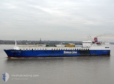
Ro-Ro/Passenger Ship
Current Trip
| Time Travelled | 10 h, 39 mins |
|---|---|
| Remaining Time | --- |
| Distance Travelled | 70.87 nm |
| Remaining Distance | --- |
| AVG Speed | 12 Knop |
| MAX Speed | 12.4 Knop |
| AVG Wind | 12.3 knots |
| MAX Wind | 15.3 knots |
| MIN Temp | 12.3°C / 54.14°F |
| MAX Temp | 15.1°C / 59.18°F |
| Djupgående | 5.4 m |
| Position mottagen | 10 h, 25 m sen |
Current Position
| Longitud | 28.72546° |
|---|---|
| Latitude | 44.05788° |
| Status | Under way using engine |
| Fart | 11.8 Knop |
| Kurs | 153.4° |
| Område | Black Sea |
| Station | T-AIS |
| Position mottagen | 10 h, 25 m sen |
Info
Information
The current position of CENK T is in Black Sea with coordinates 44.05788° / 28.72546° as reported on 2024-04-17 21:27 by AIS to our vessel tracker app. The vessel's current speed is 11.8 Knop and is heading at the port of YARIMCA. The estimated time of arrival as calculated by MyShipTracking vessel tracking app is 2024-04-18 14:00 LT
The vessel CENK T (IMO: 7528635, MMSI: 370176000) is a Ro-Ro/Passenger Ship that was built in 1978 ( 46 År gammal ). It's sailing under the flag of [PA] Panama.
In this page you can find informations about the vessels current position, last detected port calls, and current voyage information. If the vessels is not in coverage by AIS you will find the latest position.
The current position of CENK T is detected by our AIS receivers and we are not responsible for the reliability of the data. The last position was recorded while the vessel was in Coverage by the Ais receivers of our vessel tracking app.
The current draught of CENK T as reported by AIS is 5.4 meters
Weather
| Temperature | 12.7°C / 54.86°F |
|---|---|
| Wind Speed | 15 knots |
| Direction | 335° NNW |
| Pressure | 1000 hPa |
| Humidity | 86.2 % |
| Cloud Coverage | 99 % |
Featured Company
Last Port Calls
Most Visited Ports (Last year)
| Port | Arrivals | |
|---|---|---|
| 18 | ||
| 14 | ||
| 12 | ||
| 3 | ||
| 1 | ||
| 1 |
Last Trips
| Origin | Departure | Destination | Arrival | Distance | |
|---|---|---|---|---|---|
| 2024-04-14 20:03 | 2024-04-16 21:41 | 268.88 nm | |||
| 2024-04-12 23:14 | 2024-04-14 07:18 | 241.41 nm | |||
| 2024-03-23 12:20 | 2024-04-12 06:17 | 44.86 nm | |||
| 2024-03-22 00:12 | 2024-03-22 17:46 | 194.86 nm | |||
| 2023-12-22 16:39 | 2024-03-21 14:55 | 114.62 nm |
Events
| Tid | Event | Detaljer | Position / Dest | Information |
|---|---|---|---|---|
| 2024-04-17 21:32 | Status ändrad | Default Under way using engine |
44.04183 / 28.73685
YARTR
|
Fart: 11.8 kn Kurs: 153.4° |
| 2024-04-17 21:27 | UTANFÖR täckningsområde |
44.05788 / 28.72546
Black Sea
YARTR
|
Fart: 11.8 kn Kurs: 153.4° |
|
| 2024-04-17 21:17 | Status ändrad | Under way using engine Default |
44.08631 / 28.71022
YARTR
|
Fart: 9.1 kn Kurs: 154° |
| 2024-04-17 21:13 | AVGÅTT HAMN |
|
44.09828 / 28.70343
YARTR
|
Fart: 5.1 kn Kurs: 145° |
| 2024-04-17 21:09 | Status ändrad | Default Under way using engine |
44.10543 / 28.69706
[RO] CONSTANTA
|
Fart: 5.3 kn Kurs: 62° |
| 2024-04-17 20:55 | STARTAR förflyttning |
44.10414 / 28.67022
[RO] CONSTANTA
|
Fart: 3.1 kn Kurs: 88° |
|
| 2024-04-17 20:23 | Status ändrad | Under way using engine Moored |
44.10312 / 28.66534
[RO] CONSTANTA
|
Fart: Kurs: 359° |
| 2024-04-17 20:23 | Status ändrad | Moored Default |
44.10310 / 28.66534
[RO] CONSTANTA
|
Fart: Kurs: 359° |
| 2024-04-17 20:20 | Status ändrad | Default Moored |
44.10312 / 28.66535
[RO] CONSTANTA
|
Fart: Kurs: 359° |
| 2024-04-17 20:16 | Destination ändrad | YARTR ROCND |
44.10311 / 28.66540
[RO] CONSTANTA
|
Fart: Kurs: 359° |